geo.wikisort.org - Insel
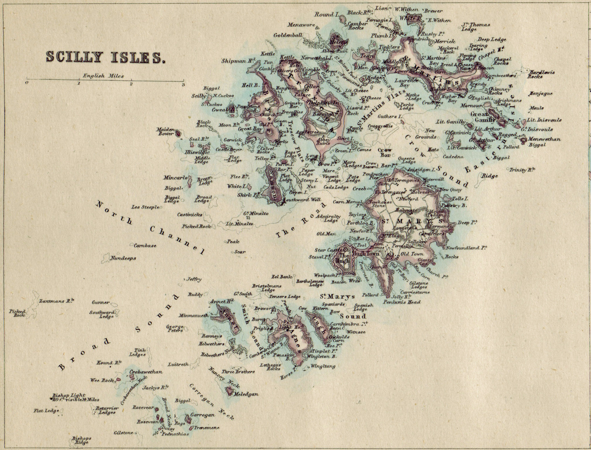
Annet ist eine der 134 unbewohnten Scilly-Inseln in Großbritannien. Sie liegt ca. 45 km vom Land’s End entfernt. Auf Annet befinden sich große Brutkolonien von Alkenvögeln, wie den Papageitauchern, die in den unzähligen Felsvorsprüngen ihre Nester bauen.
| Annet | ||
|---|---|---|
 | ||
| Gewässer | Keltische See | |
| Inselgruppe | Scilly-Inseln | |
| Geographische Lage | 49° 53′ 40″ N, 6° 22′ 20″ W | |
| ||
| Fläche | 21 ha | |
| Einwohner | unbewohnt | |

Touristen haben die Möglichkeit mit einem Ausflugsboot, von Hugh Town abfahrend, die 0,21 km² große Insel zu umfahren und die Vögel zu beobachten.
Weblinks
Commons: Annet – Sammlung von Bildern, Videos und Audiodateien
На других языках
- [de] Annet (Scilly-Inseln)
[en] Annet, Isles of Scilly
Annet (Cornish: Anet, kittiwake) is the second largest of the fifty or so uninhabited Isles of Scilly, 1 kilometre (0.62 mi) west of St Agnes with a length of 1 kilometre (0.62 mi) [1] and approximately 22 hectares (54 acres) in area. The low-lying island is almost divided in two by a narrow neck of land at West Porth which can, at times, be covered by waves. At the northern end of the island are the two granite carns of Annet Head and Carn Irish and three smaller carns known as the Haycocks. The rocky outcrops on the southern side of the island, such as South Carn, are smaller. Annet is a bird sanctuary and the main seabird breeding site in Scilly.[2][it] Annet
Annet (cornico Anet, gabbiano tridattilo) è la seconda per estensione delle circa cinquanta isole disabitate dell'arcipelago delle Isole Scilly, 1 km a ovest di St Agnes; l'isola ha una lunghezza di 1 km[1] e una superficie di circa 22 ettari. L'isola, di aspetto pianeggiante, è quasi divisa un due da uno stretto istmo di terra in località West Porth, che, in alcune occasioni, viene coperto dalle onde. All'estremità settentrionale dell'isola si trovano le due formazioni granitiche di Annet Head e Carn Irish e tre formazioni più piccole note come The Haycocks. Gli affioramenti rocciosi sul versante meridionale dell'isola, come South Carn, sono più piccoli. Annet è un santuario degli uccelli e il principale sito di nidificazione delle Isole Scilly.[2] L'isola è interdetta ai visitatori dal 15 aprile al 20 agosto di ogni anno per limitare le fonti di disturbo per gli uccelli marini nidificatori, in virtù dei quali l'isola è stata designata "Sito di Speciale Interesse Scientifico" (SSSI). Annet fa inoltre parte dell'"Area di Eccezionale Bellezza Naturale" delle Isole Scilly, della "Isles of Scilly Heritage Coast" e della "Isles of Scilly Important Plant Area"[3] L'isola è gestita dall'"Isles of Scilly Wildlife Trust"[4], che la riceve in locazione dal Ducato di Cornovaglia.Текст в блоке "Читать" взят с сайта "Википедия" и доступен по лицензии Creative Commons Attribution-ShareAlike; в отдельных случаях могут действовать дополнительные условия.
Другой контент может иметь иную лицензию. Перед использованием материалов сайта WikiSort.org внимательно изучите правила лицензирования конкретных элементов наполнения сайта.
Другой контент может иметь иную лицензию. Перед использованием материалов сайта WikiSort.org внимательно изучите правила лицензирования конкретных элементов наполнения сайта.
2019-2026
WikiSort.org - проект по пересортировке и дополнению контента Википедии
WikiSort.org - проект по пересортировке и дополнению контента Википедии