geo.wikisort.org - Coast
Zone Point (Cornish: Sawan Hir, meaning long chasm)[1] is the southernmost extremity of the Roseland peninsula extending into Falmouth Bay near St Mawes in Cornwall, United Kingdom at grid reference SW8430. [2]
This article needs additional citations for verification. (February 2015) |
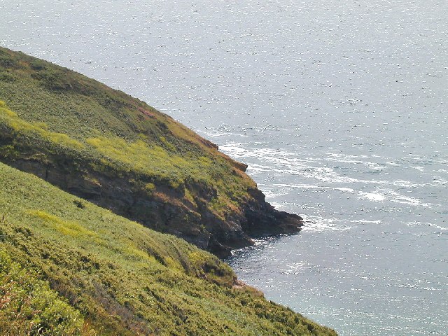

It is approximately 500 metres (550 yards) east-southeast of the St. Anthony's Lighthouse on St Anthony Head. The cliffs make the beach between Zone Point and St Anthony Head inaccessible from land and the small bay is the site of many Atlantic grey seal sightings; Atlantic grey seal pups can be seen on this beach from the headland and the sea.
The top of Zone Point is pasture with scrubby slopes. The South West Coast Path marks the transition between the two ecotypes.
The origin of the name Zone Point first appears in the 1597 map of the River Fal by Baptista Boazio as Savenheer, or the long coved point.[3]
References
- Weatherhill, Craig (2009). A Concise Dictionary of Cornish Place-Names. Westport, Co. Mayo: Evertype. ISBN 9781904808220; p. 18
- Ordnance Survey One-inch Map of Great Britain; Truro and Falmouth, sheet 190. 1961
- Jeffery, Henry (1886). "A Map of the River Fal and its Tributaries from a survey made in 1597, by Baptista Boazio". Journal of the Royal Institution of Cornwall. 9 (1): 167.
- Map sources for Zone Point
This article about a location in the former district of Carrick, Cornwall is a stub. You can help Wikipedia by expanding it. |
Другой контент может иметь иную лицензию. Перед использованием материалов сайта WikiSort.org внимательно изучите правила лицензирования конкретных элементов наполнения сайта.
WikiSort.org - проект по пересортировке и дополнению контента Википедии