geo.wikisort.org - Coast
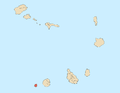
Ponta Nhô Martinho is a headland on the Island of Brava, Cape Verde. It is the southernmost point of Cape Verde. It is located nearly 4 km south of Cachaço, the nearest settlement. Formerly, the point was called Salt Point (Portuguese: Ponta do Sal), for instance in the 1747 map by Jacques-Nicolas Bellin.[3] There is a lighthouse on Ponta Nhô Martinho, which is the southernmost structure in Cape Verde. Its focal plane is 29 metres (95 ft) above sea level.[2]
Ponta Nhô Martinho | |
|---|---|
 Ponta Nhô Martinho | |
| Coordinates: 14°48′10″N 24°42′06″W | |
| Location | Southern Brava, Cape Verde |
| Offshore water bodies | Atlantic Ocean |
| Ponta Nhô Martinho Lighthouse | |
| Coordinates | 14°48′11.98″N 24°42′5.93″W |
| Foundation | masonry base |
| Construction | masonry tower |
| Height | 4 metres (13 ft) |
| Shape | quadrangular tower with lantern |
| Markings | white tower, red lantern |
| Power source | solar power |
| Focal height | 29 metres (95 ft) |
| Range | 9 nautical miles (17 km; 10 mi)[1] |
| Characteristic | Fl (4) W 15s. |
| Cape Verde no. | PT-2184[2] |
See also
- List of lighthouses in Cape Verde
- Geography of Cape Verde
References
- List of Lights, Pub. 113: The West Coasts of Europe and Africa, the Mediterranean Sea, Black Sea and Azovskoye More (Sea of Azov) (PDF). List of Lights. United States National Geospatial-Intelligence Agency. 2015. p. 427.
- Rowlett, Russ. "Lighthouses of Cape Verde". The Lighthouse Directory. University of North Carolina at Chapel Hill.
- Jacques-Nicolas Bellin (1747). "Carte des Isles du Cap Verd = Kaart van de Eilanden van Kabo Verde" (in French).
The Island of Brava | ||
|---|---|---|
| Communities and settlements |
|  |
| Parishes | ||
| Other geographical features | ||
| Landmarks and points of interests | ||
| Authority control |
|
|---|
Текст в блоке "Читать" взят с сайта "Википедия" и доступен по лицензии Creative Commons Attribution-ShareAlike; в отдельных случаях могут действовать дополнительные условия.
Другой контент может иметь иную лицензию. Перед использованием материалов сайта WikiSort.org внимательно изучите правила лицензирования конкретных элементов наполнения сайта.
Другой контент может иметь иную лицензию. Перед использованием материалов сайта WikiSort.org внимательно изучите правила лицензирования конкретных элементов наполнения сайта.
2019-2026
WikiSort.org - проект по пересортировке и дополнению контента Википедии
WikiSort.org - проект по пересортировке и дополнению контента Википедии