geo.wikisort.org - Coast
The municipality of Ponce, Puerto Rico, has 40[1] beaches including 28 on the mainland and 12 in its offshore islands, primarily at the deserted island of Caja de Muertos.[1] This list of beaches in Ponce, Puerto Rico, consists of some of the most popular beaches in the municipality of Ponce, Puerto Rico. Only natural salt-water beaches are listed.
| Part of a series on |
| Tourism in Puerto Rico |
|---|
| Tourism Regions |
|
| Beaches |
|
| Caves |
|
| Cays and islets |
| Convention centers |
|
| Culture |
|
| Islands |
|
All beaches in Ponce are public beaches and accessible to the general public at large, except for the beach at the Club Nautico de Ponce, which is accessible to members of that club only. Some public beaches are off-limits to the general public due to preservation or protection efforts. This is the case, for example, of beaches protected under the law by the Puerto Rico Department of Natural and Environmental Resources. Playa Larga beach, in Caja de Muertos, falls in this latter category. None of the beaches in Ponce are among Puerto Rico's 10 most dangerous beaches in terms of number of drownings.[2]
Among beaches in Ponce, a few of the most popular[3] are El Tuque Beach in the El Tuque sector of Barrio Canas, near highway PR-2, west of the city; La Guancha Beach at the La Guancha complex south of the city; and four beaches in Caja de Muertos: Playa Pelícano beach, Playa Larga beach, Playa Carrucho beach, and Playa Blanca beach.[4] Playa Pelicano beach was the first beach in Puerto Rico - and the entire Caribbean[5] - to attain Blue Flag Beach status.[6][7] It is also the only beach in the world part of a nature reserve that holds this recognition.[8] Most beaches in Ponce are small secluded beaches known mostly to local people and accessed by dirt roads. They are part of a coastal stretch in southwestern Puerto Rico "filled with isolated sandy coves and virgin white beaches accessible only by dirt roads that only the locals seem to know about."[9] While there are several family-oriented beaches, like La Guancha and El Tuque, there are also many beaches ideal for sunbathing and relaxation as well as many spots for just being alone.[9] Some beaches are more apt for some types of activities, such as scuba diving, than other beaches. Beaches in Caja de Muertos can be reached via private boat or, during the weekends, via a daily ferry that leaves early in the mornings (reservations are required) from the La Guancha Boardwalk in Barrio Playa.[3]
Ponce beaches are the result of mineral aggregate found in them, and this is, in turn, the result of silt carried by the Ponce river system from the mountains of Cordillera Central.[10] In this manner the composition of its beaches are determined by the geological regions through which the nearby rivers flow. Beaches west of Ponce (El Tuque, Las Salinas, Matilde, etc.) exhibit sand that is mostly white, resulting from its calcareous content, and primarily composed of coral fragments and marine shells. Beaches east of Ponce (La Guancha, Club Nautico, Hilton, Cabuyon, Vayas, etc.) exhibit sand that is mostly dark sand with magnetite, and composed of fragments of volcanic rock, quartz, and calcareous detritus.[11][12][13][14] Also, the sand at mainland Ponce beaches tends to be generally dark[15] while in the offshore Ponce islands sand is white.[16]
| External audio | |
|---|---|
Beach list summary table
Beaches on the Ponce mainland
| No. | Beach Name | Length (m) | Barrio | Sector | Coordinates | Activities and Services | Notes | Image |
|---|---|---|---|---|---|---|---|---|
| 1 | El Tuque;[17] a.k.a., Balneario El Tuque[18] |
1100[12] | Canas | El Tuque, PR-2, at km 200.1[19] | 17°58′21″N 066°40′43″W | | ||
| 2 | Punta Salinera[21] | unknown | Canas[22] | Southwest of Laguna Las Salinas on PR-2, km 200.2 | 17°58′1.67″N 066°40′18.37″W | |||
| 3 | Las Salinas[12] | unknown | Canas[12] | South of Laguna Las Salinas[23] on PR-2, km 200.2 | 17°58′07″N 066°40′00″W | [24] | ||
| 4 | Cañas[12] | 1100[12] | Canas | Between Punta Cucharas and the jetty just west of the Ponce water treatment plant.[25] Accessed from PR-2 & Ave. Punto Oro, south on the asphalt, gravel, and (then) dirt road to the end. | 17°58′42″N 066°39′07″W |
|
[26] | |
| 5 | Matilde[17][note 1] | unknown | Canas | South of the Ponce water treatment plant; just west of Río Matilde.[27][28] Accessed from PR-2 and PR-9, heading south, following the road leading to the Ponce water treatment plant. | 17°58′51″N 066°38′28″W |
|
[29] | |
| 6 | Chencha;[30] a.k.a., "El Tubo"[31] |
500[30] | Playa | Between Río Matilde eastward to the breakwater at Ocean View Restaurant (Dorado St.)[31] Accessed from PR-585, then Ave. Los Meros to the end. | 17°58′55″N 066°38′11″W | |||
| 7 | Los Meros[30] | 500[30] | Playa | Between the breakwater at Ocean View Restaurant (Dorado St) and the Villa Pesquera fishing village piers (former mouth of Río Portugués)[30] Accessed from PR-585, then Ave. Los Meros, then Ocean View Restaurant. | 17°58′57″N 066°37′44″W | [32] | ||
| 8 | Playa de Ponce[33][note 2] | unknown | Playa | Between the Villa Pesquera fishing piers and the Ave. Hostos Final pier. At the southernmost tip of PR-585[12][34] | 17°58′51″N 066°37′23″W | [35] | ||
| 9 | El Malecón[1] | unknown | Playa | At Parque Pasivo Enrique Gonzalez on Calle Bonaire,[36] two blocks south of the southernmost tip of Avenida Hostos (PR-123) in barrio Playa de Ponce | 17°58′45″N 066°37′11″W | Also the Finish site of Cruce a Nado Internacional[38] | [1] | |
| 10 | Club Náutico de Ponce | unknown | Playa | Isla de Gatas, within the Club Náutico de Ponce property, across from La Guancha Boardwalk, accessed via PR-12 | 17°57′49″N 066°37′10″W |
|
This beach is within the area of Club Nautico de Ponce, a private club |  |
| 11 | La Guancha;[39] a.k.a. Playa Carenero[12] |
850[12] | Playa[40] | La Guancha Recreational and Cultural Complex, at the southernmost tip of PR-12 (Avenida Santiago de los Caballeros) | 17°57′50″N 066°36′43″W | |||
| 12 | Playa del Hilton[43] | unknown | Playa | Hotel Ponce Hilton, west of Río Bucaná, accessible through Hilton Ponce Golf and Casino Resort, PR-12 South to Avenida Caribe | 17°58′10″N 066°36′08″W |
|
||
| 13 | Punta Cabuyón;[12] a.k.a., Playa Punta Cabullones.[45] |
325[12] | Vayas | Just west of Punta de Cabullones,[46] accessed from Barrio Bucana by way of Santa Cruz community (becomes a dirt road). | 17°58′15″N 066°35′38″W |
|
A nature reserve since 31 December 2016.[47] | |
| 14 | Vayas[12] | 2200[12] | Vayas | Area of Quinta Esperanza, across from Cayo Desgraciado,[46] accessed from PR-1 to Calle La Esperanza to the end (becomes a dirt road). | 17°58′1″N 066°34′08″W |
|
||
Beaches at offshore Ponce islands
| No. | Beach Name | Length (m) | Barrio | Sector | Coordinates | Activities and Services | Notes | Image |
|---|---|---|---|---|---|---|---|---|
| Beaches at Isla de Ratones | ||||||||
| 15 | Isla de Ratones[48] | unknown | Canas | At Isla de Ratones, accessed by kayak[48] from Reserva Natural Punta Cucharas or by boat via boat ramp at marina just west of Punta Cucharas sector on PR-2[23] | 17°57′08″N 066°40′51″W | |||
| Beaches at Isla Cardona | ||||||||
| 16 | Isla Cardona[49] | unknown | Playa | At Isla Cardona, accessed by kayak or boat | 17°57′28″N 066°38′11″W |
|
Also the Start site of Cruce a Nado Internacional[38] | [49] |
| Beaches at Caja de Muertos | ||||||||
| 17 | Pelícano[50] | 300[12] | Playa | Caja de Muertos; located on the western (docking) side of the island, between the boat dock and Cerro Morrillo,[51][52] accessed by ferry from La Guancha Boardwalk[3] | 17°53′08″N 066°31′41″W |
|
 | |
| 18 | Guardia Costanera[56] | unknown | Playa | Caja de Muertos; located on the northwest side of the island (facing the city of Ponce), northwest of the Caja de Muertos Light,[51][52] accessed by ferry from La Guancha Boardwalk[3] | 17°53′45″N 066°40′43″W |  | ||
| 19 | Blanca[50] | unknown | Playa | Caja de Muertos; located on the northwest side of the island (facing the city of Ponce), northwest of the Caja de Muertos Light.,[51][52] accessed by ferry from La Guancha Boardwalk[3] | 17°53′56″N 066°31′12″W |  | ||
| 20 | Carrucho[50][16] a.k.a., Playa Chica [50][52] |
unknown | Playa | Caja de Muertos; located on Punta Carrucho, at the northeast[59] end the island, facing the Puerto Rico mainland,[50][60][52] accessed by ferry from La Guancha Boardwalk[3] | 17°54′09″N 066°30′46″W |  | ||
| 21 | Ensenadita[50] a.k.a., Playa Pocitas[50] |
unknown | Playa | Caja de Muertos, located on the southeastern side of the island, facing the open Caribbean Sea. Accessed by ferry from La Guancha Boardwalk[3] | 17°53′38″N 066°30′54″W | |||
| 22 | Larga[50][52] | unknown | Playa | Caja de Muertos, located on the south-southeast side of the island,[51] accessed by ferry from La Guancha Boardwalk[3] | 17°53′08″N 066°31′38″W | Vereda Submarina; offshore-based snorkeling and scuba allowed.[18][50] A protected beach (i.e., no foot traffic) located on the southeastern side of the island between Cerro Morrillo and Caja de Muertos Light (the side facing the open Caribbean Sea). |
 | |
Activities Permitted:
 Swimming
 Snorkeling
 Scuba Diving
 Surfing
 Boating
 Camping
 Hiking
 Picnicking
 Fishing
 Sunbathing
 Lookout tower
Services Provided:
 Visitor's Center
 Lifeguards
 Restrooms
 Children's Playground
International Recognitions Attained:
 Blue Flag beach
Gallery
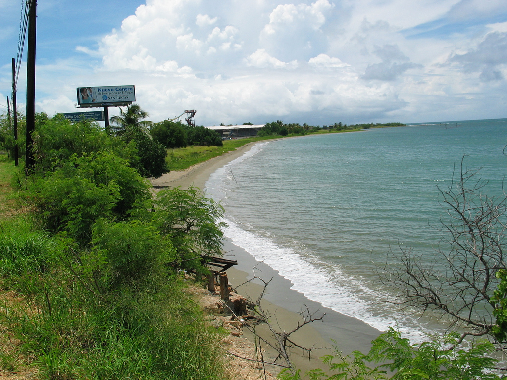
 Beach at the Ponce Hilton Hotel, looking west

See also
- Puerto Rico Tourism Company
- Porta Caribe
Notes
- While some sources may name this beach "Matilda", there is no Playa Matilda in Ponce; the correct spelling (and the one most authorities use) is "Matilde".
- Not to be confused with the populated neighborhood and municipal ward "Barrio Playa de Ponce".
References
- Las 1,200 playas de Puerto Rico. Primera Hora. 9 March 2015. Page/Photo 29 of 41. Accessed 9 March 2015.
- Ley 221 of 17 December 2015: A law to amend "Ley de la Junta Interagencial para el Manejo de las Playas de Puerto Rico." Puerto Rico 17th Legislative Assembly, 6th Session. Puerto Rico Department of State. 24 December 2015. Accessed 25 January 2017.
- Best Beaches / Caribbean / Puerto Rico / Ponce / Ponce Beaches. BestBeaches.com. 2017. Accessed 20 January 2017.
- Por algo le llaman 'El Edén del Caribe'. Carmen Cila Rodríguez. La Perla del Sur. 20 April 2011. Accessed 3 May 2011. Re-accessed January 2017.
- Distinguen con bandera azul a Playa Pelícano en Caja de Muertos. Mi Puerto Rico Verde.com 18 December 2013. Accessed 23 January 2017.
- Bandera azul para Caja de Muerto. Archived 22 October 2013 at the Wayback Machine El Sur a la Vista. Ponce, Puerto Rico. 1 December 2010. Accessed 15 December 2010.
- Bandera azul para Caja de Muerto. El Sur a la Vista. Ponce, Puerto Rico. 1 December 2010. Accessed 24 January 2017.
- Playa Pelícano. Lionel Valentin Calderon. Directorio de Puerto Rico. 2017. Accessed 24 January 2017.
- Puerto Rico: The Best Beaches: The Best Beaches for Being Alone. Frommer's Puerto Rico 2017. Accessed 20 January 2017.
- The World's Coasts: Online - Puerto Rico: South Coast 1. Jack Morelock, Wilson Ramirez and Maritza Barreto. Geological Oceanography Program >> Coastal Morphology & the Coastline [Shoreline] of Puerto Rico >> Coastal Papers >> World Coastlines 2003 - Puerto Rico [The World's Coasts: Online - Puerto Rico] >> Page 3 [South Coast 1]. University of Puerto Rico, Recinto Universitario de Mayaguez. Department of Marine Sciences. Geological Oceanography Program. 1 Oct 2002. Accessed 1 February 2017.
- Leovigildo Vázquez Iñigo. Clases de arenas en Puerto Rico. 1983.
- Plan de Uso de Terrenos de Puerto Rico: Perfil Regional - Region Sur. (Borrador Preliminar.) Estado Libre Asociado de Puerto Rico. Junta de Planificacion. Oficina del Plan de Uso de Terrenos. San Juan, Puerto Rico. February 2006. Page 15. Accessed 2 December 2011.
- Plan de Uso de Terrenos de Puerto Rico: Perfil Regional - Region Sur. (Borrador Preliminar.) Estado Libre Asociado de Puerto Rico. Junta de Planificacion. Oficina del Plan de Uso de Terrenos. San Juan, Puerto Rico. February 2006. Page 15. Accessed 31 January 2017.
- Coastline and Beach Analysis: Tallaboa to Salinas. Shoreline of Puerto Rico. University of Puerto Rico, Recinto Universitario de Mayaguez. Accessed 30 January 2017.
- La Guancha: A Fun Weekend Spot for the Whole Family. Gwen. Puerto Rico Day Trips. 28 June 2015. Accessed 30 January 2017.
- El secreto paraíso del Caribe. Carmen Cila Rodríguez. La Perla del Sur. Ponce, Puerto Rico. 14 October 2010. Accessed 23 January 2017.
- Coastal study sites south coast Puerto Rico: El Tuque Beach, Ponce. Archived 7 January 2017 at the Wayback Machine University of Puerto Rico, Recinto Universitario de Mayaguez. Department of Marine Sciences. Geological Oceanography Program. Mayaguez, Puerto Rico.
- Ponce Beaches. BestBeaches.com. 2017. Accessed 24 January 2017.
- Playa El Tuque: Ponce, Puerto Rico. DescubraPuertoRico.com 2017. Accessed 25 January 2017.
- Beaches in Ponce, Puerto Rico. Lindsay Nixon. USA Today. (US Travel » Puerto Rico Travel » Puerto Rico Beaches » Beaches in Ponce, Puerto Rico.) Accessed 20 January 2017.
- Listo el plan de seguridad de Ponce para el 4 de julio: A raíz de la festividad podrán disfrutar del Complejo Recreativo la Guancha, El Tuque, Playa Punta Salinera, el Río del Real Anón, Isla de Caja de Muerto e Isla de Cardona. CyberNews. 3 July 2019. Ponce, Puerto Rico: La Perla del Sur. Accessed 6 July 2019.
- Listo el plan de seguridad de Ponce para el 4 de julio: A raíz de la festividad podrán disfrutar del Complejo Recreativo la Guancha, El Tuque, Playa Punta Salinera, el Río del Real Anón, Isla de Caja de Muerto e Isla de Cardona. CyberNews. 3 July 2019. Ponce, Puerto Rico: La Perla del Sur. Accessed 6 July 2019.
- PREPA Geographic Response Plan Map: PR-59: GRP - Oil Spill Sensitive Site Report for Sector: San Juan - Laguna de las Salinas, Ponce. (Site ID: A42) State of Florida. Fish and Wildlife Commission. Fish and Wildlife Research Institute. 27 May 2011. Accessed 25 January 2017.
- Playa Las Salinas. Rafael Santiago Toro. Flickr. 22 October 2010. Accessed 28 January 2017.
- Punta Cuchara. University of Puerto Rico, Recinto Universitario de Mayaguez. Department of Marine Sciences. Geological Oceanography Program. Accessed 24 January 2017.
- Playa Cañas. Jose Francisco Salgado. Flickr. 31 January 2013. Accessed 28 January 2017.
- Punta Cuchara. University of Puerto Rico, Recinto Universitario de Mayaguez. Accessed 24 January 2017.
- Matilda (sic) Beach, Ponce. Archived 7 January 2017 at the Wayback Machine University of Puerto Rico, Recinto Universitario de Mayaguez. Geological Oceanography Program. Accessed 24 January 2017.
- Playa Matilde Beach. University of Puerto Rico, Recinto Universitario de Mayaguez. Department of Marine Sciences. Geological Oceanography Program. Accessed 28 January 2017.
- Esfuerzo colectivo para renovar la Playa de Ponce. Pedro A. Menéndez Sanabria. Voces del Sur. vocesdelsurpr.com. 10 August 2016. Accessed 26 January 2017.
- La Playa de Ponce Reverdece. Domingo Rodriguez. La Regata: El Periodico Nautico de Puerto Rico. Caguas, Puerto Rico: Editorial La Regata. Year 19. Issue 3 (March 2016). (ISUU Issue 1603) Page 28. March 2016. Accessed 27 January 2017.
- Neysa Rodriguez Deynes. Brevario Sobre la Historia de Ponce.Gobierno Municipal de Ponce. Oficina de Cultura y Turismo. Ponce, Puerto Rico. 2002. p. 113
- Ponce Beach. Caribya. IIWINC. 2017. Accessed 20 January 2017.
- Map of Ponce Beach. Caribya. IIWINC. 2017. Accessed 20 January 2017.
- Playa de Ponce. Trazando Fronteras. 17 May 2010. Accessed 28 January 2017.
- Nadadores Venezolanos: A defender su dominio en el Cruce a Nado Internacional. Junior Lugo Marrero. La Perla del Sur. Ponce, Puerto Rico. Year 31. Issue 1552. Page 53. 28 August 2013. Accessed 23 January 2017.
- Regresa el Cruce a Nado a Ponce. Junior Lugo Marrero. La Perla del Sur. Ponce, Puerto Rico. Year 32. Issue 1604. Page 51. 26 August 2014. Accessed 23 January 2017.
- Regresa el Cruce a Nado Internacional, La Perla del Sur. Ponce, Puerto Rico. Year 31. Issue 1552. Page 53. 28 August 2013. Accessed 23 January 2017.
- Inauguran Complejo de Recreación La Guancha. El Nuevo Día. 15 June 1998.[permanent dead link] (In Spanish.)
- Chapter IX: Porto Rico. West Indies Pilot. Volume 1:The Bermuda Islands, Bahama Islands and the Greater Antilles. United States Hydrographic Office. United States Navy. Fourth Edition. 1922. Page 594. Accessed 22 January 2017.
- La Guancha: Ponce, Puerto Rico. ZeePuertoRico.com 23 January 2017.
- Punta Carenero. Descubra Puerto Rico.com Accessed 22 January 2017.
- Monitoria de Playas. Junta de Calidad Ambiental de Puerto Rico. Programa de Monitoria de Playas y Notificacion Publica. "Notificacion Ambiental, Emitida el 20 de Enero de 2017." 20 January 2017. Accessed 24 January 2017.
- Playa del Hilton. Northernleits. Flickr. 11 August 2011. Accessed 28 January 2017.
- Hydrogeology and Hydrology of the Punta Cabullones Wetland Area, Ponce, Southern Puerto Rico, 2007–08. Jesús Rodríguez-Martínez and Luis R. Soler-López. Prepared in cooperation with the Municipio Autónomo de Ponce and the Puerto Rico Department of Natural and Environmental Resources. USGS. Scientific Investigations Report 2014–5102. 20 August 2014. Accessed 28 January 2017.
- Bahía de Ponce and Approaches. NOAA Booklet Chart Number 25683. NOAA. Office of Coast Survey. US Dept of Commerce. Page 10 of 16. Accessed 23 January 2017.
- Designan nuevas reservas naturales en Ponce y Santa Isabel. 31 Voces del Sur. vocesdelsurpr.com. December 2016. Accessed 26 January 2017.
- At Ratones Key. Karlianette Torres Rivera. Puerto Rico de Aventura: The Magazine for the Adventurer Traveler. Accessed 24 January 2017.
- Playa Isla Cardona. University of Puerto Rico. Department of Marine Sciences. Geological Oceanography Program. Accessed 28 January 2017.
- Caja de Muertos: Un tesoro en las aguas del Mar Caribe. Archived 29 March 2015 at the Wayback Machine Mydalis M. Lugo Marrero. Revista Marejada: Revista Ambiental. 3 December 2011. Accessed 20 October 2013.
- Reserva Natural Isla Caja de Muertos: Laboratorio Natural para Fomentar el Estudio de las Aves dentro del Escutismo. Archived 20 October 2013 at the Wayback Machine Javier González Delgado. Universidad Metropolitana, Escuela Graduada de Asuntos Ambientales. San Juan, PR. Page 74. 7 December 2010. Accessed 20 October 2013.
- Topographic Map of Caja de Muertos, showing roads and hiking trails. Archived 19 February 2015 at the Wayback Machine "Topográfico Playa de Ponce (N1752.5 W6630/7.5)." Drawn by J. A. Dones. Oficina de Planificación de Recursos Costaneros. Departamento de Recursos Naturales y Ambientales de Puerto Rico. 1962. Accessed 20 October 2013.
- Reserva Natural Isla Caja de Muertos: Laboratorio Natural para Fomentar el Estudio de las Aves dentro del Escutismo. Archived 20 October 2013 at the Wayback Machine Javier González Delgado. Universidad Metropolitana, Escuela Graduada de Asuntos Ambientales. San Juan, PR. 7 December 2010. Page 76. Accessed 25 January 2017.
- Bandera Azul para Caja de Muertos: El DRNA anunció este reconocimiento que logró la playa Pelícano de esta reserva natural. El Nuevo Dia. 1 December 2010. Accessed 23 January 2017.
- Playa Pelicano (Pelican Beach), Caja de Muertos Island, Puerto Rico: Falicities at Pelicano Beach. Islands of Puerto Rico. 2017. Accessed 23 January 2017.
- Reserva Natural Isla Caja de Muertos: Laboratorio Natural para Fomentar el Estudio de las Aves dentro del Escutismo. Archived 20 October 2013 at the Wayback Machine Javier González Delgado. Universidad Metropolitana, Escuela Graduada de Asuntos Ambientales. San Juan, PR. 7 December 2010. Page 85. Accessed 19 January 2017.
- Beaches Southwest Puerto Rico. Discover Puerto Rico. 2017. Accessed 28 January 2017.
- Playa Coast Guard: Ponce, Puerto Rico. Puerto Rico Hoteles y Paradores. Accessed 23 January 2013.
- The World's Coasts: Online - Puerto Rico. Jack Morelock, Wilson Ramirez and Maritza Barreto. Geological Oceanography Program >> Coastal Morphology & the Coastline [Shoreline] of Puerto Rico >> Coastal Papers >> World Coastlines 2003 - Puerto Rico [The World's Coasts: Online - Puerto Rico] >> Page 8 [Outlying Islands]. University of Puerto Rico, Recinto Universitario de Mayaguez. Department of Marine Sciences. Geological Oceanography Program. 1 Oct 2002. Accessed 1 February 2017.
- Reserva Natural Isla Caja de Muertos: Laboratorio Natural para Fomentar el Estudio de las Aves dentro del Escutismo. Archived 20 October 2013 at the Wayback Machine Javier González Delgado. Universidad Metropolitana, Escuela Graduada de Asuntos Ambientales. San Juan, PR. 7 December 2010. Page 51. Accessed 19 January 2017.
Further reading
- Ambiente: Costas de Puerto Rico, Encyclopedia Puerto Rico
- Cayetano Coll y Toste. Boletin Historico de Puerto Rico. Volume XII. 1924-1925.
- USGS Hydrologic Unit Map – Caribbean Region (1974)
External links
- Isla Caja de Muertos, with coordinates for Playa Pelicano
- Geographic Information and Coordinates for Balneario El Tuque
- USGS Geographic Names Information Service
- Playas de Puerto Rico
- University of Puerto Rico, Recinto Universitario de Mayaguez. Department of Marine Sciences. Geological Oceanography Program. Punta Cucharas Study
- El Tuque Beach
- Sand dunes at Matilda Beach
- Beaches Southwest Puerto Rico: El Tuque Beach. Discover Puerto Rico. 2017. Accessed 28 January 2017.
- Hydrogeology and Hydrology of the Punta Cabullones Wetland Area, Ponce, Southern Puerto Rico, 2007–08. Jesús Rodríguez-Martínez and Luis R. Soler-López. Prepared in cooperation with the Municipio Autónomo de Ponce and the Puerto Rico Department of Natural and Environmental Resources. USGS. Scientific Investigations Report 2014–5102. 20 August 2014. Accessed 28 January 2017.
- Ponce Projects. University of Puerto Rico, Recinto Universitario de Mayaguez. Department of Marine Sciences. Geological Oceanography Program. Accessed 28 January 2017.
Ponce, Puerto Rico | ||
|---|---|---|
| ||
| Barrios |
|  |
| Beaches |
| |
| Museums |
| |
| Hotels |
| |
| Events |
| |
| Theaters |
| |
| Parks |
| |
| Hospitals |
| |
| Universities |
| |
| Islands | ||
| Rivers | ||
| Mountains | ||
Другой контент может иметь иную лицензию. Перед использованием материалов сайта WikiSort.org внимательно изучите правила лицензирования конкретных элементов наполнения сайта.
WikiSort.org - проект по пересортировке и дополнению контента Википедии