geo.wikisort.org - River
Río Pastillo is a river in the municipality of Ponce, Puerto Rico. It is also known as Río Marueño in the area of the municipality where it runs through barrio Marueño.[7] Together with Cañas River, Pastillo forms Matilde River. Pastillo is one of the 14 rivers in the municipality. The river originates at an altitude of 435 feet. Its tributaries are Quebrada Limon and Quebrada del Agua brooks and the river runs for 19 kilometers before feeding into Río Matilde at a height of 15 feet in Barrio Canas Urbano.
| Río Pastillo Río Marueño | |
|---|---|
 Río Pastillo during the dry season in Barrio Canas | |
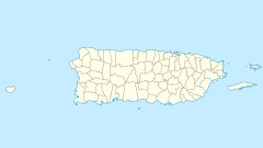
 Map showing the location of Río Pastillo among the other rivers in the municipality. The area in pink represents the urban zone of the city | |
 Location of mouth | |
| Etymology | Barrio Marueño |
| Location | |
| Country | United States |
| Territory | Puerto Rico |
| Municipality | Ponce |
| Physical characteristics | |
| Source | |
| • location | Barrio Guaraguao, Ponce |
| • coordinates | 18.0019106°N 66.6404508°W[1] |
| • elevation | 435 feet (133 m)[3] |
| Mouth | |
• location | Rio Matilde |
• elevation | 15 feet (4.6 m)[4] |
| Length | 19 kilometers (12 mi)[5] |
| Basin features | |
| Progression | Marueño Quebrada Limón Canas Canas Urbano |
| River system | Río Matilde[6] |
| Tributaries | |
| • left | Quebrada Limon Quebrada del Agua |
Origin

Río Pastillo[note 1] has its origin in the northern mountains of Ponce's Barrio Marueño,[8] in an area called Yagrumo.[9] This river runs for approximately 19 kilometers (12 mi) before reaching barrio Canas in the city of Ponce where it merges with Río Canas to form Matilde River.[10] The Government of Puerto Rico has plans to canalize this river.[11]
Feeder streams
Quebrada Limón and Quebrada del Agua are two of the main feeder streams to Pastillo River.[12] Quebrada del Agua was diverted via canalization to drain directly to the Caribbean Sea.[13] In times of heavy rainfall, Quebrada del Agua was prone to overflow, as it happened on 7 October 1985, when 16 people died due to its flooding.[14]
Course of the river
The following table summarizes the course of Rio Pastillo in terms of roads crossed. Roads are listed as the river flows from its origin in the mountains of Quebrada Limon, east of the city of Ponce, to its merging with Rio Canas to form Rio Matilde in Barrio Canas (N/A = Data not available):
| No. | Barrio | Road | Road's km marker | NBI ID[15] | Bridge name (if any) | Direction (of bridge traffic) | Coordinates | Notes |
|---|---|---|---|---|---|---|---|---|
| 1 | Marueño | PR-501 | 4.7 | N/A | Unnamed | Both | 18°4′12.7194″N 66°39′57.7434″W | 0.1 km N of Camino La Tuna |
| 2 | Marueño | PR-501 | 4.3 | N/A | Unnamed | Both | 18°3′48.888″N 66°39′49.8234″W | 0.1 km S of Camino Parcelas Viejas; 0.2 km S of INT PR-501 & PR 502 |
| 3 | Quebrada Limon | PR-502 | 1.5 | 7701 | Unnamed | Both | 18°2′46.3554″N 66°39′49.968″W | 0.1 km S of Camino Las Lisas |
| 4 | Canas | PR-132 | 21.5 | 2731 | Unnamed | Both | 18°2′4.4514″N 66°39′44.136″W | Immediately W of INT w/PR-502; next to Esc. Julia Cordero Negron, Bo. Quebrada Limón |
| 5 | Canas | North Main Street | not marked | 21581 | Unnamed | Both | 18°0′45.144″N 66°38′53.9514″W | At entrance to Jardines del Caribe-3ra Seccion (South of PR 132, km 3.1); N Main St is in J. del Caribe, between Calle 18 and Calle 22 |
| 6 | Canas Urbano | PR-500 | 1.0 | 23221 | Unnamed | Both | 18°0′23.508″N 66°38′37.7874″W | At where PR-163 and PR-500 become one same road |
See also
- List of rivers of Puerto Rico
- List of rivers of Ponce
Notes
- Río Pastillo has sometimes been erroneously called Río Matilde. For example HERE (Informe Ecológico de Flora y Fauna, Proyecto Gasoducto del Sur: Peñuelas, Ponce, Juana Díaz, Santa Isabel, Salinas. For: Proyecto Gasoducto del Sur - Peñuelas, Ponce, Juana Díaz, Santa Isabel, Salinas. By: ENSR (Piscatway, NJ) - AEE (Autoridad de Energia Electrica). Retrieved 26 November 2013.) states "Río Matilde: ... Hacia el Norte desde su intersección con la Quebrada del Agua se le conoce como Río Pastillo." Translated and paraphrased: North of its intersection with Quebrada del Agua creek, Rio Matilde is known as Río Pastillo.
References
- U.S. Geological Survey Geographic Names Information System: Río Pastillo
- U.S. Geological Survey Geographic Names Information System: Río Pastillo
- Maptest. Archived 18 February 2010 at the Wayback Machine Government of the Commonwealth of Puerto Rico. General Purpose Population Data, Census 2000. Unidad de Sistemas de Información Geográfica, Área de Tecnología de Información Gubernamental, Oficina de Gerencia y Presupuesto. Gobierno de Puerto Rico. Retrieved 24 October 2011.
- Maptest. Archived 18 February 2010 at the Wayback Machine Government of the Commonwealth of Puerto Rico. General Purpose Population Data, Census 2000. Unidad de Sistemas de Información Geográfica, Área de Tecnología de Información Gubernamental, Oficina de Gerencia y Presupuesto. Gobierno de Puerto Rico. Retrieved 24 October 2011.
- Estudios Sociales: Hidrografia of Ponce, Puerto Rico. Projecto Salon Hogar. Retrieved 8 August 2009.
- Los Rios. Archived 1 April 2012 at the Wayback Machine Hojas de Nuestro Ambiente. February 2007: P013. Page 3. Puerto Rico Department of Natural and Environmental Resources. Retrieved 30 October 2011.
- Las Fiestas Populares de Ponce. Ramon Marin. San Juan, Puerto Rico: Editorial de la Universidad de Puerto Rico. 1994. Page 187. Retrieved 23 July 2012.
- La Historia de Nuestros Barrios: Barrio Marueño, Ponce. El Sur a la Vista. 21 June 2010.
- Neysa Rodriguez-Deynes. Brevario Sobre la Historia de Ponce, Y Sus Principales Lugares de Interés. Secretaria de Arte y Cultura, Gobierno Municipal de Ponce, Ponce, Puerto Rico. 1991. Page 2.
- Estudios Sociales: Hidrografia of Ponce, Puerto Rico. Projecto Salon Hogar. Retrieved August 8, 2009.
- Ponce en Marcha: Obras que si se ven. Government of Puerto Rico. El Sur a la Vista. Ponce, Puerto Rico. 2 November 2011. Page 56.
- Estudios Sociales: Hidrografia of Ponce, Puerto Rico. Projecto Salon Hogar. Retrieved 8 August 2009.
- Sunny A. Cabrera Salcedo. Hacia un Estudio Integral de la Toponimia del Municipio de Ponce, Puerto Rico. Ph. D. dissertation. May 1999. University of Massachusetts Amherst. Graduate School. Department of Spanish and Portuguese. Page 14.)
- Ferdinand Quiñones and Karl G. Johnson. The Floods of May 17–18, 1985 and October 6–7, 1985 in Puerto Rico. U.S. Geological Survey. Open File Report 87-123. Prepared in Conjunction with the Puerto Rico Department of Natural Resources, Puerto Rico Environmental Quality Board, and the Puerto Rico Highway Authority. San Juan, Puerto Rico. 1987. Page 11.
- National Bridge Inventory Data: Puerto Rico, Ponce. James Baughn. BridgeReports.com 2018. Accessed 26 November 2018.
External links
Другой контент может иметь иную лицензию. Перед использованием материалов сайта WikiSort.org внимательно изучите правила лицензирования конкретных элементов наполнения сайта.
WikiSort.org - проект по пересортировке и дополнению контента Википедии