geo.wikisort.org - Coast
Anna Maria is a city in Manatee County, Florida, United States. The population was 1,503 at the 2010 census. According to the 2018 U.S. Census Bureau's estimates, the city grew slightly to 1,749.[4] The city occupies the northern part of Anna Maria Island and is one of three municipalities on the island. The others are Holmes Beach in the center and Bradenton Beach in the south.
Anna Maria, Florida | |
|---|---|
City | |
 Beachfront homes in Anna Maria. | |
 Seal | |
| Motto: "Manatee County Florida" | |
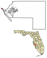 Location of Anna Maria in Manatee County, Florida. | |
| Coordinates: 27°31′49″N 82°44′4″W | |
| Country | |
| State | |
| County | Manatee |
| Settled | 1892 |
| Incorporated (city) | 1925 |
| Government | |
| • Type | Strong Mayor-Commission |
| • Mayor | Dan Murphy |
| • Commission Chair | Carol Carter |
| Area | |
| • Total | 0.86 sq mi (2.23 km2) |
| • Land | 0.73 sq mi (1.90 km2) |
| • Water | 0.13 sq mi (0.32 km2) |
| Elevation | 0 ft (0 m) |
| Population (2020) | |
| • Total | 968 |
| • Density | 1,317.01/sq mi (508.26/km2) |
| Time zone | UTC-5 (Eastern (EST)) |
| • Summer (DST) | UTC-4 (EDT) |
| ZIP code | 34216 (originally 33501) |
| Area code | 941 |
| FIPS code | 12-01475[2] |
| GNIS feature ID | 0277889[3] |
| Website | www |
Anna Maria is part of the Bradenton–Sarasota–Venice Metropolitan Statistical Area.
Etymology
Ponce de Leon was said to have named the island for Maria Anna von der Pfalz-Neuburg, the queen of Charles II of Spain, the sponsor of his expedition. In the past, pronunciation of the name differed: old timers said "Anna Mar-EYE-a," but most people today say "Anna Mar-EE-a."[5] According to a regional historian of note, Lillian Burns, the daughter of the early land developer, Owen Burns, the correct pronunciation of the name of the island by its early settlers was, an-na ma-rye-a, since it was named for the strong winds occurring in the area, using the German term for the wind, Maria.[6] This pronunciation may be heard in the song, "They Call the Wind Maria", from the musical, Paint Your Wagon.
Despite the common legends of the name origins for the city and island, former Tampa Mayor Madison Post named the island for his wife Maria and his sister-in-law Anna.[7]

History
In 1893, George Emerson Bean would build a home near the present day Rod & Real Pier.[8] Two years later in 1895 he filed a homesteaded claim of 160 acres (0.65 km2) on the north part of Anna Maria Island. Prior to Bean's homestead claim, Andrew Gowanlack would reside in the area where Bean would file his homestead at. However, Andrew never filed for a homestead claim but did receive 3 acres of land after Bean filed his homestead claim out of squatting rights.[9] After George Bean's death in 1898, the land went to his son, George Wilhelm Bean, who partnered with Charles Roser, a wealthy real estate developer from St. Petersburg, to form the Anna Maria Beach Company to develop the area.[8]
In 1911, the Anna Maria City Pier would be built by the Anna Maria Beach Company to accommodate steamships carrying residents and visitors to the island. The pier would have several buildings attached to it. An extension of the pier containing a home would be built in 1913 before the area the house was on in the pier was destroyed in September 1927.[10] Sometime during 1927, a jail would be built as a form of containment for bar patrons who were rowdy and was used until 1940 when a fire would burn down its roof and cells.[11]
Compiled in the late 1930s and first published in 1939, the Florida guide listed Anna Maria's population as 77 describing it as:
a resort at the northern extremity of Anna Maria Key, consists of many cottages in a jungle setting.[12]
— Federal Writers' Project, "Part III: The Florida Loop", Florida; a guide to the southernmost state (1947)
Bradenton would attempt to annex the City of Anna Maria in 1963. Anna Maria would hold a special election that was described as being "non-official" on April 2, 1963 to confirm Bradenton's decision. However, it would not be approved as 297 voted against it while 9 voted in favor of it.[13]
During Hurricane Irma in 2017, the city pier would be damaged significantly and demolished the following year with plans to rebuilt it.[10]
Geography

Anna Maria is located at 27°31′49″N 82°44′04″W.[14]
According to the United States Census Bureau, the city has a total area of 1.0 square mile (2.6 km2), of which 0.8 square miles (2.1 km2) is land and 0.2 square miles (0.52 km2) (21.21%) is water.
Demographics
| Historical population | |||
|---|---|---|---|
| Census | Pop. | %± | |
| 1930 | 77 | — | |
| 1940 | 158 | 105.2% | |
| 1950 | 345 | 118.4% | |
| 1960 | 690 | 100.0% | |
| 1970 | 1,137 | 64.8% | |
| 1980 | 1,537 | 35.2% | |
| 1990 | 1,744 | 13.5% | |
| 2000 | 1,814 | 4.0% | |
| 2010 | 1,503 | −17.1% | |
| 2020 | 968 | −35.6% | |
| U.S. Decennial Census[15] | |||
As of the census[2] of 2000, there were 1,814 people, 897 households, and 572 families residing in the city. The population density was 2,338.3 inhabitants per square mile (897.9/km2). There were 1,538 housing units at an average density of 1,982.6 per square mile (765.5/km2). The racial makeup of the city was 98.18% White, 0.33% African American, 0.11% Native American, 0.28% Asian, 0.44% from other races, and 0.66% from two or more races. Hispanic or Latino of any race were 2.48% of the population.
There were 897 households, out of which 14.3% had children under the age of 18 living with them, 55.4% were married couples living together, 6.5% had a female householder with no husband present, and 36.2% were non-families. 29.9% of all households were made up of individuals, and 16.4% had someone living alone who was 65 years of age or older. The average household size was 2.02 and the average family size was 2.46.
In the city, the population was spread out, with 12.5% under the age of 18, 3.3% from 18 to 24, 14.9% from 25 to 44, 36.2% from 45 to 64, and 33.2% who were 65 years of age or older. The median age was 56 years. For every 100 females, there were 90.3 males. For every 100 females age 18 and over, there were 88.3 males.
The median income for a household in the city was $40,341, and the median income for a family was $51,628. Males had a median income of $40,125 versus $24,934 for females. The per capita income for the city was $28,767. About 10.8% of families and 10.5% of the population were below the poverty line, including 13.1% of those under age 18 and 14.7% of those age 65 or over.
References
- "2020 U.S. Gazetteer Files". United States Census Bureau. Retrieved October 31, 2021.
- "U.S. Census website". United States Census Bureau. Retrieved 2008-01-31.
- "US Board on Geographic Names". United States Geological Survey. 2007-10-25. Retrieved 2008-01-31.
- "Population and Housing Unit Estimates". Retrieved June 4, 2019.
- Florida state facts
-
- mcbobleonard. "Historical Tour of Anna Maria Island, Florida". Floridahistory.org. Retrieved 2018-04-23.
- City of Anna Maria Archived 2015-11-20 at the Wayback Machine
- Riles, Anna (February 19, 1969). "Speech by Anna Maria Riles "Island Homestead"". Manatee County Public Library System: Digital Collection. Retrieved 2021-05-05.
{{cite web}}: CS1 maint: url-status (link) - Anna Maria Beach Company (1913). "Pier and Unique Home of Mr. John Trice, Anna Maria Beach" (Postcard). Manatee County Public Library System: Digital Collection. Archived from the original on 2021-05-17. Retrieved 2021-05-17.
- "Anna Maria City Jail". Manatee County Public Library System: Digital Collection (Postcard). 1960. Archived from the original on 2021-08-02. Retrieved 2021-08-02.
- Federal Writers' Project (1947). Florida: A Guide to the Southernmost State (5th ed.). New York: Oxford University Press. p. 395.
- "'Big City' Resolution". The Islander. July 9, 1964. Retrieved August 20, 2021.
- "US Gazetteer files: 2010, 2000, and 1990". United States Census Bureau. 2011-02-12. Retrieved 2011-04-23.
- "Census of Population and Housing". Census.gov. Retrieved June 4, 2015.
External links
![]() Media related to Anna Maria, Florida at Wikimedia Commons
Media related to Anna Maria, Florida at Wikimedia Commons
Municipalities and communities of Manatee County, Florida, United States | ||
|---|---|---|
County seat: Bradenton | ||
| Cities |  | |
| Town | ||
| CDPs | ||
| Unincorporated communities | ||
| Ghost towns |
| |
| Footnotes | ‡This populated place also has portions in an adjacent county or counties | |
| ||
Authority control | |
|---|---|
| General | |
| National libraries | |
| Other |
|
Другой контент может иметь иную лицензию. Перед использованием материалов сайта WikiSort.org внимательно изучите правила лицензирования конкретных элементов наполнения сайта.
WikiSort.org - проект по пересортировке и дополнению контента Википедии