geo.wikisort.org - Coast
Venice is a city in Sarasota County, Florida, United States. The city includes what locals call "Venice Island", a portion of the mainland that is accessed via bridges over the artificially created Intracoastal Waterway. The city is located in Southwest Florida.[6] As of the 2020 Census, the city had a population of 25,463.[7][8] Venice is part of the North Port–Sarasota–Bradenton metropolitan statistical area.
Venice, Florida | |
|---|---|
City | |
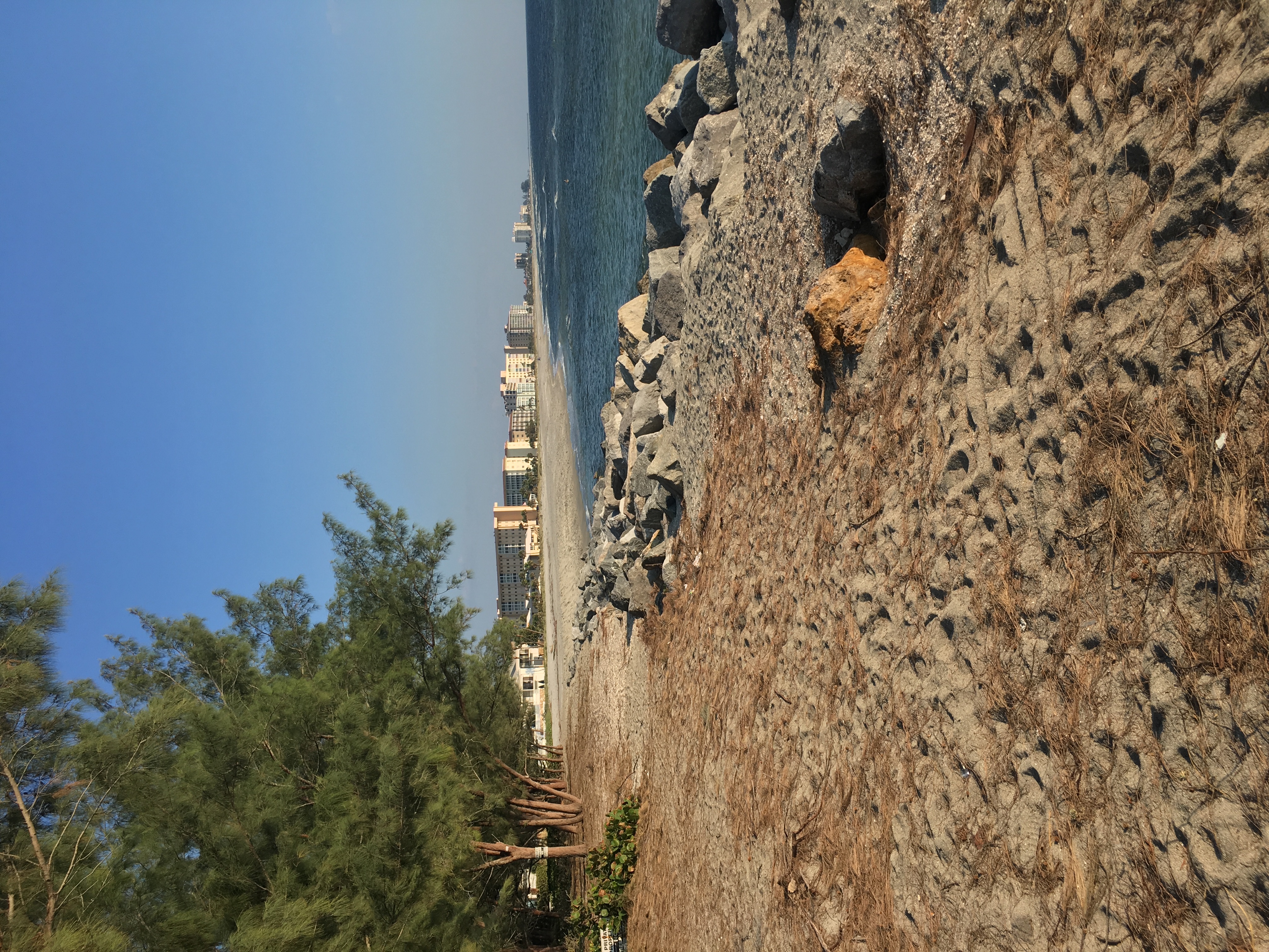 Venice's Beachfront from Humphris Park | |
|
Seal | |
| Nickname: Shark Tooth Capital of the World[1] | |
| Motto: "City on the Gulf"[2] | |
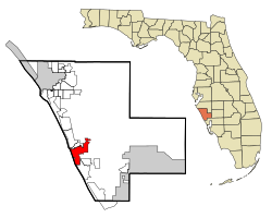 Location in Sarasota County and the state of Florida | |
| Coordinates: 27°6′N 82°26′W | |
| Country | United States |
| State | Florida |
| County | Sarasota |
| Horse and Chaise | 1800s |
| Venice | 1888 |
| Incorporated | May 9, 1927, by the Brotherhood of Locomotive Engineers |
| Area | |
| • Total | 17.78 sq mi (46.05 km2) |
| • Land | 16.13 sq mi (41.77 km2) |
| • Water | 1.65 sq mi (4.28 km2) |
| Elevation | 10 ft (3 m) |
| Population (2020) | |
| • Total | 25,463 |
| • Density | 1,578.71/sq mi (609.54/km2) |
| Time zone | UTC−5 (Eastern (EST)) |
| • Summer (DST) | UTC−4 (EDT) |
| ZIP codes | 34284, 34285, 34292, 34293 |
| Area code | 941 |
| FIPS code | 12-73900[4] |
| GNIS feature ID | 0292749[5] |
| Website | venicegov.com |
History
The area that is now Venice was originally the home of Paleo-Indians, with evidence of their presence dating back to 8200 BCE.[9] As thousands of years passed, and the climate changed and some of the Pleistocene animals that the Indians hunted became extinct, the descendents of the Paleo-Indians found new ways to create stone and bone weapons to cope with their changing environment. These descendents became known as the Archaic peoples. Evidence of their camps along with their stone tools were discovered in parts of Venice.[10] Over several millennia the culture and people who lived in the area changed. The peoples who the Spanish encountered when they arrived in 1500s were mound-builders. Venice lay in a boundary area between two cultures, the Tocobaga and the Calusa, and so you can find evidence of each in the area.[11]
The 1800s is when the area saw the first wave of "European" settlers. Venice was first known as Horse and Chaise because of a carriage-like tree formation that marked the spot for fishermen. In the 1870s, Robert Rickford Roberts established a homestead near a bay that bears his name today, Roberts Bay.[12] Francis H. "Frank" Higel, originally from France, arrived in Venice in 1883 with his wife and six sons. He purchased land in the Roberts' homestead for $2,500, equivalent to $73,000 in 2021[13], to set up his own homestead. Higel established a citrus operation involving the production of several lines of canned citrus items, such as jams, pickled orange peel, lemon juice, and orange wine.[14] Higel established a post office in 1885 with the name Eyry as a service for the community's thirty residents. In February he was appointed as postmaster but the office was shut down months later, in November 1885, with services moving back to Osprey. In 1888, another post office was established, this time with the name Venice, a name Higel himself suggested because of its likeness to the canal city in Italy.[15][16]
During the Florida land boom of the 1920s, Fred H. Albee, an orthopedic surgeon renowned for his bone-grafting operations, bought 112 acres (45 ha) from Bertha Palmer to develop Venice.[12] He hired John Nolen to plan the city and create a master plan for the streets. Albee sold the land to the Brotherhood of Locomotive Engineers and retained Nolen as city planner. The first portions of the city and infrastructure were constructed in 1925–1926.[17]
Geography
According to the United States Census Bureau, the city has a total area of 16.6 square miles (43.1 km2), of which 15.3 square miles (39.5 km2) is land and 1.4 square miles (3.5 km2), or 8.19%, is water.[8] The climate of Venice is Humid Subtropical, bordering very closely on a Tropical Savanna climate and features pronounced wet and dry seasons.
Climate
| Climate data for Venice, Florida, 1991–2020 normals, extremes 1927–present | |||||||||||||
|---|---|---|---|---|---|---|---|---|---|---|---|---|---|
| Month | Jan | Feb | Mar | Apr | May | Jun | Jul | Aug | Sep | Oct | Nov | Dec | Year |
| Record high °F (°C) | 89 (32) |
89 (32) |
90 (32) |
95 (35) |
98 (37) |
100 (38) |
100 (38) |
99 (37) |
99 (37) |
97 (36) |
91 (33) |
89 (32) |
100 (38) |
| Average high °F (°C) | 72.4 (22.4) |
75.0 (23.9) |
77.9 (25.5) |
82.5 (28.1) |
87.3 (30.7) |
89.9 (32.2) |
91.5 (33.1) |
91.5 (33.1) |
90.0 (32.2) |
85.8 (29.9) |
80.0 (26.7) |
75.0 (23.9) |
83.2 (28.4) |
| Daily mean °F (°C) | 62.0 (16.7) |
64.6 (18.1) |
67.7 (19.8) |
72.5 (22.5) |
77.5 (25.3) |
81.4 (27.4) |
82.9 (28.3) |
83.1 (28.4) |
81.6 (27.6) |
76.6 (24.8) |
69.9 (21.1) |
64.9 (18.3) |
73.7 (23.2) |
| Average low °F (°C) | 51.6 (10.9) |
54.2 (12.3) |
57.5 (14.2) |
62.5 (16.9) |
67.8 (19.9) |
72.9 (22.7) |
74.3 (23.5) |
74.7 (23.7) |
73.2 (22.9) |
67.5 (19.7) |
59.7 (15.4) |
54.8 (12.7) |
64.2 (17.9) |
| Record low °F (°C) | 23 (−5) |
26 (−3) |
31 (−1) |
38 (3) |
49 (9) |
56 (13) |
62 (17) |
65 (18) |
60 (16) |
36 (2) |
29 (−2) |
22 (−6) |
22 (−6) |
| Average precipitation inches (mm) | 2.68 (68) |
2.00 (51) |
2.97 (75) |
2.47 (63) |
3.25 (83) |
7.81 (198) |
7.39 (188) |
8.34 (212) |
7.16 (182) |
3.35 (85) |
1.54 (39) |
2.31 (59) |
51.27 (1,302) |
| Average precipitation days (≥ 0.01 in) | 7.5 | 5.4 | 5.9 | 5.3 | 6.5 | 12.2 | 14.9 | 16.0 | 14.4 | 8.1 | 4.7 | 6.4 | 107.3 |
| Source: NOAA[18][19] | |||||||||||||
Demographics
| Historical population | |||
|---|---|---|---|
| Census | Pop. | %± | |
| 1930 | 309 | — | |
| 1940 | 507 | 64.1% | |
| 1950 | 727 | 43.4% | |
| 1960 | 3,444 | 373.7% | |
| 1970 | 6,648 | 93.0% | |
| 1980 | 12,153 | 82.8% | |
| 1990 | 16,922 | 39.2% | |
| 2000 | 17,764 | 5.0% | |
| 2010 | 20,748 | 16.8% | |
| 2020 | 25,463 | 22.7% | |
| U.S. Decennial Census[20] | |||
As of the 2020 census,[21] there was a population of 25,463, with 12,521 households.
1.2% of the population were under 5 years old, 6.4% were under 18 years old, and 61.9% was 65 years and older.
Of that population, 92.8% were white, 0.6% black or African American, 0.1% American Indian and Alaska Native, 2.4% Asian, 0.2% Native Hawaiian and Other Pacific Islander, 3.4% two or more races, and 3.1% Hispanic or Latino.
3,204 veterans lived in the city and 9.5% of the population were foreign born persons. 54.6% of the population were female persons.
90.9% of the households had a computer and 81.3% had a broadband internet subscription.
The median household income was $61,953 with a per capita income of $60,284. 6.8% of the population lived below the poverty threshold.
Arts and culture
Annual cultural events


Venice has been listed in several publications as being the "Shark's Tooth Capital of the World".[22] It hosts the Shark's Tooth Festival every year to celebrate the abundance of fossilized shark's teeth that can be found on its coastal shores.
Museums and other points of interest
The following structures and areas are listed on the National Register of Historic Places:
- Armada Road Multi-Family District
- Blalock House
- Eagle Point Historic District
- Edgewood Historic District
- Hotel Venice
- House at 710 Armada Road South
- Johnson-Schoolcraft Building
- Levillain-Letton House
- Triangle Inn
- Valencia Hotel and Arcade
- Venezia Park Historic District
- Venice Depot
Theatre and music
- Venice Theatre is the largest per-capita community theater in the United States with an operating budget of almost three million dollars.[23]
Media
Venice's newspaper is the Venice Gondolier Sun. It is published twice each week and has a circulation of 13,500 copies.[24][25]
Tampa Bay's Univision affiliate WVEA-TV is licensed to Venice, though it is based in Tampa and broadcasts from Riverview.
Infrastructure
Transportation
Venice is served by U.S. Highway 41, which runs north–south on the western side of Florida; Interstate 75 is a short distance east of Venice.
Passenger railroad service, served by the Seaboard Coast Line, last ran to the station in 1971, immediately prior to the Amtrak assumption of passenger rail operation.[26] Previously Venice was one of the Florida destinations of the Orange Blossom Special.[27]
Venice Municipal Airport is a city managed public-use airport located two miles (3.2 km) south of the central business district.
Law enforcement
Venice is patrolled by the Venice Police Department, Tom Mattmuller is the current Chief of Police. The small department has special units for bike patrols, traffic patrols, and boat patrols, amongst the normal police services provided. There are a total of 47 police officers that serve Venice. [28]
Notable people
- Dri Archer, American football player [29]
- Trey Burton, American football player [30]
- Hector A. Cafferata Jr., United States Marine who received the Medal of Honor for his heroic service at the Battle of Chosin Reservoir during the Korean War[31]
- Walter Farley, author of The Black Stallion[32]
- Dick Hyman, jazz musician [33]
- Forrest Lamp, professional football player
- Alvin Mitchell, American football player [34][35]
- Tom Tresh, professional baseball player
- Steve Trout, former major league baseball pitcher
- Early Wynn, professional baseball player
See also
- Huffman Aviation, a flight school at Venice Municipal Airport which was attended by several of the hijackers of the September 11 attacks
- Kentucky Military Institute, which wintered in Venice for many years
- Ringling Bros. and Barnum & Bailey Circus, whose Clown College originally was located in Venice, and whose winter headquarters used to be in Venice
- Tervis Tumbler, a United States drinkware manufacturer with headquarters and production in Venice
References
- "Authentic Florida: Venice, "Shark Tooth Capital of the World"". Visit Sarasota. Retrieved April 10, 2018.
- "Official Website of City of Venice, Florida". Official Website of City of Venice, Florida. Retrieved September 19, 2012.
- "2020 U.S. Gazetteer Files". United States Census Bureau. Retrieved December 2, 2021.
- "U.S. Census website". United States Census Bureau. Retrieved January 31, 2008.
- "US Board on Geographic Names". United States Geological Survey. October 25, 2007. Retrieved January 31, 2008.
- "Map of Southwest Florida".
- US Census Bureau (September 24, 2021). "QuickFacts - Venice city, Florida". US Census Bureau - Quick Facts. Retrieved September 24, 2021.
{{cite web}}: CS1 maint: url-status (link) - "Geographic Identifiers: 2010 Demographic Profile Data (G001): Venice city, Florida". U.S. Census Bureau, American Factfinder. Archived from the original on February 12, 2020. Retrieved April 10, 2018.
- Milanich, Jerald T. (February 1976). "Indians of North Central Florida". Florida Anthropologist. 31: 131–140.
- Almy, Marion M. (September 1985). "An Archaeological Survey of Selected Portion of the City of Venice". City of Venice: unpublished manuscript prepared for Venice Historical Survey Committee. p. 7.
- Mathews, Janet Snyder (2017). Venice: Journey from Horse and Chaise (2nd ed.). Sesquicentennial Productions Inc. pp. 10–11. ISBN 978-0-9621986-0-1.
- Angermann, Chris (February 16, 2013). "In Venice, an island of history and charm". Sarasota Herald-Tribune. Retrieved February 15, 2021.
- 1634–1699: McCusker, J. J. (1997). How Much Is That in Real Money? A Historical Price Index for Use as a Deflator of Money Values in the Economy of the United States: Addenda et Corrigenda (PDF). American Antiquarian Society. 1700–1799: McCusker, J. J. (1992). How Much Is That in Real Money? A Historical Price Index for Use as a Deflator of Money Values in the Economy of the United States (PDF). American Antiquarian Society. 1800–present: Federal Reserve Bank of Minneapolis. "Consumer Price Index (estimate) 1800–". Retrieved April 16, 2022.
- "Early History". Venice, Florida. Retrieved February 6, 2021.
- "Frank Higel was Entrepreneur and Pioneer". Sarasota History Alive!. Retrieved February 6, 2021.
- Deming, J., Schwarz, R., Carender, P., Delanaye, D., & Williams, J. Sarasota County Department of Historical Resources. (1990). An Historic Resources Survey of the Coastal Zone of Sarasota County, Florida. Department of Environmental Regulation. Retrieved from https://www.govinfo.gov/content/pkg/CZIC-g70-215-c63-f6-1990/html/CZIC-g70-215-c63-f6-1990.htm
- "The History of Venice, Fl: Preserving the Past". Visit Sarasota. Retrieved February 6, 2021.
- "NOWData - NOAA Online Weather Data". National Oceanic and Atmospheric Administration. Retrieved May 23, 2021.
- "Summary of Monthly Normals 1991-2020". National Oceanic and Atmospheric Administration. Retrieved May 23, 2021.
- "Census of Population and Housing". Census.gov. Retrieved June 4, 2015.
- "QuickFacts Venice city, Florida". United States Census Bureau. Retrieved May 26, 2022.
- "Profile for Venice, Florida, FL". ePodunk. Archived from the original on November 3, 2014. Retrieved September 19, 2012.
- "Venice Theatre History | Venice Theatre". Venice Theatre. Retrieved February 4, 2016.
- "Venice Gondolier Sun". Venice Gondolier Sun. Retrieved September 19, 2012.
- "Venice Gondolier Sun". Mondo Times. Retrieved September 19, 2012.
- "Venice Train Depot | Sarasota History Alive!". Archived from the original on February 1, 2014. Retrieved June 18, 2013.
- Bowen, Eric H. "The Orange Blossom Special – December, 1941 – Streamliner Schedules". Retrieved April 4, 2017.
- "City of Venice". Retrieved April 4, 2017.
- Palattella, Henry (March 2, 2020). "What the hell happened to Dri Archer?". Medium. Retrieved January 4, 2021.
- Levey-Baker, Cooper (January 3, 2019). "With the NFL Playoffs Looming, a Former Venice High Football Star Hopes for More Super Bowl Magic". Sarasota Magazine. Retrieved February 3, 2022.
- "Obituary: Hector A. Cafferata Jr. 1929 - 2016". Sarasota Herald Tribune. April 15, 2016.
- About Walter Farley: The Black Stallion. The Black Stallion | Black Stallion Ranch - The Official Fan Site By Tim Farley. (2017, May 10). Retrieved February 4, 2022, from https://theblackstallion.com/web/author/
- Feinman, M. (Spring 2012). A Conversation with Dick Hyman. Saw Palm, 6, 97-99. Retrieved from http://www.sawpalm.org/uploads/6/6/2/8/6628902/saw_palm_-_volume_6_-_2012.pdf on 2 February 2022.
- "ALVIN MITCHELL". profootballarchives.com. Archived from the original on September 9, 2015. Retrieved October 23, 2015.
- "Alvin Mitchell". Trading Card Database. Retrieved February 4, 2022.
External links
Municipalities and communities of Sarasota County, Florida, United States | ||
|---|---|---|
County seat: Sarasota | ||
| Cities |  | |
| Town | ||
| CDPs |
| |
| Unincorporated communities | ||
| Footnotes | ‡This populated place also has portions in an adjacent county or counties, †This populated place also has portions in the City of North Port | |
| ||
Authority control | |
|---|---|
| General | |
| National libraries | |
| Other | |
На других языках
[de] Venice (Florida)
Venice ist eine Stadt im Sarasota County im US-Bundesstaat Florida mit 20.748 Einwohnern (Stand: 2010).- [en] Venice, Florida
Другой контент может иметь иную лицензию. Перед использованием материалов сайта WikiSort.org внимательно изучите правила лицензирования конкретных элементов наполнения сайта.
WikiSort.org - проект по пересортировке и дополнению контента Википедии