geo.wikisort.org - Sea
The Labrador Current is a cold current in the North Atlantic Ocean which flows from the Arctic Ocean south along the coast of Labrador and passes around Newfoundland, continuing south along the east coast of Canada near Nova Scotia. Near Nova Scotia, this cold water current meets the warm northward moving Gulf Stream. The combination of these two currents produces heavy fogs and has also created one of the richest fishing grounds in the world.
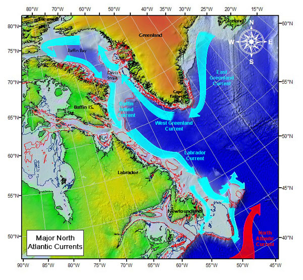
In spring and early summer, the Labrador Current transports icebergs from the glaciers of Greenland southwards into the trans-Atlantic shipping lanes. The waters of the current have a cooling effect on the Canadian Atlantic provinces, and on the United States' upper northeast coast from Maine south to Massachusetts. South of Cape Cod, Massachusetts, the Gulf Stream becomes the dominant ocean current.
Iceberg transport
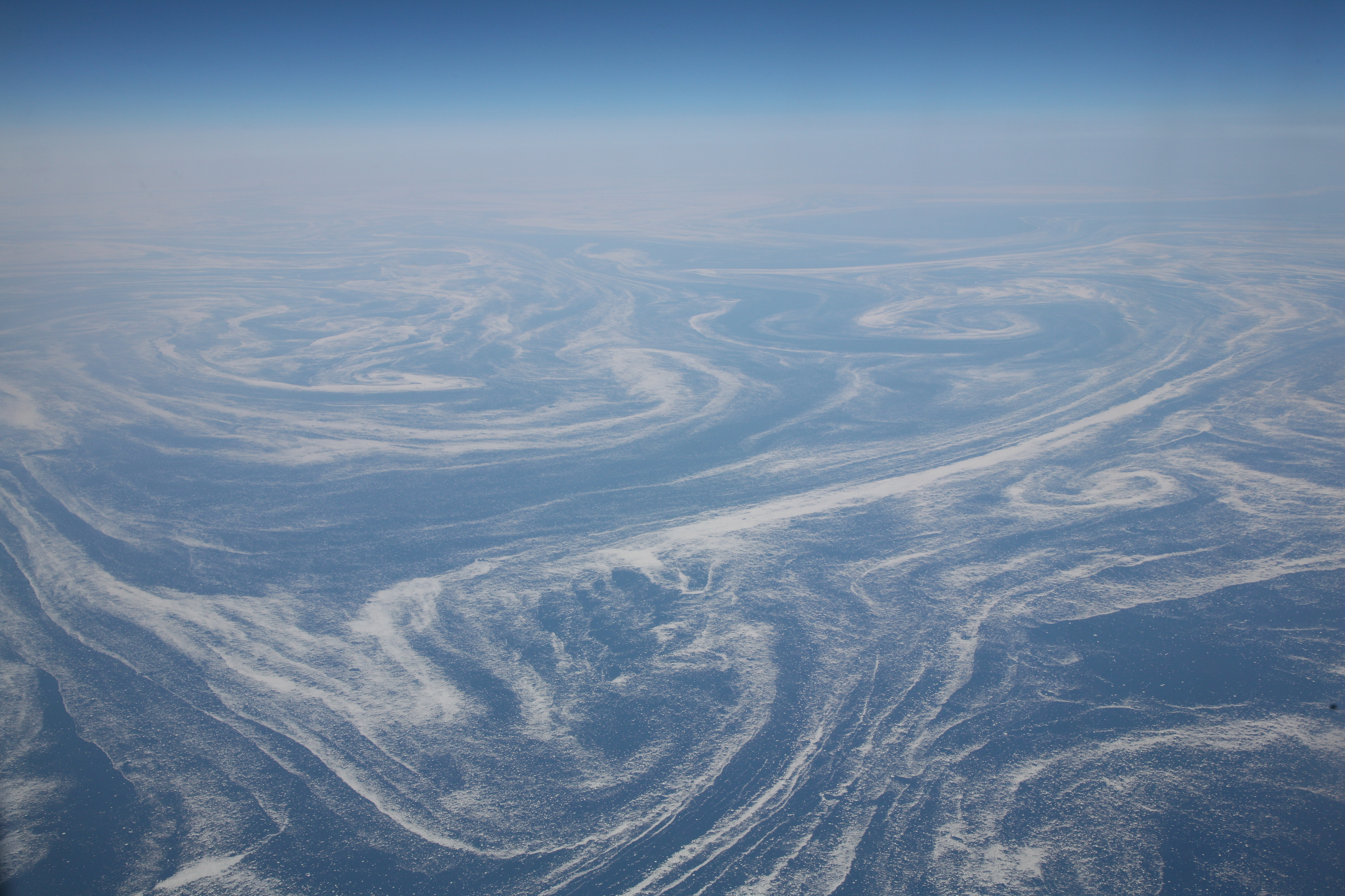
The Labrador Current has a tendency to sometimes go farther south and/or east than normal. This can produce hazardous shipping conditions, for it can carry icebergs into an area of the Atlantic where they are not usually found. The current has been known to transport icebergs as far south as Bermuda and as far east as the Azores. After the sinking of RMS Titanic in 1912, the International Ice Patrol was set up to track icebergs, including those found in areas of the ocean where they are rarely located.[1]
References
- "Forefront of Evidence-Based Disaster Management". Suburban Emergency Management Project. Archived from the original on 2009-10-07. Retrieved 2010-01-05. The "Meandering Labrador Current" paragraph
External links
Ocean currents and gyres | |||||||||||
|---|---|---|---|---|---|---|---|---|---|---|---|
| Currents |
| ||||||||||
| Gyres |
| ||||||||||
| Related |
| ||||||||||
На других языках
- [en] Labrador Current
[ru] Лабрадорское течение
Лабрадо́рское течение — это холодное морское течение в Атлантическом океане, протекающее между побережьем Канады и Гренландией и устремлённое в южном направлении из моря Баффина до Ньюфаундлендской банки. Скорость течения 25—55 см/с; в феврале температура на поверхности изменяется от −1 °C на севере до 5 °C на юге, повышаясь в августе до 2-10 °C соответственно[1].Другой контент может иметь иную лицензию. Перед использованием материалов сайта WikiSort.org внимательно изучите правила лицензирования конкретных элементов наполнения сайта.
WikiSort.org - проект по пересортировке и дополнению контента Википедии