geo.wikisort.org - Sea
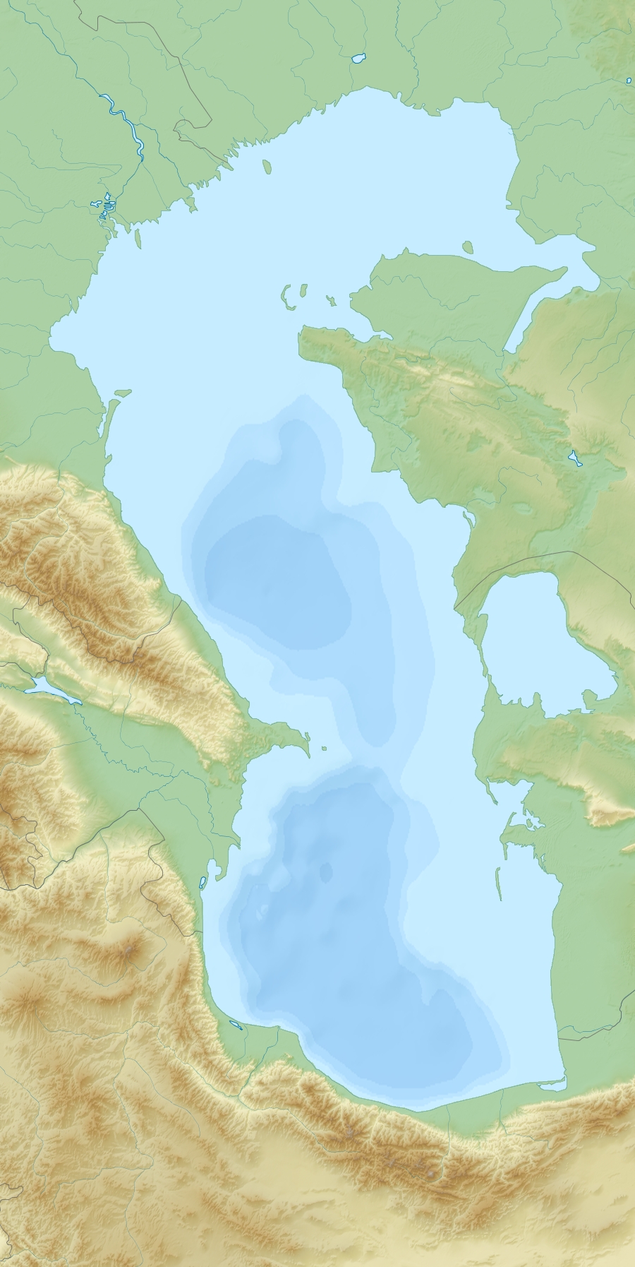
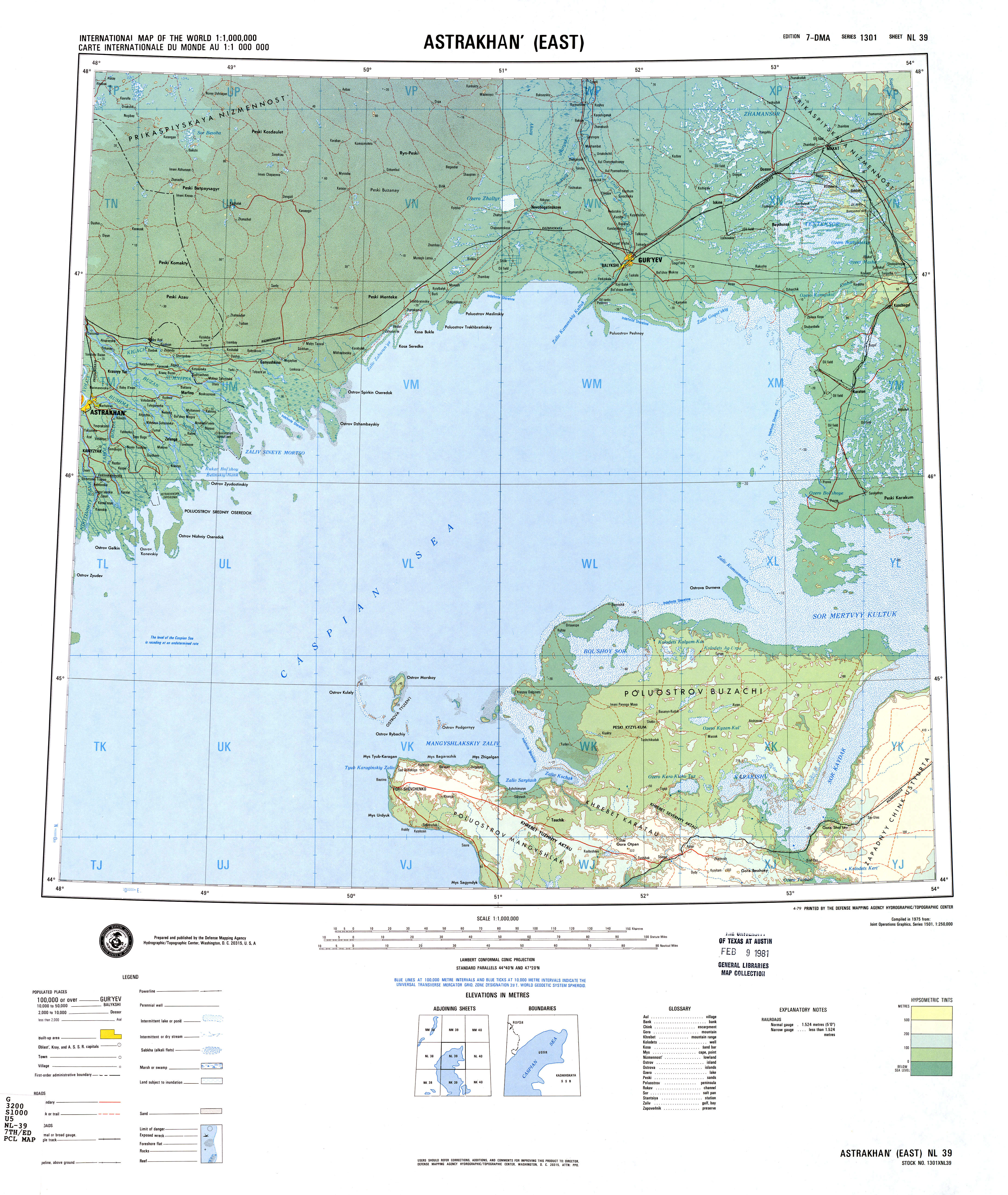
The Kaydak Inlet or Sor Kaydak (Russian: Залив Кайдак) is a narrow inlet or arm at the eastern end of the Dead Kultuk (former Komsomolets), a bay of the Caspian Sea in the coast of Kazakhstan. Located at the mainland end of the bay, it forms the eastern limit of the Buzachi Peninsula, at the north of the Mangyshlak Peninsula.[1] The inlet is shallow and cuts deep into the coast extending east and then roughly southwards in a SSW direction. Like all shallow gulfs of the eastern shores of the Caspian, it has a high salinity.[2]
Kaydak Inlet
Залив Кайдак Sor Kaydak | |
|---|---|
Inlet | |
 Kaydak Inlet | |
| Coordinates: 44°41′N 53°25′E | |
| Country | Kazakhstan |
| Region | Mangystau Region |
| Sea | Caspian Sea |
In the same manner as the Dead Kultuk, the Kaydak Inlet had a distinct coastline in former times, but since the 1990s, with higher Caspian Sea levels, the water penetrates inland through the neck of the bay producing waterlogged marshes. Nowadays both the bay and the inlet are filled with Caspian Sea water.[3] The water in the shallow inlet has striking colours, in which delicate tones of blue or of brown predominate according to the seasons.[4]
Cartography
The area was mapped by Fedor Ivanovich Soimonov during the Caspian Expedition, which surveyed the Caspian Sea from 1719 to 1727, but was only accurately described later by G. S. Karelin in 1832.[3]
 |
 |
See also
References
- NASA Visible Earth: Sor Kaydak, Caspian Sea, Kazakhstan
- Jacques C.J. Nihoul, Peter O. Zavialov, Philip P. Micklin eds. Dying and Dead Seas Climatic Versus Anthropic Causes, p. 189
- Igor S. Zonn, Aleksey N Kosarev, Michael H. Glantz & Andrey G. Kostianoy, The Caspian Sea Encyclopedia, p. 156
- Earth As Art 3: A Landsat Perspective
External links
- Caspian Sea Biodiversity
- Overview of oil and natural gas in the Caspian Sea region Last Updated: August 26, 2013
This Kazakhstan location article is a stub. You can help Wikipedia by expanding it. |
На других языках
- [en] Kaydak Inlet
[ru] Кайдак
Кайда́к (каз. Қайдақ) — узкий и длинный мелководный залив на восточном берегу Каспийского моря на территории Казахстана, составляющий продолжение Мёртвого Култука (залива Цесаревича) на юго-западе и ограничивающий с востока полуостров Бузачи. Глубина залива доходит местами до 4—5 метров. К западу от залива находится песчаная равнина Жылымшык.Другой контент может иметь иную лицензию. Перед использованием материалов сайта WikiSort.org внимательно изучите правила лицензирования конкретных элементов наполнения сайта.
WikiSort.org - проект по пересортировке и дополнению контента Википедии