geo.wikisort.org - Fiume
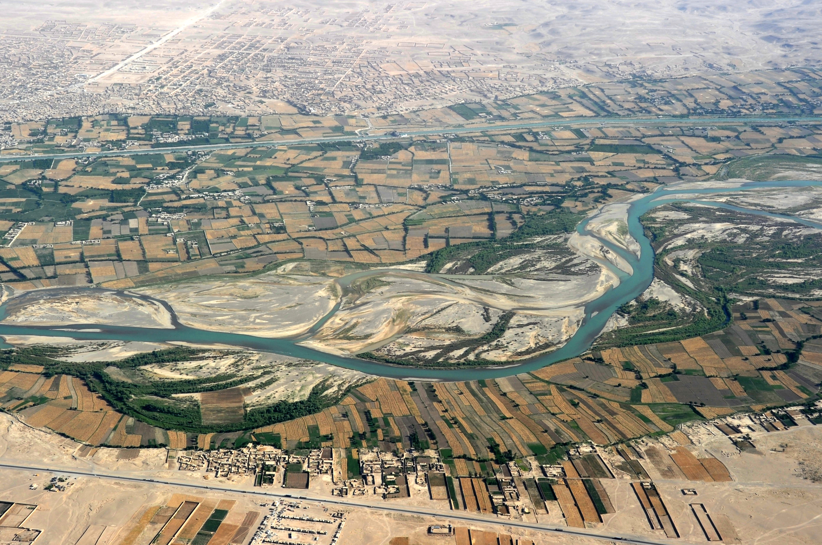
L'Argandāb o Arghandāb Rōd[2] è un fiume dell'Afghanistan, lungo 400 km. Nasce nell'Hazarajat, presso la città di Ghazni, e scorre in direzione sud-ovest fino a confluire nel fiume Helmand, di cui è il maggior affluente, presso Lashkar Gah, 30 km a valle di Girishk.
| Arghandab | |
|---|---|
 | |
| Stato | |
| Lunghezza | 562[1] km |
| Bacino idrografico | 52 955[1] km² |
| Altitudine sorgente | 3 900 m s.l.m. |
| Nasce | Kūh-e Ṣafīd (Hazarajat) 32°46′48″N 66°54′36″E |
| Sfocia | Helmand 31°26′37″N 64°22′59″E |
 | |
Nella parte bassa del corso del fiume l'acqua viene ampiamente sfruttata per l'irrigazione e la valle è coltivata e popolata.
Non è chiaro se l'antico Arachotus sia riconducibile all'Arghandab o al suo principale affluente, il Tarnak, che gli scorre parallelo. Le rovine a Ulan Robat, che si suppone rappresentino la città di Arachosia, sorgono nel suo bacino; il lago conosciuto come Ab-i-Istada, probabilmente il lago Arachotus, è vicino alla sorgente del Tarnak, sebbene non comunichi con questo. Sul Tarnak sorge una diga che ha la funzione di poter regolare l'irrigazione e nella stagione estiva diventa quasi asciutto.
Nel 2015 si è conclusa la prima fase del progetto per riattivare la diga di Dahla (31°50′58″N 65°53′19″E). Seconda diga più grande dell'Afghanistan e costruita nel 1952.[3][4]

Note
- (EN) Arḡandāb river, su iranicaonline.org. URL consultato il 27 febbraio 2019.
- Arghandāb Rōd (river), su getty.edu. URL consultato il 28 febbraio 2019.
- (EN) Dahla Dam project first phase nears completion, su pajhwok.com. URL consultato il 28 febbraio 2019.
- (EN) World Bank, ADB sign agreement to co-finance Kandahar's Dahla Dam rehabilitation project, su 1tvnews.af. URL consultato il 28 febbraio 2019 (archiviato dall'url originale il 1º marzo 2019).
Altri progetti
 Wikimedia Commons contiene immagini o altri file su Arghandab
Collegamenti esterni
- Arghandab, su sapere.it, De Agostini.
| Controllo di autorità | VIAF (EN) 315129974 · LCCN (EN) sh88006944 |
|---|
На других языках
[de] Arghandāb
Der Arghandāb ist ein ca. 400 km langer Fluss in der Helmand-Provinz im Süden Afghanistans.[en] Arghandab River
Arghandab is a river in Afghanistan, about 400 km (250 mi) in length. It rises in the Hazarajat country north-west of Ghazni, flows south-west passing near the city of Kandahar, and then falls into the Helmand 30 km (19 mi) below Girishk. In its lower course it is much used for irrigation, under the control of the Helmand and Arghandab Valley Authority, and the valley is cultivated and populous; yet the water is said to be somewhat brackish. It is doubtful whether the ancient Arachotus is to be identified with the Arghandab or with its chief confluent the Tarnak, which joins it on the left 50 km (31 mi) southwest of Kandahar.[2] The Tarnak, which flows south of Kandahar, is much shorter (length about 320 km or 200 miles) and less copious.- [it] Arghandab
[ru] Аргандаб
Арганда́б[1] (перс. رود ارغنداب; в верховье Сайдахмад[2]) — река в центральной части Афганистана[3]. Левый и самый крупный приток реки Гильменд[4][5].Другой контент может иметь иную лицензию. Перед использованием материалов сайта WikiSort.org внимательно изучите правила лицензирования конкретных элементов наполнения сайта.
WikiSort.org - проект по пересортировке и дополнению контента Википедии