geo.wikisort.org - River
The Viaur (French pronunciation: [vjɔʁ]) is a 168-kilometre-long (104 mi) river in south-western France. It is a left tributary of the Aveyron.[1] Its source is in the southern Massif Central, north of Millau. It flows generally west through the following departments and towns:
- Aveyron: Pont-de-Salars
- Tarn: Pampelonne
- Tarn-et-Garonne: Laguépie
| Viaur | |
|---|---|
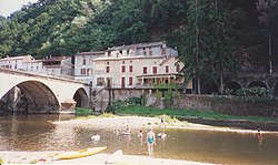
 The Viaur at Laguépie | |
| Location | |
| Country | France |
| Physical characteristics | |
| Source | |
| • location | Massif Central |
| • elevation | 1,070 m (3,510 ft) |
| Mouth | |
• location | Aveyron |
• coordinates | 44°8′39″N 1°58′1″E |
| Length | 168 km (104 mi) |
| Basin size | 1,530 km2 (590 sq mi) |
| Discharge | |
| • average | 6 m3/s (210 cu ft/s) |
| Basin features | |
| Progression | Aveyron→ Tarn→ Garonne→ Gironde estuary→ Atlantic Ocean |
The Viaur flows into the Aveyron in Laguépie.
Its main tributary is the Céor.
References
| Wikimedia Commons has media related to Viaur. |
На других языках
[de] Viaur
Der Viaur ist ein Fluss in Südfrankreich, in der Region Okzitanien.- [en] Viaur
[es] Río Viaur
El río Viaur es un río de Francia, el principal afluente del río Aveyron, en el que desemboca, por la izquierda, en Laguépie (Tarn y Garona), a 150msnm. Nace a 1.090 msnm, en el Puech del Pal, en el macizo Central, en el departamento de Aveyron. Su longitud es de 166 km y drena una cuenca de 1.530 km².[it] Viaur
Il Viaur è un fiume del centro della Francia, affluente dell'Aveyron, lungo 168 km.[1] Nasce presso Vézins-de-Lévézou, nel dipartimento dell'Aveyron, sul Puech del Pal, e sfocia a Laguépie, nel Tarn e Garonna.Текст в блоке "Читать" взят с сайта "Википедия" и доступен по лицензии Creative Commons Attribution-ShareAlike; в отдельных случаях могут действовать дополнительные условия.
Другой контент может иметь иную лицензию. Перед использованием материалов сайта WikiSort.org внимательно изучите правила лицензирования конкретных элементов наполнения сайта.
Другой контент может иметь иную лицензию. Перед использованием материалов сайта WikiSort.org внимательно изучите правила лицензирования конкретных элементов наполнения сайта.
2019-2025
WikiSort.org - проект по пересортировке и дополнению контента Википедии
WikiSort.org - проект по пересортировке и дополнению контента Википедии

