geo.wikisort.org - Mountains
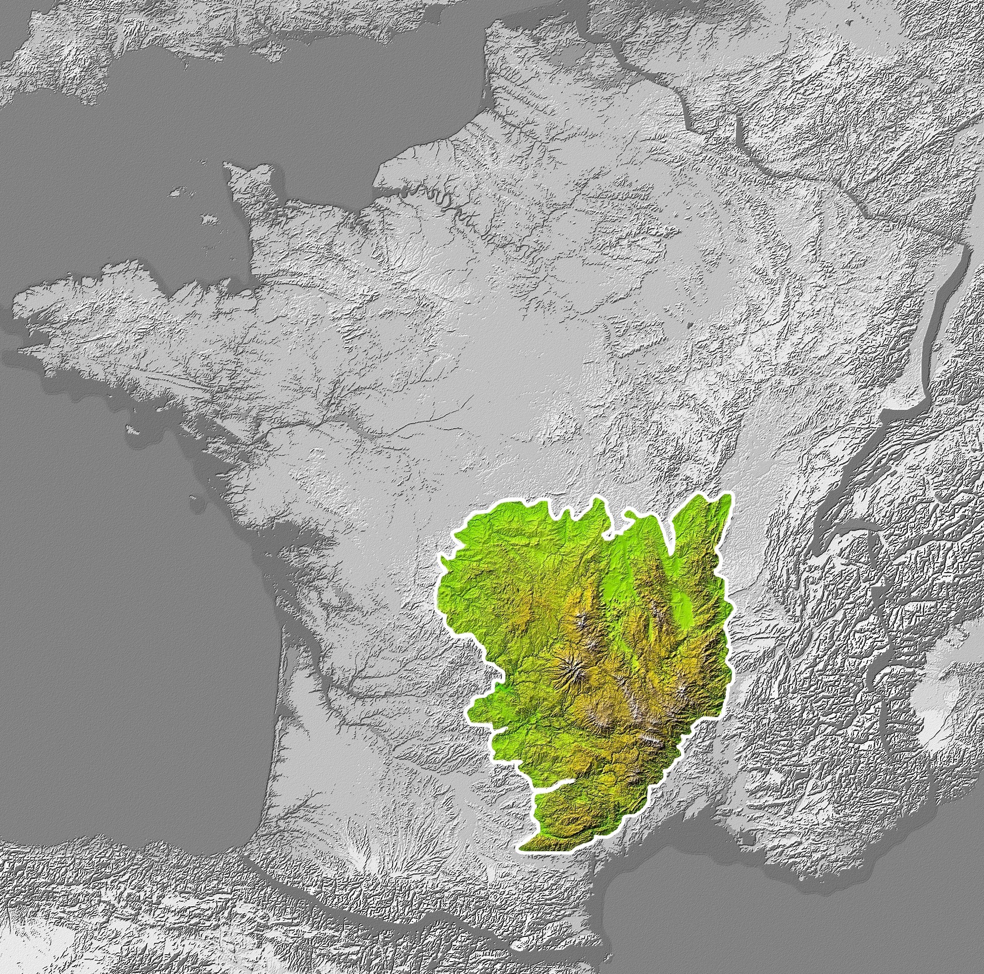
The Massif Central (French pronunciation: [masif sɑ̃tʁal]; Occitan: Massís Central, pronounced [maˈsis‿senˈtral]; literally "Central Massif") is a highland region in south-central France, consisting of mountains and plateaus. It covers about 15% of mainland France.
This article relies largely or entirely on a single source. (May 2019) |
| Massif Central | |
|---|---|
 View of Puy de Sancy, the highest peak in the Massif Central | |
| Highest point | |
| Peak | Puy de Sancy |
| Elevation | 1,886 m (6,188 ft) |
| Coordinates | 45°31′42″N 2°48′51″E |
| Naming | |
| Native name | Massís Central (Occitan) |
| Pronunciation | UK: /ˌmæsiːf sɒ̃ˈtrɑːl/, US: /mæˌsiːf -, - sɛnˈ-, məˌsiːf sɑːnˈ-/[1][2][3] French: [masif sɑ̃tʁal] Occitan: [maˈsis senˈtɾal] |
| Geography | |
| |
| Country | France |
| Regions | Auvergne-Rhône-Alpes, Bourgogne-Franche-Comté, Nouvelle-Aquitaine and Occitania |
| Range coordinates | 46°N 3°E |
Subject to volcanism that has subsided in the last 10,000 years, these central mountains are separated from the Alps by a deep north–south cleft created by the Rhône river and known in French as the sillon rhodanien (literally "Rhône furrow"). The region was a barrier to transport within France until the opening of the A75 motorway, which not only made north–south travel easier, but also opened access to the massif itself.
Geography and geology
The Massif Central is an old massif, formed during the Variscan orogeny, consisting mostly of granitic and metamorphic rocks. It was powerfully raised and made to look geologically younger in the eastern section by the uplift of the Alps during the Paleogene period and in the southern section by the uplift of the Pyrenees. The massif thus presents a strongly asymmetrical elevation profile with highlands in the south and in the east (Cévennes) dominating the valley of the Rhône and the plains of Languedoc and, by contrast, the less elevated region of Limousin in the northwest.
These tectonic movements created faults and may be at the origin of the volcanism in the massif (but the hypothesis is not proved yet). In fact, above the crystalline foundation, one can observe many volcanoes of many different types and ages: volcanic plateaus (Aubrac, Cézallier), stratovolcanoes (Mounts of Cantal, Monts Dore), and small, very recent monogenic volcanoes (Chaîne des Puys, Vivarais). The entire region contains a large concentration of around 450 extinct volcanoes. The Chaîne des Puys (near Clermont-Ferrand), a range running north to south and less than 160 km2 (60 sq mi) long, contains 115 of them (monogenic volcanoes only).[citation needed] The Auvergne Volcanoes regional natural park is in the massif. The amusement park of Vulcania near Clermont-Ferrand allows visitors to discover this natural heritage and introduces them to volcanology.
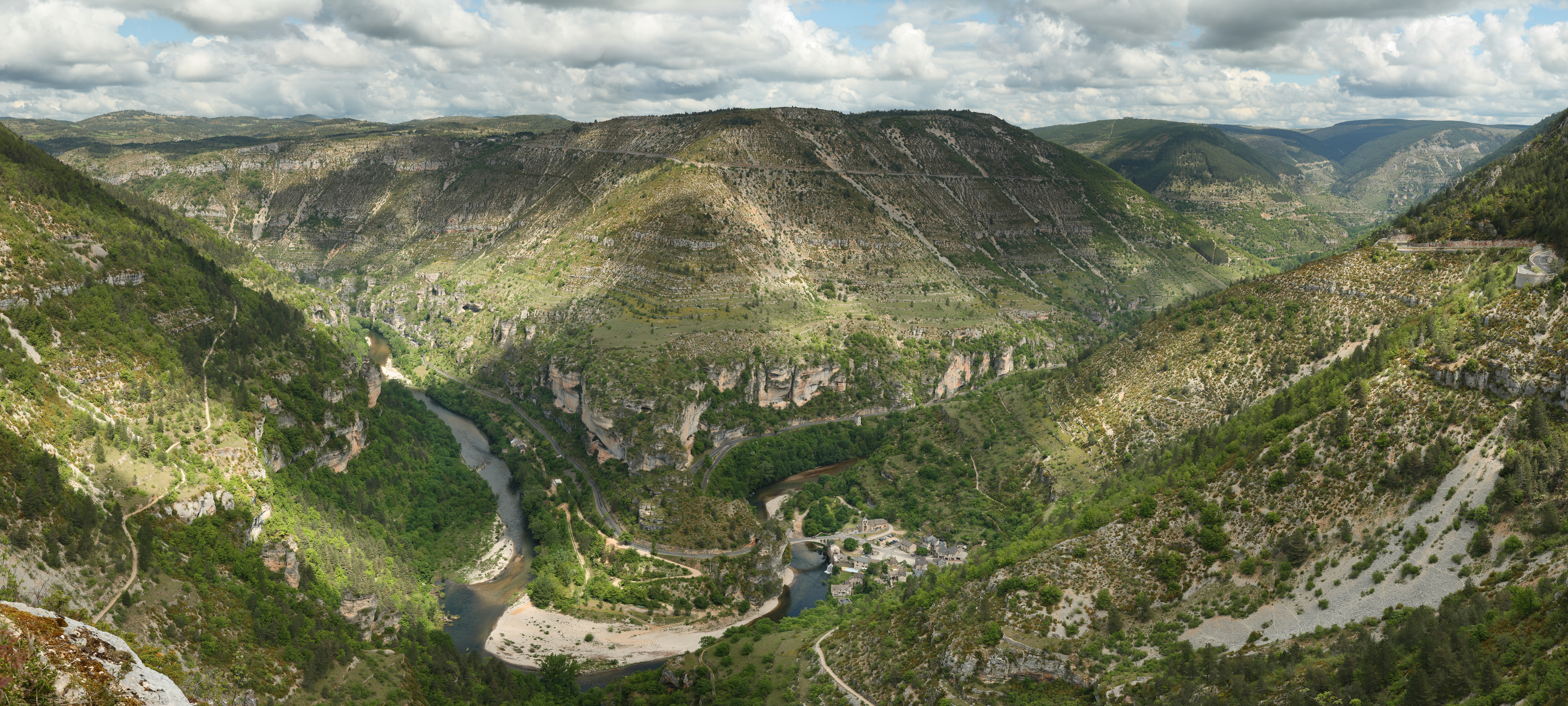
In the south, one remarkable region, made up of features called Causses in French, consists of raised limestone plateaus cut by very deep canyons. The most famous of these is the Gorges du Tarn (canyon of the Tarn).
Mountains
Mountain ranges, with notable individual mountains, are (roughly north to south):
- Chaîne des Puys
- Puy de Dôme (1,464 m, 4,803 ft)
- Puy de Pariou (1,210 m, 3,970 ft)
- Puy de Lassolas (1,187 m, 3,894 ft)
- Puy de la Vache (1,167 m, 3,829 ft)
- Monts Dore
- Puy de Sancy (1,886 m, 6,188 ft)
- Monts du Lyonnais
- Pilat massif
- Crêt de la Perdrix (1,431 m, 4,695 ft)
- Mounts of Cantal
- Plomb du Cantal (1,855 m, 6,086 ft)
- Puy Mary (1,787 m, 5,863 ft)
- Forez
- Pierre-sur-Haute (1,634 m, 5,361 ft)
- L'Aubrac
- Signal de Mailhebiau (1,469 m, 4,820 ft)
- Margeride
- Signal de Randon (1,551 m, 5,089 ft)
- Vivarais (Ardèche)
- Mont Mézenc (1,753 m, 5,751 ft)
- Mont Gerbier de Jonc (1,551 m, 5,089 ft)
- Cévennes
- Mont Lozère (1,699 m, 5,574 ft), the highest non-volcanic summit
- Mont Aigoual (1,567 m, 5,141 ft), near Le Vigan, Florac
- Monts de Lacaune
- Montgrand (1,267 m, 4,157 ft)
- Monts de l'Espinouse
- Sommet de l'Espinouse (1,124 m, 3,688 ft)
- Montagne Noire
- Pic de Nore (1,211 m, 3,973 ft)
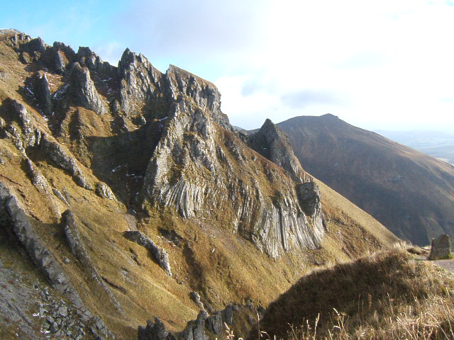
 Chaine des Puys in Auvergne
 Puy de Sancy (1,886 m, 6,188 ft)
 The Cévennes range
 Gorges du Tarn canyon


Plateaus
- Causse du Larzac
- Plateau de Millevaches
- Plateau de Lévézou
- Causse du Comtal
- Causse de Sauveterre
- Causse de Sévérac
- Causse Méjean
- Causse Noir
- Causse de Blandas
Administration
The following departments are generally considered as part of the Massif Central: Allier, Ardèche, Aude, Aveyron, Cantal, Corrèze, Creuse, Gard, Haute-Garonne, Haute-Loire, Haute-Vienne, Hérault, Loire, Lot, Lozère, Puy-de-Dôme, Rhône, Saône-et-Loire, Tarn, and Tarn-et-Garonne; these form parts of the regions of Auvergne-Rhône-Alpes, Bourgogne-Franche-Comté, Nouvelle-Aquitaine and Occitania.
The largest cities in the region are Clermont-Ferrand, Limoges, and Saint-Étienne.
Economy
In the Massif Central, the industry remains little developed except locally (metallurgy in Saint-Étienne, tire industry in Clermont-Ferrand, headquarters of Michelin, world leader in the sector, aeronautics industry in Figeac, etc.). The other industries present are linked to agriculture (Groupe Limagrain, the world's third-largest seed producer, cheese-producing industries that export to the world, such as Cantal and Roquefort).
On the agricultural level, the Limagne plain is dominated by major cereal crops, but in the mountains, it is mainly livestock farming that predominates: cattle farming in the west for meat and milk (Cantal cheese), sheep farming in the south on the limestone plateaus (Roquefort cheese).
Finally, tourism is booming, taking advantage of the UNESCO heritage classification of the volcanoes of the Chaîne des Puys and the Causses and Cévennes region.
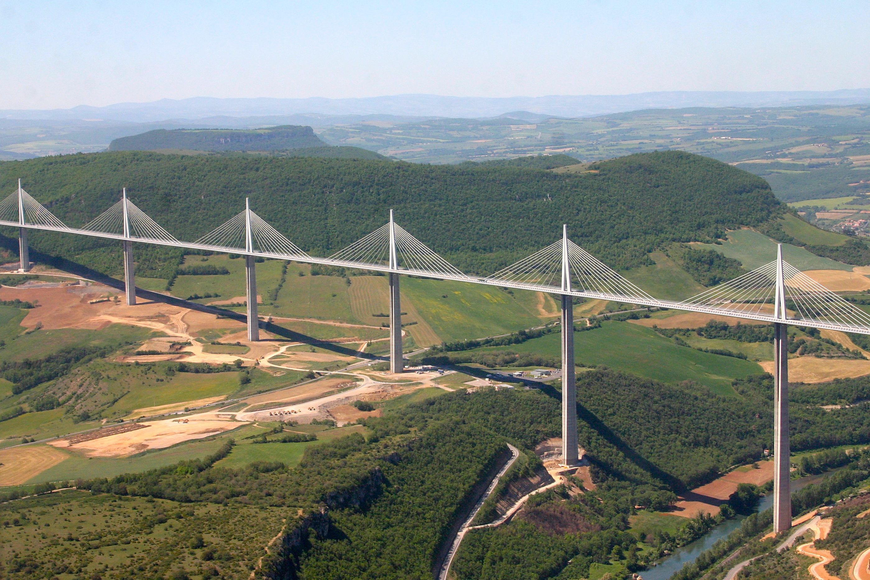
The entire economy of the Massif Central has benefited from the opening of roads, in particular the construction of the A75 motorway (on which is located the famous Millau Viaduct).
See also
- Geography of France
References
- "Massif Central" (US) and "Massif Central". Lexico UK English Dictionary. Oxford University Press. Archived from the original on 2020-03-18.
- "Massif Central". The American Heritage Dictionary of the English Language (5th ed.). HarperCollins. Retrieved 17 May 2019.
- "Massif Central". Merriam-Webster Dictionary. Retrieved 17 May 2019.
External links
 Media related to Massif Central at Wikimedia Commons
Mountain ranges of France | ||
|---|---|---|
| ||
Authority control | |
|---|---|
| General |
|
| National libraries | |
| Other |
|
На других языках
[de] Zentralmassiv
Das Zentralmassiv (französisch Massif central, okzitanisch Massís central) ist ein Gebirge in der Mitte des südlichen Frankreich, das mit einer Fläche von 85.000 km2 ungefähr 15 Prozent des Landes einnimmt. Es trägt seinen Namen aufgrund seiner zentralen Lage in Südfrankreich. Mit einer durchschnittlichen Höhe von 700 Metern und einer maximalen Höhe von 1885 Metern in den Monts Dore ist es höher als die deutschen Mittelgebirge.- [en] Massif Central
[es] Macizo Central
El macizo Central (en occitano: Massís Central o Massís Centrau; en francés: Massif Central) es una región elevada de Francia, situada al centro-sur del país, que está compuesta básicamente de montañas y mesetas. Se trata de un macizo herciniano que presenta tanto zonas volcánicas, con conos y cráteres bien definidos, sobre todo en Auvernia, como grandes mesetas calizas (causses) de suelo pobre y dedicado frecuentemente al pastoreo de ganado ovino. En las zonas graníticas, o de suelo ácido y clima húmedo, como la meseta Millevaches, o el Aubrac, abundan los brezales y pastos. En los últimos cincuenta años se ha producido un fuerte aumento de la superficie forestal en esta región, antiguamente denominada «la cabeza calva de Francia». Esto se debe en parte al éxodo rural, y a la necesidad de implantar un aprovechamiento racional de los recursos naturales, reorientando la economía de muchas zonas a la producción maderera, como sucede en el Morvan (Borgoña).[fr] Massif central
Le Massif central est un massif montagneux essentiellement hercynien qui occupe le centre de la moitié sud de la France métropolitaine. D'une surface de 85 000 km2, soit 15 % environ du territoire métropolitain, c'est le massif le plus vaste du pays. Le massif est d'altitude moyenne et ses reliefs sont souvent arrondis par l'érosion. Il culmine à 1 885 mètres au sommet volcanique du puy de Sancy (sud-ouest du Puy-de-Dôme). Dans l'ensemble, il s'est formé il y a 500 millions d'années, bien que les causses et surtout les reliefs volcaniques soient plus récents, ces derniers étant consécutifs à la formation des Alpes et des Pyrénées. Le Massif central abrite en effet l'essentiel des volcans français de métropole.[it] Massiccio Centrale
Il Massiccio Centrale (in francese Massif Central, in occitano Massís Central) è una vasta regione geografica della Francia centro-meridionale, prevalentemente montuosa e collinare, con una superficie di 85.000 km², separata a est dalle Prealpi francesi dalla valle del Rodano; l'origine geologica della catena montuosa è costituita da un bacino di vulcani estinti e tutti i grandi fiumi francesi, ad eccezione del Rodano, hanno le loro sorgenti (o quelle dei loro principali affluenti) nella zona montuosa o collinare di tale massiccio.[ru] Центральный массив
Центра́льный масси́в[2] (фр. Massif Central) — горный массив в центре и на юге Франции. На востоке отделён от Альп глубокой долиной Роны, вытянутой с севера на юг. Высота до 1886 м (гора Санси).Другой контент может иметь иную лицензию. Перед использованием материалов сайта WikiSort.org внимательно изучите правила лицензирования конкретных элементов наполнения сайта.
WikiSort.org - проект по пересортировке и дополнению контента Википедии