geo.wikisort.org - Mountains
Mont Aigoual (French pronunciation: [mɔ̃ ɛɡwal]; Occitan: Mont Augal, elevation 1567m / 5141 ft) is the highest point of the Gard department, France. It is part of the Massif Central, and it is located within the Cévennes National Park. Its southern slopes are the source of the river Hérault flowing into the Mediterranean.
| Mont Aigoual | |
|---|---|
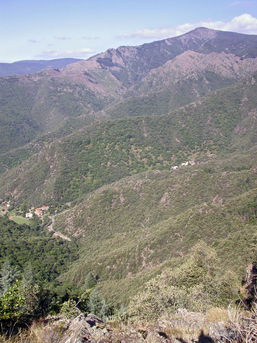 East face of Mont Aigoual | |
| Highest point | |
| Elevation | 1,567 m (5,141 ft) |
| Prominence | 730 m (2,400 ft) |
| Coordinates | 44°07′22″N 3°34′30″E |
| Geography | |
| Location | |
| Parent range | Massif Central |

When the sky is clear, it is possible to see the Mediterranean Sea, the Pyrenees, and also the Alps and Mont Blanc in particular. The summit is accessible by car from a variety of converging surfaced approaches.
Geography and climate
This granite and schist outcrop is a major water catchment area in the Massif Central, being located where clouds from the cold Atlantic converge with warm Mediterranean air currents. The heavy rainfall has given the mountain its name: originally "Aiqualis" ('the watery one'). In an average year rainfall can measure up to 2,250 mm (89 in), making it the wettest place in France. Mont Aigoual forms part of the watershed between the Mediterranean and Atlantic.
The meteorological observatory, built in 1887 by the French Rivers Authority and Forestry Commission under the direction of Georges Fabre, is currently occupied by the French meteorological service (Météo France). It is the last remaining weather station in France which is still inhabited by meteorologists. An exhibition on weather forecasting is open to visitors in the summer months.
Severe weather conditions are sometimes recorded:
- Maximum Temperature : 29.9 °C in 2019;
- Minimum Temperature : -28 °C in 1956;
- Maximum wind speed : 360 km/h on November 1, 1968;
- Maximum rain in 24 hours: 607 mm from 6 p.m. on 30th to 6 p.m. on October 31, 1963;
- Maximum snow during one year : 10.24 metres;
- Frozen days: 144;
- High temperature days (> 25 °C) : 0;
- Rain days: 170;
- High wind days (> 16 m/s) : 265;
- Fog days: 241;
- Days with snow: 116.
Mont Aigoual features a cool-summer variant of an oceanic climate (Cfc), bordering to a subpolar (Dfc) (highland) climate.
| Town | Sunshine (hours/yr) |
Rain (mm/yr) | Snow (days/yr) | Storm (days/yr) | Fog (days/yr) |
|---|---|---|---|---|---|
| National average | 1,973 | 770 | 14 | 22 | 40 |
| Mont Aigoual | N/A | 1,931.7 | 62.3 | 22.7 | 241.0 |
| Paris | 1,661 | 637 | 12 | 18 | 10 |
| Nice | 2,724 | 767 | 1 | 29 | 1 |
| Strasbourg | 1,693 | 665 | 29 | 29 | 56 |
| Brest | 1,605 | 1,211 | 7 | 12 | 75 |
| Climate data for Mont Aigoual, France (altitude 1567m, 1991–2020 normals, extremes 1896–present) | |||||||||||||
|---|---|---|---|---|---|---|---|---|---|---|---|---|---|
| Month | Jan | Feb | Mar | Apr | May | Jun | Jul | Aug | Sep | Oct | Nov | Dec | Year |
| Record high °C (°F) | 15.6 (60.1) |
15.0 (59.0) |
16.5 (61.7) |
20.5 (68.9) |
25.0 (77.0) |
29.9 (85.8) |
28.2 (82.8) |
29.4 (84.9) |
27.8 (82.0) |
20.6 (69.1) |
18.6 (65.5) |
16.7 (62.1) |
29.9 (85.8) |
| Average high °C (°F) | 1.2 (34.2) |
1.0 (33.8) |
3.6 (38.5) |
6.2 (43.2) |
10.3 (50.5) |
14.7 (58.5) |
17.6 (63.7) |
17.6 (63.7) |
13.0 (55.4) |
9.0 (48.2) |
4.4 (39.9) |
2.4 (36.3) |
8.4 (47.1) |
| Daily mean °C (°F) | −1.0 (30.2) |
−1.4 (29.5) |
1.1 (34.0) |
3.4 (38.1) |
7.4 (45.3) |
11.5 (52.7) |
14.1 (57.4) |
14.3 (57.7) |
10.2 (50.4) |
6.7 (44.1) |
2.2 (36.0) |
0.1 (32.2) |
5.7 (42.3) |
| Average low °C (°F) | −3.2 (26.2) |
−3.8 (25.2) |
−1.5 (29.3) |
0.7 (33.3) |
4.4 (39.9) |
8.3 (46.9) |
10.6 (51.1) |
10.9 (51.6) |
7.4 (45.3) |
4.3 (39.7) |
0.0 (32.0) |
−2.3 (27.9) |
3.0 (37.4) |
| Record low °C (°F) | −23.1 (−9.6) |
−28.0 (−18.4) |
−19.7 (−3.5) |
−14.0 (6.8) |
−8.6 (16.5) |
−3.3 (26.1) |
−0.8 (30.6) |
−0.2 (31.6) |
−6.0 (21.2) |
−9.8 (14.4) |
−15.0 (5.0) |
−20.6 (−5.1) |
−28.0 (−18.4) |
| Average precipitation mm (inches) | 176.4 (6.94) |
141.1 (5.56) |
136.9 (5.39) |
169.3 (6.67) |
157.5 (6.20) |
89.1 (3.51) |
57.0 (2.24) |
60.4 (2.38) |
184.0 (7.24) |
309.7 (12.19) |
297.4 (11.71) |
191.2 (7.53) |
1,970 (77.56) |
| Average precipitation days (≥ 1.0 mm) | 12.2 | 10.2 | 10.3 | 11.2 | 10.8 | 7.4 | 6.2 | 7.2 | 8.4 | 13.5 | 13.9 | 12.9 | 124.3 |
| Average snowy days | 12.2 | 11.6 | 11.4 | 9.1 | 3.9 | 0.5 | 0.0 | 0.0 | 0.4 | 2.6 | 6.8 | 10.2 | 68.7 |
| Average relative humidity (%) | 82 | 85 | 83 | 84 | 84 | 82 | 76 | 78 | 80 | 84 | 83 | 81 | 81.8 |
| Source 1: Météo France[2][3][4] | |||||||||||||
| Source 2: Infoclimat.fr (humidity and snowy days, 1961–1990)[5] | |||||||||||||
Tour de France
Mont Aigoual (1507 metres) was first used by the Tour de France in 1987 on Stage 17 from Millau to Avignon, when Italian rider Silvano Contini (Italy) of Del Tongo was first over the summit.[6]
The climb featured in the 2020 Tour de France on Stage 6 as a summit finish from Le Teil.[7] The winner was the Kazakh cyclist Alexey Lutsenko of Astana Pro Team.
The Rider by Tim Krabbé
The Tour of Mont Aigoual is the semi-fictional cycle race in the book The Rider by Tim Krabbé.
The race is recreated on the Rapha[8] and on the inrng[9] weblogs
References
- Paris, Nice, Strasbourg, Brest
- "Données climatiques de la station de Mont Aigoual" (in French). Meteo France. Retrieved January 7, 2016.
- "Climat Languedoc-Roussillon" (in French). Meteo France. Retrieved January 7, 2016.
- "Climate of Mont Aigoual 1991-2020" (PDF) (in French). Météo-France. Retrieved June 10, 2022.
- "Normes et records 1961-1990: Mont Aigoual (30) - altitude 1567m" (in French). Infoclimat. Retrieved January 7, 2016.
- Memoire du Cyclisme - Mont Aigoual
- "Stage 6 Tour de France 2020". ASO. Retrieved 28 August 2020.
- Rapha weblog
- inrng weblog
- Green Guide:Languedoc, Roussillon, Tarn Gorges pp65–68, Michelin Tyre PLC, 1998 ISBN 2-06-136602-3
- The Rider - Tim Krabbe, Bloomsbury Publishing, 2002 ISBN 978-0-7475-5941-2
| Authority control: National libraries |
|---|
На других языках
[de] Mont Aigoual
Der Mont Aigoual liegt im Süden der Cevennen und ist mit 1567 m der höchste Berg im Département Gard und der zweithöchste der Cevennen, nach dem Mont Lozère. Bei klarem Wetter ist es möglich vom Gipfel das Mittelmeer, die Pyrenäen und die Alpen mit dem Gipfel des Mont Blanc zu sehen.- [en] Mont Aigoual
[fr] Mont Aigoual
Le mont Aigoual est un sommet situé dans le Sud du Massif central, à la limite entre les départements du Gard et de la Lozère. Il culmine à 1 565 mètres d'altitude[1]. Cela en fait le point culminant du Gard et le second point le plus haut de la Lozère (ainsi que des Cévennes) après le sommet de Finiels (1 699 m) situé dans le mont Lozère.[it] Monte Aigoual
Il monte Aigoual (occitano: Augal) (1.667 m s.l.m.) è la vetta più alta delle Cevenne, nella zona sud-est del Massiccio Centrale francese. Si trova al confine fra il dipartimento del Lozère e quello del Gard. Il suo territorio è all'interno del Parco nazionale delle Cevenne.Другой контент может иметь иную лицензию. Перед использованием материалов сайта WikiSort.org внимательно изучите правила лицензирования конкретных элементов наполнения сайта.
WikiSort.org - проект по пересортировке и дополнению контента Википедии