geo.wikisort.org - River
The Hérault (French pronunciation: [eʁo] (![]() listen); Occitan: Erau) is a river in southern France. Its length is 147.6 kilometres (91.7 mi).[1] Its source is on the slopes of Mont Aigoual in the Cévennes mountains. It reaches the Mediterranean Sea near Agde.
listen); Occitan: Erau) is a river in southern France. Its length is 147.6 kilometres (91.7 mi).[1] Its source is on the slopes of Mont Aigoual in the Cévennes mountains. It reaches the Mediterranean Sea near Agde.
| Hérault | |
|---|---|
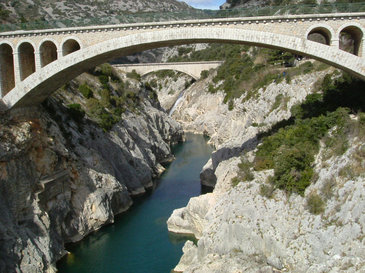 A bridge and aqueduct over the Hérault near Saint-Guilhem-le-Désert, as seen from Pont du Diable | |
 | |
| Native name | L'Hérault (French) |
| Location | |
| Country | France |
| Physical characteristics | |
| Source | |
| • location | Mont Aigoual Cévennes |
| Mouth | |
• location | Mediterranean Sea |
• coordinates | 43°16′57″N 3°26′39″E |
| Length | 147.6 km (91.7 mi) |
| Basin size | 2,900 km2 (1,100 sq mi) |
| Discharge | |
| • average | 50 m3/s (1,800 cu ft/s) |
Name
The river was known in Latin as Arauris (or Araura by Strabo). The name is sometimes considered Pre-Celtic although the element Ara- suggests a Celtic root.[2][3]
Towns

The Hérault flows through the following departments and towns:
- Gard: Valleraugue.
- Hérault (named after the river): Ganges, Pézenas (nearby), Agde.
Tributaries
|
|
|
Navigation
The lower reaches of the Hérault, from Bessan to the sea at Agde, are navigable. The lowest 2.5 kilometres (1.6 mi) are tidal, whilst the next 1 kilometre (0.62 mi) forms part of the Canal du Midi. These two sections of the river are linked to each other, and to the Canal du Midi to the west, by short junction canals and the famous Agde Round Lock.[4][5]
At the upper end of the section of the Hérault used by the Canal du Midi, the Prades Lock provides access to the Canal du Midi to the east. Above this lock, the river is navigable for a further 4 kilometres (2.5 mi) or so.[5]
References
- Sandre. "Fiche cours d'eau - L'Hérault (Y2--0200)".
- Hubert, Henri (June 17, 2013). The Rise of the Celts. Routledge. ISBN 9781136202636 – via Google Books.
- http://docshare02.docshare.tips/files/28516/285161581.pdf [bare URL PDF]
- "Agde – River Herault". Afloat in France. grehanman guides. Retrieved 2010-11-23.
- "Canal du Midi". Afloat in France. grehanman guides. Retrieved 2010-11-23.
This Occitania geographical article is a stub. You can help Wikipedia by expanding it. |
На других языках
[de] Hérault
Der Hérault (Okzitanisch: Erau, von lateinisch: Arauris) ist ein Fluss in Südfrankreich (Region Okzitanien), der dem Département Hérault seinen Namen gegeben hat.- [en] Hérault (river)
[es] Río Hérault
El río Hérault (en occitano Erau o Eraur) es un río costero de Francia que desemboca en el mar Mediterráneo en Le Grau-d’Agde, un barrio de Agda. El río da nombre al departamento de Hérault, por el que discurre en su mayor parte. Nace en el macizo Central francés, en el macizo de las Cévennes, junto al monte Aigoual (Gard). Su longitud es de 160 km y drena una cuenca de unos 2900 km².[it] Hérault (fiume)
L'Hérault (in occitano: Erau o Eraurè) è un fiume della Francia meridionale che si trova nella regione Occitania, di cui attraversa il dipartimento di Gard e poi quello dell'Hérault in direzione nord-sud per poi sfociare nel Mediterraneo presso Agde, al centro del Golfo del Leone, dopo 147.6 km.[1] Dà il nome all'omonimo dipartimento.[ru] Эро (река)
Эро́ (фр. Hérault, окс. Erau / Eraur) — река в департаментах Гар, Эро и Лозер региона Окситания на юге Франции длиной 147,6 км[1].Другой контент может иметь иную лицензию. Перед использованием материалов сайта WikiSort.org внимательно изучите правила лицензирования конкретных элементов наполнения сайта.
WikiSort.org - проект по пересортировке и дополнению контента Википедии