geo.wikisort.org - River
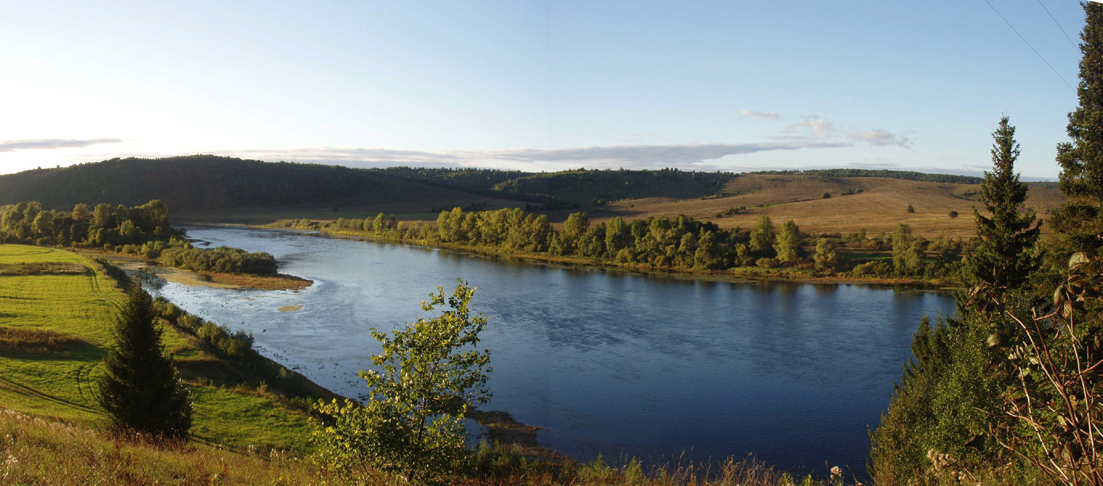
The Ufa (Russian: Уфа, Bashkir: Ҡариҙел, Qariðel, Qaraidel, literally The Black Idel) is a river in the Ural Mountains, Chelyabinsk Oblast, Sverdlovsk Oblast, and the Republic of Bashkortostan; a right tributary of the river Belaya.[1][2] It is 918 kilometres (570 mi) long, and its basin covers 53,100 square kilometres (20,500 sq mi).[3] It freezes up between late October and early December and stays under the ice until April or May. Pavlovka Hydroelectric Station is along the Ufa. The river's water is widely used for water supply. The main ports are Krasnoufimsk and Ufa (at the mouth of the river).
| Ufa | |
|---|---|
 | |
| Native name | |
| Location | |
| Country | Russia |
| Physical characteristics | |
| Mouth | Belaya |
• coordinates | 54°40′41″N 55°59′26″E |
| Length | 918 km (570 mi) |
| Basin size | 53,100 km2 (20,500 sq mi) |
| Discharge | |
| • average | 388 m3/s (13,700 cu ft/s) |
| Basin features | |
| Progression | Belaya→ Kama→ Volga→ Caspian Sea |
Tributaries
The largest tributaries of the Ufa are, from source to mouth:[3]
References
- "Ufa". Merriam Webster. Retrieved 9 February 2014.
- Уфа (река), Great Soviet Encyclopedia
- «Река УФА», Russian State Water Registry
This Sverdlovsk Oblast location article is a stub. You can help Wikipedia by expanding it. |
This Bashkortostan location article is a stub. You can help Wikipedia by expanding it. |
This Chelyabinsk Oblast location article is a stub. You can help Wikipedia by expanding it. |
This article related to a river in Russia is a stub. You can help Wikipedia by expanding it. |
На других языках
[de] Ufa (Fluss)
Die 918 km lange Ufa (russisch Уфа; baschkirisch Ҡариҙел; tatarisch Өфә/Öfä, tschuwaschisch Ӗпхӳ) ist ein rechter Nebenfluss der Belaja im europäischen Teil Russlands.- [en] Ufa (river)
[es] Río Ufá
El río Ufá (también transcrito como Oufa o Ufa) (en ruso, Караидель; en baskir: Ҡариҙел, Qaridhel, literalmente, El Idel Negro) es un largo río ruso localizado en la Rusia europea, un afluente por la derecha del río Belaya, un afluente a su vez del río Kama y este del río Volga. Tiene una longitud de 918 km y desagua una cuenca de 53.100 km² (similar en extensión a países como Croacia o Bosnia y Herzegovina).[it] Ufa (fiume)
La Ufa (anche Karaidel', dal baschiro Ҡариҙел, fiume nero) è un fiume della Russia europea orientale (Oblast' di Čeljabinsk e Sverdlovsk e Repubblica del Baškortostan), affluente di destra della Belaja nel bacino della Kama.[ru] Уфа (река)
Уфа́ (Уфи́мка, Караиде́ль; башк. Өфө, башк. Ҡариҙел слушать — «чёрная река») — река на Урале и в Предуралье, в Челябинской, Свердловской областях и Башкортостане, правый и самый крупный приток реки Белой (бассейн Волги)[2].Другой контент может иметь иную лицензию. Перед использованием материалов сайта WikiSort.org внимательно изучите правила лицензирования конкретных элементов наполнения сайта.
WikiSort.org - проект по пересортировке и дополнению контента Википедии