geo.wikisort.org - River
The Sambre (French pronunciation: [sɑ̃bʁ]; Dutch: Samber, Dutch pronunciation: ['sɑmbər] (![]() listen)) is a river in northern France and in Wallonia, Belgium. It is a left-bank tributary of the Meuse, which it joins in the Wallonian capital Namur.
listen)) is a river in northern France and in Wallonia, Belgium. It is a left-bank tributary of the Meuse, which it joins in the Wallonian capital Namur.
| Sambre | |
|---|---|
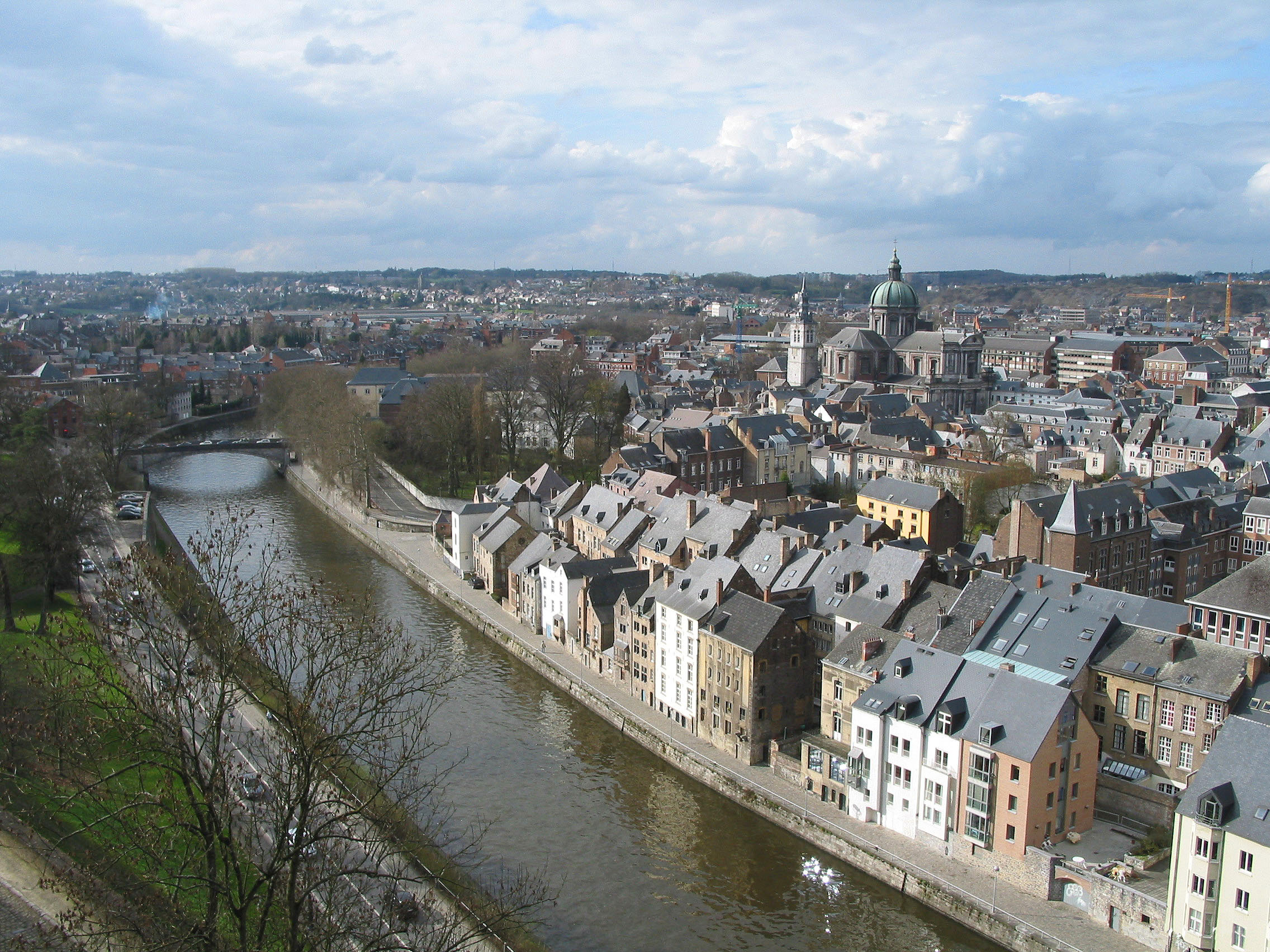 The Sambre in the centre of Namur | |
 | |
| Location | |
| Countries | Belgium and France |
| Physical characteristics | |
| Source | |
| • location | Picardy |
| • elevation | 199 m (653 ft) |
| Mouth | |
• location | Meuse at Namur |
• coordinates | 50°27′43″N 4°52′15″E |
| Length | 193 km (120 mi) |
| Basin size | 2,740 square kilometres (1,060 sq mi) |
| Basin features | |
| Progression | Meuse→ North Sea |
The source of the Sambre is near Le Nouvion-en-Thiérache, in the Aisne département. It passes through the Franco-Belgian coal basin, formerly an important industrial district. The navigable course begins in Landrecies at the junction with the Canal de la Sambre à l'Oise, which links with the central French waterway network (or did, until navigation was interrupted in 2006 following structural failures).[1] It runs 54 km and 9 locks 38.50m long and 5.20m wide down to the Belgian border at Jeumont. From the border the river is canalised in two distinct section over a distance of 88 km with 17 locks. The Haute-Sambre is 39 km long and includes 10 locks of the same dimensions as in France, down to the industrial town of Charleroi. The rest of the Belgian Sambre was upgraded to European Class IV dimensions (1350-tonne barges) in the immediate post-World War II period. It lies at the western end of the sillon industriel, which is still Wallonia's industrial backbone, despite the cessation of all coal-mining and decline in the steel industry. The river flows into the Meuse at Namur, Belgium.
The navigable waterway is managed in France by Voies Navigables de France and in Belgium by the Service Public Wallon - Direction générale opérationnelle de la Mobilité et des Voies hydrauliques (Operational Directorate of Mobility and Inland Waterways)[2]
Course
The Sambre flows through the following départements of France, provinces of Belgium and towns:
- Aisne (F): Barzy-en-Thiérache
- Nord (F): Landrecies, Aulnoye-Aymeries, Hautmont, Maubeuge
- Hainaut (B): Thuin, Montigny-le-Tilleul, Charleroi
- Namur (B): Floreffe, Namur
 The Sambre at Aulne Abbey in Belgium
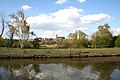 The Sambre at Flawinne (Namur)
 The Sambre at Ham-sur-Sambre
 The Sambre at Moustier-sur-Sambre
 A barge on the Sambre in Namur
 The Sambre in Namur
 The canalised Sambre running through the centre of Charleroi


Main tributaries
- Helpe Mineure[3]
- Helpe Majeure[3]
- Eau d’Heure[4] (Eau d'Heure lakes)
- Hantes[3][4]
- Thure[3][4]
- Biesmelle[4]
- Thyria[4]
- Eau d’Yves[4]
- Piéton, northern tributary, confluence in Charleroi.[4][5]
- Hanzinne,[4] confluence in Châtelet
- Biesmes d’Aiseau[4]
- Orneau[4]
- Ligne[4]
- Eau d’Eppe[4]
- Ruisseau de Fosses[4]
- Solre[3]
Events
- On 24 February 1912, Regina Magritte, the mother of the famous surrealist painter Réné Magritte, drowned herself in this river at Châtelet.[6]
Battles
The 19th-century theory that the Sambre was the location of Julius Caesar's battle against a Belgic confederation (57 BC), was discarded a long time ago,[7] but is still repeated.
Three important battles were fought in Fleurus, a suburb of Charleroi on the north bank of the Sambre: the Thirty Years' War Battle of Fleurus (1622), the Nine Years' War Battle of Fleurus (1690), and the crucial 26 June 1794 Battle of Fleurus (1794), the most significant battle of the Flanders Campaign in the Low Countries during the French Revolutionary Wars. The last was fought on both banks of the river, culminating a campaign that had involved multiple crossings and re-crossings of the river.
Heavy fighting occurred along the river during World War I, especially at the siege of Namur in 1914 (Battle of Charleroi) and in the last month of the war Battle of the Sambre (1918).
References
- Edwards-May, David (2010). Inland Waterways of France. St Ives, Cambs., UK: Imray. pp. 246–249. ISBN 978-1-846230-14-1.
- Edwards-May, David (2014). European Waterways Map and Concise Directory. Lambersart, France: Transmanche. pp. 11–12, 17–20 and fold-out map. ISBN 979-10-94429-00-6.
- Sandre. "Fiche cours d'eau - La Sambre Canalisée (D0--022-)"., see tab "Affluents"
- "Contrats de rivière en Wallonie - Sambre". Environnement.wallonie.be. Retrieved 25 March 2018.
- "Le Ruisseau "le Piéton" - Piéton, Village du Hainaut". Pieton.eu. Retrieved 25 March 2018.
- Harris, James C. (2007-08-01). "The Murderer Threatened (L'assassin Menacé)". Archives of General Psychiatry. 64 (8): 882–883. doi:10.1001/archpsyc.64.8.882. ISSN 0003-990X. PMID 17679631.
- Pierre Turquin ("La Bataille de la Selle (du Sabis) en l' An 57 avant J.-C." in Les Études Classiques 23/2 (1955), 113-156) has proved beyond reasonable doubt that the battle was fought at the River Selle, west of modern Saulzoir.
External links
- River Sambre and Canal de la Sambre à l'Oise with maps and details of places, moorings and facilities for boats, by the author of Inland Waterways of France, Imray
- Navigation details for 80 French rivers and canals (French waterways website section)
Authority control | |
|---|---|
| General |
|
| National libraries | |
| Other | |
На других языках
[de] Sambre
Die Sambre (niederländisch Samber) ist ein 193 Kilometer langer Fluss in Frankreich (88 km) und Belgien (105 km). Unterhalb ihrer Quelle im nordfranzösischen Département Aisne durchquert sie das Département Nord, tritt bei Jeumont nach Belgien über und mündet bei Namur als größter linker Nebenfluss in die Maas.- [en] Sambre
[es] Río Sambre
El río Sambre es un río europeo, un afluente por la izquierda del río Mosa, que discurre por Francia y Bélgica. Nace cerca de le Nouvion-en-Thiérache (Aisne), a 200 m sobre el nivel del mar, y desemboca en el Mosa en Namur (Valonia, Bélgica), tras un curso de 180 km, de ellos 62 km en Francia. Su cuenca drena 2750 km², de ellos 1250 km² en Francia.[it] Sambre
La Sambre è un fiume internazionale francese e belga lungo 190 km, affluente in sinistra orografica della Mosa.[ru] Самбра (река)
Са́мбра[1] (фр. Sambre, Самбр[2]) — река во Франции и Бельгии, левый приток Мааса. Длина 190 км, площадь водосборного бассейна — 2740 км². Судоходна почти на всём протяжении.[источник не указан 733 дня]Другой контент может иметь иную лицензию. Перед использованием материалов сайта WikiSort.org внимательно изучите правила лицензирования конкретных элементов наполнения сайта.
WikiSort.org - проект по пересортировке и дополнению контента Википедии