geo.wikisort.org - River
Solre is a river in France that runs in the Département Nord in the region Hauts-de-France. It originates from the confluence of two source streams at Solre-le-Château, in the Avesnois Regional Nature Park.[1] The river generally drains to the northwest and empties at 22.4 kilometers east of Maubeuge, in the municipality of Rousies, as a right tributary to the channeled Sambre.[2]
| Solre | |
|---|---|
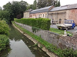
 The river in Ferrière-la-Grande | |
| Location | |
| Country | France |
| Physical characteristics | |
| Source | |
| • location | in the municipality of Solre-le-Château |
| • elevation | 180 m (590 ft) |
| Mouth | |
• location | in the municipality of Rousies in the canalized Sambre |
• coordinates | 50°17′2″N 4°0′52″E |
| Length | 22.4 km (13.9 mi) |
| Basin size | 2,740 square kilometres (1,060 sq mi) |
| Basin features | |
| Progression | Sambre→ Meuse→ North Sea |
Places on the river
References
- Avesnois Regional Nature Park
- (in French) Sandre. "Fiche cours d'eau - Solre (D0200600)".
Wikimedia Commons has media related to Solre.
На других языках
[de] Solre
Die Solre ist ein Fluss in Frankreich, der im Département Nord in der Region Hauts-de-France verläuft. Sie entsteht aus dem Zusammenfluss zweier Quellbäche bei Solre-le-Château, im Regionalen Naturpark Avesnois. Der Fluss entwässert generell in nordwestlicher Richtung und mündet nach 22[2] Kilometern östlich von Maubeuge, im Gemeindegebiet von Rousies, als rechter Nebenfluss in die kanalisierte Sambre.- [en] Solre
[it] Solre
La Solre è un fiume francese che scorre nel Dipartimento del Nord, nella regione dellꞌAlta Francia, ed è affluente alla riva destra della Sambre. La sua lunghezza è di 23 km.Текст в блоке "Читать" взят с сайта "Википедия" и доступен по лицензии Creative Commons Attribution-ShareAlike; в отдельных случаях могут действовать дополнительные условия.
Другой контент может иметь иную лицензию. Перед использованием материалов сайта WikiSort.org внимательно изучите правила лицензирования конкретных элементов наполнения сайта.
Другой контент может иметь иную лицензию. Перед использованием материалов сайта WikiSort.org внимательно изучите правила лицензирования конкретных элементов наполнения сайта.
2019-2025
WikiSort.org - проект по пересортировке и дополнению контента Википедии
WikiSort.org - проект по пересортировке и дополнению контента Википедии

