geo.wikisort.org - River
The Ruggles River is a waterway in Qikiqtaaluk Region, Nunavut, Canada. It is located within Ellesmere Island's Quttinirpaaq National Park. The river is the only outflow for Lake Hazen.[1] It flows southeast to Chandler Fiord and out to Lady Franklin Bay.
| Ruggles River | |
|---|---|
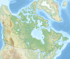  Location of mouth | |
| Location | |
| Country | Canada |
| Territory | Nunavut |
| Physical characteristics | |
| Source | Lake Hazen |
| • location | Ellesmere Island |
| Mouth | Lady Franklin Bay |
The river drops 157 m (515 ft) in elevation between its source and its mouth. At less than 1.5 m (4.9 ft) deep, it is quite shallow.[2] Except during very cold years, the Ruggles River remains partially open all year long. It is populated by Arctic char.[2]
History
In 1958, a 13th-century winter house was excavated along the Ruggles River.[3]
See also
References
- Clark, Douglas (2000-09-07). "Assessing the Health of the Lake Hazen Ecosystem, Ellesmere Island, Northwest Territories". eman-rese.ca. Parks Canada. Archived from the original on 28 September 2007. Retrieved 4 March 2010.
- Babaluk, J.A.; H.R. Wissink; B.G. Troke; D.A. Clark; J.D. Johnson (December 2001). "Summer Movements of Radio-Tagged Arctic Charr {Salvelinus alpinus} in Lake Hazen, Nunavut, Canada" (PDF). Arctoc. aina.ucalgary.ca. 54 (4): 419.
- Nabokov, Peter; Robert Easton (1989). Native American architecture. Oxford University Press. pp. 191. ISBN 0-19-503781-2.
ruggles.
| Core topics |
|  |
|---|---|---|
| Kitikmeot Region |
| |
| Kivalliq Region |
| |
| Qikiqtaaluk Region |
| |
| National Parks |
| |
| Territorial Parks |
| |
| ||


 | This Qikiqtaaluk Region, Nunavut location article is a stub. You can help Wikipedia by expanding it. |
На других языках
- [en] Ruggles River
[ru] Рагглс
Рагглс (англ. Ruggles River) — река на острове Элсмир в Канадском регионе Нунавут (район Кикиктани). Длина реки — 28,8 км[1].Текст в блоке "Читать" взят с сайта "Википедия" и доступен по лицензии Creative Commons Attribution-ShareAlike; в отдельных случаях могут действовать дополнительные условия.
Другой контент может иметь иную лицензию. Перед использованием материалов сайта WikiSort.org внимательно изучите правила лицензирования конкретных элементов наполнения сайта.
Другой контент может иметь иную лицензию. Перед использованием материалов сайта WikiSort.org внимательно изучите правила лицензирования конкретных элементов наполнения сайта.
2019-2026
WikiSort.org - проект по пересортировке и дополнению контента Википедии
WikiSort.org - проект по пересортировке и дополнению контента Википедии