geo.wikisort.org - River
The River Itchen in Hampshire, England, rises to the south of New Alresford and flows 26 miles (42 km) to meet Southampton Water below the Itchen Bridge. The Itchen Navigation was constructed in the late 17th and early 18th centuries to enable barges to reach Winchester from Southampton Docks, but ceased to operate in the mid-19th century and is largely abandoned today.
| Itchen Alre (see tributary so-named) | |
|---|---|
 The Itchen near Avington | |
 Map of the River Itchen (dark blue) and its principal tributary (the Alre, grey). Southampton Water is shown in light blue and canal sections of the Itchen Navigation in green. | |
| Etymology | Unknown |
| Location | |
| Country | England |
| County | Hampshire |
| City | Winchester Southampton |
| Physical characteristics | |
| Source | |
| • location | south of New Cheriton, Kilmeston, Hampshire, England |
| • coordinates | 51.0426°N 1.1603°W |
| Mouth | Southampton Water |
• location | Southampton, Hampshire |
• coordinates | 50°54′19″N 1°23′08″W |
• elevation | 0 metres |
| Length | 26 miles (42 km) or unconventionally: 88 km (55 mi) (including all anabranches) |
| Basin size | 119.619 km2 (46.185 sq mi) |
| Width | |
| • maximum | ide |
| Discharge | |
| • location | Riverside Park, Bitterne Park |
| • average | 5.3 m3/s (190 cu ft/s) |
| • minimum | 1.75 m3/s (62 cu ft/s)14 August 1995 |
| Discharge | |
| • location | Highbridge, Hampshire |
| • average | 5.4 m3/s (190 cu ft/s) |
| Discharge | |
| • location | Easton, Hampshire |
| • average | 4.3 m3/s (150 cu ft/s) |
| Basin features | |
| Tributaries | |
| • left |
|
| • right | Cheriton Stream |
| Site of Special Scientific Interest | |
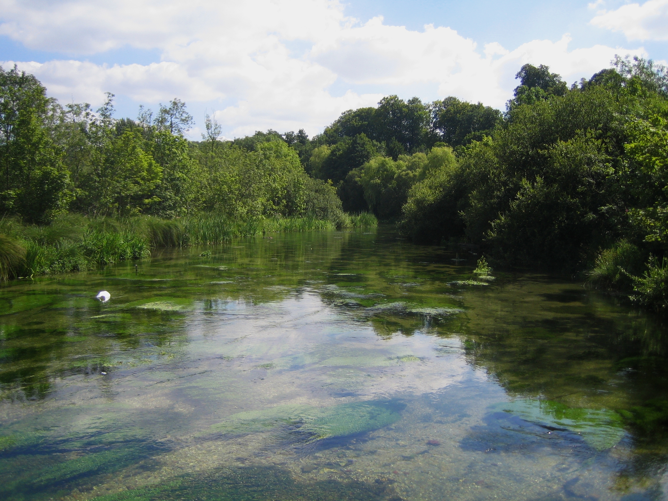
 The river near Bishopstoke | |
| Location | Hampshire |
|---|---|
| Grid reference | SU 496 261[1] |
| Interest | Biological |
| Area | 748.5 hectares (1,850 acres)[1] |
| Notification | 2000[1] |
| Location map | Magic Map |
The river is one of the world's premier chalk streams for fly fishing,[2] amenable to dry fly or nymphing. The local chalk aquifer has excellent storage and filtration and the river has long been used for drinking water. Watercress thrives in its upper reaches.[citation needed]
Much of the river from its source to Swaythling is classified as a 748.5-hectare (1,850-acre) biological Site of Special Scientific Interest (SSSI),[1][3] and a Special Area of Conservation,[4] of which the 9-hectare (22-acre) Hockley Meadows nature reserve is a part.[5] The Itchen estuary is part of the separate Lee-on-The Solent to Itchen Estuary SSSI.[6]
Etymology and other name
The name is likely from a Brittonic language and in meaning unknown. The settlement of Itchen Abbas, before its abbot's ownership, is transcribed by early Middle English orthography which used the letter c followed by e or i to denote the /tʃ/ sound and an e invariably after an n to avoid those down strokes being ambiguous thus, as Icene in the Domesday Book of 1086.[7] The name, in upper parts was once seen as interchangeable with the tributary Alre.[8][9]
Course
The source is north of Kilmeston, in that civil[10] and ecclesiastical parish.[11] The river flows north, through Cheriton village and east of overwhelmingly agricultural Tichborne village, before joining up with tributaries the River Alre and Candover Brook immediately north-west of the town of New Alresford. The river then carves its way west passing the villages of Avington, Itchen Stoke, Itchen Abbas, Martyr Worthy, Easton, and Abbots Worthy; to enter the cathedral and arts-rich city of Winchester it crosses Winnall Moors to turn south for its remainder.[12]

It flows in anabranches through the city, some close enough to Winchester Cathedral to cause great problems to the foundations in the past. The main channel flows through Winchester City Mill and to the east of the city's Roman walls, along a promenaded reach known as "The Weirs".
It waters or can overflow into water-meadows, passing: the Hospital of St Cross; the villages of Twyford; Shawford; between the town of Eastleigh and the village of Bishopstoke; and through Itchen Valley Country Park before reaching the northern suburbs of Southampton at Mansbridge. Between Winchester and Mansbridge, sections were deepened or widened for the long-disused Itchen Navigation, and the former towpath forms part of the Itchen Way.[13]
Monks Brook flows into the Itchen at Swaythling, and the river then passes under Woodmill Bridge and becomes tidal. Four further bridges cross it before the Test estuary in Southampton Water:
- Cobden Bridge, a road bridge connecting Bitterne Park and St Denys.
- Cobden railway bridge carrying the Southampton – Portsmouth railway line. Opened in 1866 the bridge is supported by two sets of cast iron cylinders resulting in three 115 feet openings.[14] The bridge's girders are made from wrought iron.[14] In order to try and prevent the Northam Bridge Company from trying to block the bill authorising the railway, it was agreed that pedestrians would not be allowed to use the bridge.[15] Even so the opening of the viaduct diverted traffic from other crossings with the Woolston Floating Bridge seeing a significant fall in income.[16]
- Northam Bridge, a road bridge carrying the A3024 road from Bitterne Manor to Northam, which was originally opened in 1799.[17]
- The Itchen Bridge, a high-level toll road bridge connecting the docks area with Woolston. This replaced the Woolston Floating Bridge (a chain ferry) which had previously crossed the river at this point.
Between the latter two, the river passes St Mary's Stadium, the home of Southampton F.C. As the river meets Southampton Water it passes several rowing clubs, sailing clubs and the major mixed-development on the left bank in Woolston, called Centenary Quay.
Watermills
Surviving mills on the Itchen include Winchester City Mill, now restored to working order by the National Trust, Abbey Mill, converted to a restaurant, St Cross Mill, Gaters Mill, now offices, and Woodmill in Southampton, now a recreational water activities centre.
Marinas and boatyards

The lower part of the river is an important yachting centre and contains several marinas, sailing centres and boatyards. From seaward they are:[18]
- Ocean Village Marina (MDL), on the western shore just below the Itchen Bridge and close to the city centre
- Southampton Water Activities Centre, almost underneath the bridge on the western shore
- Itchen Marine, just above the bridge, principally a towage business but with some berths for yachts and the only fuel berth in the river
- Merlin Boatyard, opposite Itchen Marine, on the eastern shore
- Lauren Marine Services, a small marina on the eastern side
- Ocean Quay and Solent Breeze Yacht Charter on the west side
- Shamrock Quay (MDL), the biggest marina in the river, also on the west
- Saxon Wharf (MDL) is almost adjacent to Shamrock Quay, containing the biggest boat lift in Britain (200t)
- Kemps Quay Marina on the eastern (now northern) shore, a drying marina and boatyard
- Quayside Marina, a single long pontoon next to Kemps
- Drivers Wharf, another single long pontoon, parallel to the shore, with a crane and boatyard
Above Northam Bridge, the limit of navigation for masted craft, are the Vespasian Road boatyard and numerous small establishments.
Ecology
The SSSI covers the river and its banks, with fen, flood meadows, wet woodland and swamp. It has populations of the nationally rare southern damselfly and white-clawed crayfish. Other fauna include otters, water voles, Atlantic salmon, shovelers and Cetti's warblers.[19]
Water quality
The Environment Agency measure water quality of the river systems in England. Each is given an overall ecological status, which may be one of five levels: high, good, moderate, poor and bad. There are several components that are used to determine this, including biological status, which looks at the quantity and varieties of invertebrates, angiosperms and fish, and chemical status, which compares the concentrations of various chemicals against known safe concentrations. Chemical status is rated good or fail.[20]
Water quality of the River Itchen in 2019:
| Section | Ecological Status | Chemical Status | Overall Status | Length | Catchment | Channel |
|---|---|---|---|---|---|---|
| Itchen[21] | Good | Fail | Moderate | 87.94 km (54.64 mi) including all anabranches (unconventional) | 119.619 km2 (46.185 sq mi) | multi |
| Itchen (Cheriton Stream)[22] | Good | Fail | Moderate | 11.045 km (6.863 mi) | 76.892 km2 (29.688 sq mi) | multi |
| Candover Brook[23] | Moderate | Fail | Moderate | 9.599 km (5.965 mi) | 71.761 km2 (27.707 sq mi) | multi |
| Nun's Walk Stream[24] | Good | Fail | Moderate | 3.336 km (2.073 mi) | 43.95 km2 (16.97 sq mi) | single |
See also
- Death and the Maiden, a 1947 novel featuring the river
- List of rivers of the United Kingdom
References
- "Designated Sites View: River Itchen". Sites of Special Scientific Interest. Natural England. Retrieved 18 May 2020.
- Taylor, Howard. "Upstream Dry Fly Fishing". Ringwood BH24 4HS, United Kingdom: Dry Fly Fishing Ltd. Archived from the original on 1 February 2011. Retrieved 1 July 2012.
The pristine rivers of Southern England offer the world's premier trout fly fishing...the most beautiful and quintessentially English...fly fishing beats on the famous...Test...Dever...Itchen and the Hampshire Avon.
{{cite web}}: CS1 maint: location (link) - "Map of River Itchen". Sites of Special Scientific Interest. Natural England. Retrieved 18 May 2020.
- "Designated Sites View: River Itchen". Special Areas of Conservation. Natural England. Retrieved 24 April 2020.
- "Hockley Meadows". Hampshire and Isle of Wight Wildlife Trust. Retrieved 30 April 2020.
- "Designated Sites View: Lee-on-The Solent to Itchen Estuary". Sites of Special Scientific Interest. Natural England. Retrieved 17 April 2020.
- Mills, David (2011), A Dictionary of British Place-Names, Oxford University Press, ISBN 978-0-19-960908-6 (p. 259)
- Knight, Charles (1867). Geography: The English Cyclopaedia, Volume IV. London: Bradbury, Evans. p. 631.
- Camden, William (1586). Britannia. J. B. p. 181.
William Camden alre.
- "Archived copy" (PDF). Archived from the original (PDF) on 31 August 2018. Retrieved 5 September 2020.
{{cite web}}: CS1 maint: archived copy as title (link) - "A Church Near You".
- Ordnance Survey (2004). OS Explorer Map 132 – Winchester, New Alresford & East Meon. ISBN 0-319-23601-3.
- Ordnance Survey (2004). OS Explorer Map OL22 – New Forest. ISBN 0-319-23616-1.
- Moody, Bert (1992). Southampton's Railways. Waterfront Publications. p. 93. ISBN 0946184631.
- Marsh, Keith (2007). The Book of Bittern From Roman Town to City Suburb. Halsgrove. p. 145. ISBN 9781841146355.
- Jones, B.C (1977). Crossing the Itchen. City of Southampton. pp. 14–15.
- Holt, John; Anne Cole (February 1992). A bend in the River. Southampton: Bitterne Local History Society.
- Admiralty Charts: Small Craft Folio SC5600 Chart 10A
- "River Itchen citation" (PDF). Sites of Special Scientific Interest. Natural England. Retrieved 18 May 2020.
- "Glossary (see Biological quality element; Chemical status; and Ecological status)". Catchment Data Explorer. Environment Agency. 17 February 2016.
 Text was copied from this source, which is available under an Open Government Licence v3.0. © Crown copyright.
 - "Itchen". Catchment Data Explorer. Environment Agency.
- "Itchen (Cheriton Stream)". Catchment Data Explorer. Environment Agency.
- "Candover Brook". Catchment Data Explorer. Environment Agency.
- "Nun's Walk Stream". Catchment Data Explorer. Environment Agency.
External links
- Map source for the source and mouth
- River Itchen Archaeology Project Home Page
| Main rivers main tributaries & sub-tributaries |
|  | ||||||||||
|---|---|---|---|---|---|---|---|---|---|---|---|---|
| Canals and Navigations | ||||||||||||
| Ordinary watercourses | ||||||||||||
| Lakes, ponds and wetlands |
| |||||||||||
| Coast |
| |||||||||||
Categories: Rivers, Canals | ||||||||||||
| Biological |
|
|---|---|
| Geological |
|
На других языках
- [en] River Itchen, Hampshire
[ru] Ичен
Ичен (англ. River Itchen; ранее также известна под названием Алре) — река в Великобритании.Другой контент может иметь иную лицензию. Перед использованием материалов сайта WikiSort.org внимательно изучите правила лицензирования конкретных элементов наполнения сайта.
WikiSort.org - проект по пересортировке и дополнению контента Википедии