geo.wikisort.org - River
The Pregolya or Pregola (Russian: Прего́ля; German: Pregel; Lithuanian: Prieglius; Polish: Pregoła) is a river in the Russian Kaliningrad Oblast exclave.
| Pregolya | |
|---|---|
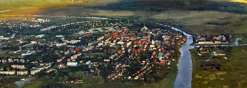 The Pregolya in Gvardeysk. | |
| Location | |
| Country | Russia |
| Physical characteristics | |
| Source | |
| • location | Instruch and Angrapa confluence |
| Mouth | |
• location | Vistula Lagoon, Baltic Sea |
• coordinates | 54.6827°N 20.3778°E |
| Basin size | 15,500 km2 (6,000 sq mi) |
| Discharge | |
| • average | 90 m3/s (3,200 cu ft/s) |
Name
A possible ancient name by Ptolemy of the Pregolya River is Chronos (from Germanic *hrauna, "stony")[citation needed], although other theories identify Chronos as a much larger river, the Nemunas.[citation needed]
The oldest recorded names of the river are Prigora (1302), Pregor (1359), Pregoll, Pregel (1331), Pregill (1460). Georg Gerullis connected the name with Lithuanian prãgaras, pragorė̃ ("abyss") and the Lithuanian verb gérti ("drink"). Vytautas Mažiulis instead derived it from spragė́ti or sprógti ("burst") and the suffix -ara ("river").[1]
Overview
It starts as a confluence of the Instruch and the Angrapa and drains into the Baltic Sea through the Vistula Lagoon. Its length under the name of Pregolya is 123 km, 292 km including the Angrapa. The basin has an area of 15,500 km2. The average flow is 90 m3/s.
Euler's Seven Bridges of Königsberg problem was based on the bridges crossing the river in Königsberg (now Kaliningrad).
Cities and towns
Tributaries
See also
- List of rivers of Russia
- Bridges of Konigsberg problem
References
Authority control | |
|---|---|
| General |
|
| National libraries | |
This Kaliningrad Oblast location article is a stub. You can help Wikipedia by expanding it. |
This article related to a river in Russia is a stub. You can help Wikipedia by expanding it. |
На других языках
[de] Pregel
Der Pregel (prußisch Preigara und Preigile, russisch Прего́ля (Pregolja), litauisch Prieglius) ist ein Fluss in der Oblast Kaliningrad, dem russischen Teil Ostpreußens. Er ist 123 km, zusammen mit der Angerapp, einem der bedeutendsten Zuflüsse, 292 km lang. Sein Einzugsgebiet umfasst 15.500 km². Der mittlere Abfluss (MQ) liegt bei 90 m³/s.- [en] Pregolya
[es] Río Pregolia
El río Pregolia (en ruso: Преголя) (en alemán, Pregel; en lituano, Prieglius; en polaco, Pregoła) es un río en el exclave ruso del óblast de Kaliningrado.[it] Pregel
Il Pregel (in russo Pregolja) è un fiume dell'Oblast' di Kaliningrad in Russia, anticamente situato nella metà settentrionale dell'antica Prussia Orientale, oggi annessa alla Russia.[ru] Преголя
Прего́ля (Преголь[2]; прусск. Preigile, Preigara[3]), прежде Прегель (нем. Pregel) — река в России, впадающая в Калининградский (Вислинский) залив Балтийского моря. Длина — 123 км, площадь бассейна — 15 500 км²[4].Другой контент может иметь иную лицензию. Перед использованием материалов сайта WikiSort.org внимательно изучите правила лицензирования конкретных элементов наполнения сайта.
WikiSort.org - проект по пересортировке и дополнению контента Википедии