geo.wikisort.org - River
The Angrapa (Russian: Анграпа, Polish: Węgorapa, German: Angerapp, Lithuanian: Angrapė) is a river that begins in northeastern Poland and ends in the Kaliningrad Oblast of Russia. Originating in Lake Mamry, it joins the 101-km-long Instruch at a point near Chernyakhovsk – variously assessed as lying 140,[1] 169,[2] or 172 km[3] from its source – to form the Pregolya. Its largest tributaries are the 89-km-long Gołdapa, which joins just before the border, and the Pissa (98 km).
| Angrapa Węgorapa | |
|---|---|
 The Angrapa River in Mieduniszki Wielkie, Poland | |
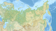
 Location of mouth in Russia | |
| Location | |
| Country | Poland, Russia |
| Physical characteristics | |
| Source | |
| • location | Lake Mamry |
| • coordinates | 54°11′51″N 21°43′07″E |
| Mouth | |
• location | Pregolya |
• coordinates | 54°38′52″N 21°47′29″E |
| Basin features | |
| Progression | Pregolya→ Baltic Sea |
The name Angrapa is derived from the Old Prussian words anguris (eel) and apis (river). The towns of Węgorzewo, Ozyorsk and Chernyakhovsk as well as the village of Mayakovskoye, are situated along the course of the Angrapa.
References
- Second Assessment of transboundary rivers, lakes and groundwaters by the Economic Commission for Europe
- Angrapa in the State Water Register of Russia
- Hydrologia Pojezierza Mazurskiego
See also
- Rivers of Poland
- Rivers of Russia
- List of rivers of Europe
На других языках
[de] Angrapa
Die Angrapa (kyrillisch russisch Анграпа .mw-parser-output .IPA a{text-decoration:none}[anˈgrapa], deutsch Angerapp, polnisch Węgorapa [vɛŋɡɔˈrapa]) ist ein Fluss im russischen Oblast Kaliningrad und in Polen, im historischen Ostpreußen. Der Name leitet sich von prußisch angurgis/angurys-ape ab und bedeutet auf Altpreußisch „Aalfluss“.- [en] Angrapa
[it] Angrapa
L'Angrapa (Анграпа in russo, Węgorapa in polacco, Angerapp in tedesco) è un fiume che attraversa il territorio dell'ex Prussia Orientale, nelle attuali Polonia e Russia.[ru] Анграпа
Ангра́па (польск. Węgorapa — Венгорапа; устар. нем. Angerapp[2]) — река в Польше и Калининградской области России. Приток Преголи. Длина реки — 169 км, площадь водосборного бассейна — 3960 км²[3], среднегодовой расход воды — 14,5 м³/с[4].Текст в блоке "Читать" взят с сайта "Википедия" и доступен по лицензии Creative Commons Attribution-ShareAlike; в отдельных случаях могут действовать дополнительные условия.
Другой контент может иметь иную лицензию. Перед использованием материалов сайта WikiSort.org внимательно изучите правила лицензирования конкретных элементов наполнения сайта.
Другой контент может иметь иную лицензию. Перед использованием материалов сайта WikiSort.org внимательно изучите правила лицензирования конкретных элементов наполнения сайта.
2019-2025
WikiSort.org - проект по пересортировке и дополнению контента Википедии
WikiSort.org - проект по пересортировке и дополнению контента Википедии