geo.wikisort.org - River
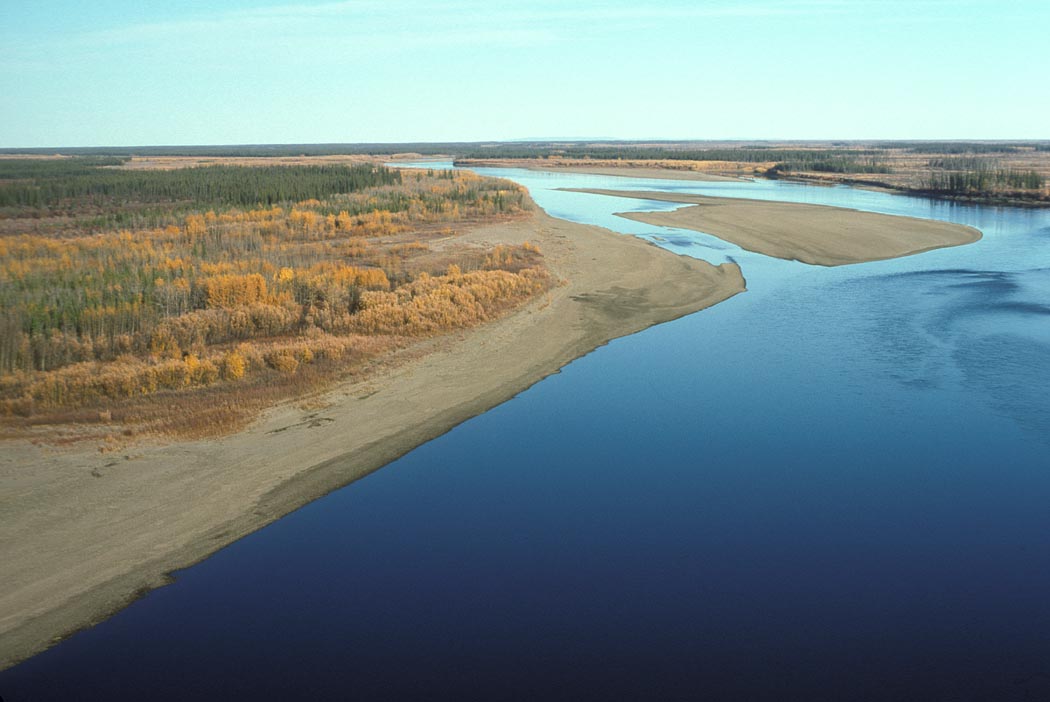
The Porcupine River (Ch’ôonjik[3] in Gwich’in) is a 916 km (569 mi) tributary of the Yukon River in Canada and the United States. It rises in the Ogilvie Mountains north of Dawson City, Yukon, Canada.[4] From there it flows north through the community of Old Crow, veers southwest into the U.S. state of Alaska, and enters the larger river at Fort Yukon, Alaska.[4] It derives its name from the Gwich'in word for the river, Ch'oonjik, or "Porcupine Quill River".
| Porcupine River | |
|---|---|
 Porcupine River | |
 Location of the mouth of the Porcupine River in Alaska | |
| Native name | Ch’ôonjik (Gwichʼin) |
| Location | |
| Countries |
|
| Territories/States |
|
| Physical characteristics | |
| Source | Nahoni Range |
| • location | Ogilvie Mountains, Yukon, Canada |
| • coordinates | 65°28′N 139°32′W[1] |
| Mouth | Yukon River |
• location | Fort Yukon, Alaska, United States |
• coordinates | 66°35′42″N 145°18′32″W[1] |
• elevation | 126 m (413 ft)[1] |
| Length | 916 km (569 mi) |
| Basin size | 118,000 km2 (46,000 sq mi)[2] |
| Discharge | |
| • average | 414 m3/s (14,600 cu ft/s)[2] |
The Porcupine caribou herd, whose range includes the Arctic National Wildlife Refuge (ANWR) in Alaska, gets its name from its calving grounds around the Porcupine River.
Possible (but disputed) evidence of the oldest known human habitation in North America comes from a cave on one of the Porcupine's tributaries, the Bluefish River. Many apparently human-modified animal bones have been discovered in the Bluefish Caves. Radiocarbon dating has assessed them as 25,000 to 40,000 years old—several thousand years earlier than the generally accepted date for human habitation of North America.[5]
Boating
The Porcupine River offers the possibility of "an excellent novice river trip for those experienced in remote wilderness travel,"[4] according to author Karen Jettmar. Boaters can travel by canoe, kayak, or raft, though rafters may have difficulty with upriver winds. A 800 km (500 mi) float trip beginning at Summit Lake in the Yukon Territory, descending the Bell River to its confluence with the Porcupine, and continuing to Fort Yukon is all rated Class I (easy) on the international scale of river difficulty. However, in high water the difficulty may rise to Class II in Upper and Lower Rampart canyons, downstream of the international border, where the current is swift.[4]
See also
References
- "Porcupine River". Geographic Names Information System. United States Geological Survey. January 1, 2000. Retrieved November 3, 2013.
- Benke and Cushing, p. 802
- Holton, Gary (July 16, 2013). "Alaska Native Language Archive: Alaska Place Names". University of Alaska Fairbanks. Retrieved November 3, 2013.
- Jettmar, Karen (2008) [1993]. The Alaska River Guide: Canoeing, Kayaking, and Rafting in the Last Frontier (3rd ed.). Birmingham, Alabama: Menasha Ridge Press. pp. 132–34. ISBN 978-0-89732-957-6.
- Morlan, R.E. (1986). "Pleistocene archaeology in Old Crow Basin: a critical reappraisal". In Bryan, Alan Lyle (ed.). New Evidence for the Pleistocene Peopling of the Americas. Peopling of the Americas: Symposia series. Orono, Maine: Center for the Study of Early Man, University of Maine. pp. 27–48.
Works cited
- Benke, Arthur C., ed., and Cushing, Colbert E., ed.; Bailey, Robert C. (2005). "Chapter 17: Yukon River Basin" in Rivers of North America. Burlington, Massachusetts: Elsevier Academic Press. ISBN 0-12-088253-1. OCLC 59003378.
External links
- Treasures of the snow Manuscript at Dartmouth College Library
Authority control | |
|---|---|
| General |
|
| National libraries | |
| Other | |
На других языках
[de] Porcupine River
Der Porcupine River (Porcupine: englisch für Baumstachler) ist ein 721 km langer Fluss im kanadischen Territorium Yukon und in Alaska.- [en] Porcupine River
[es] Río Porcupine
El río Porcupine es un afluente del río Yukón que discurre por el Territorio del Yukón y por Alaska. Nace en las montañas Ogilvie al norte de Dawson City, Territorio del Yukón, su cauce tiende al norte, gira hacia el suroeste yendo a través del territorio de Old Crow, Yukón y desemboca en el río Yukón en Fort Yukón, Alaska[it] Porcupine (fiume)
Il fiume Porcupine è un corso d'acqua che nasce nella catena montuosa Nahoni, nello Yukon (Canada) e scorre entrando in Alaska per confluire presso Fort Yukon nel fiume Yukon.[ru] Поркьюпайн
По́ркьюпайн[1] (англ. Porcupine River, гвичин: Ch’ôonjik[2]) — река в Канаде и США, протекающая по территории Юкон и штату Аляска[3][4].Другой контент может иметь иную лицензию. Перед использованием материалов сайта WikiSort.org внимательно изучите правила лицензирования конкретных элементов наполнения сайта.
WikiSort.org - проект по пересортировке и дополнению контента Википедии