geo.wikisort.org - River
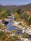
The Ostriconi is a small coastal river in the department of Haute-Corse, Corsica, France.
| Ostriconi | |
|---|---|
Mouth of the Ostriconi on the beach | |
| Location | |
| Country | France |
| Region | Corsica |
| Department | Haute-Corse |
| Physical characteristics | |
| Mouth | Mediterranean Sea |
• location | Palasca |
• coordinates | 42°39′34″N 9°03′29″E |
| Length | 23.2 kilometres (14.4 mi) |
| Basin size | 135 square kilometres (52 sq mi) |
Course
The Ostriconi is 23.34 kilometres (14.50 mi) long. It crosses the communes of Lama, Novella, Palasca, Pietralba and Urtaca.[1]
The Ostriconi rises to the east of the village of Pietralba below the 1,427 metres (4,682 ft) Punta di Paganella and the 1,469 metres (4,820 ft) Monte Reghia di Pozzo. It flows west and passes to the south of Pietralba, then flows northwest to the sea. The T30 road runs parallel to the Ostriconi for most of its length.[2]
Tributaries
The following streams (ruisseaux) are tributaries of the Ostriconi:
- Vadellare 10 kilometres (6.2 mi)
- Monticellaciu 3 kilometres (1.9 mi)
- Peraldu 2 kilometres (1.2 mi)
- Piobetta 2 kilometres (1.2 mi)
- Scubella 1 kilometre (0.62 mi)
- Monte Grossu 2 kilometres (1.2 mi)
- Campotile 1 kilometre (0.62 mi)
- Cruschininca 1 kilometre (0.62 mi)
- Monticellaciu 3 kilometres (1.9 mi)
- Chierchiu 7 kilometres (4.3 mi)
- Manichella 5 kilometres (3.1 mi)
- Fiume di Gargalagne 7 kilometres (4.3 mi)
- Fiume a I Peri 4 kilometres (2.5 mi)
- Salginco 7 kilometres (4.3 mi)
- Noci 7 kilometres (4.3 mi)
- Malpruniccia 2 kilometres (1.2 mi)
- Cava 1 kilometre (0.62 mi)
- San Giorgio 5 kilometres (3.1 mi)
- Mezzanello 2 kilometres (1.2 mi)
- Parghinese 5 kilometres (3.1 mi)
- Noci 7 kilometres (4.3 mi)
- Cugnolu 5 kilometres (3.1 mi)
- l'Ondole 5 kilometres (3.1 mi)
- Fiume di Cuvertoio 4 kilometres (2.5 mi)
- Grotta Rossa 1 kilometre (0.62 mi)
- Funtana Bona 4 kilometres (2.5 mi)
- Appiatelli 4 kilometres (2.5 mi)
- e Scale 2 kilometres (1.2 mi)
- Nuvalicce 4 kilometres (2.5 mi)
- Compolelli 3 kilometres (1.9 mi)
- Malculo 3 kilometres (1.9 mi)
- Bodulo 1 kilometre (0.62 mi)
- Ravin de l'Ostricone 3 kilometres (1.9 mi)
- l'Orneto 3 kilometres (1.9 mi)
- Ponte 2 kilometres (1.2 mi)
- Furchelle 2 kilometres (1.2 mi)
- Felicione 2 kilometres (1.2 mi)
- Ostincaia 1 kilometre (0.62 mi)
- Villanaccio 1 kilometre (0.62 mi)
- Valle Tesi 1 kilometre (0.62 mi)
- Focolaccio 1 kilometre (0.62 mi)
- Valli 1 kilometre (0.62 mi)
- Sossa 1 kilometre (0.62 mi)
- Calasconi 1 kilometre (0.62 mi)
Notes
Sources
- "L'Ostriconi", Sandre (in French), retrieved 2021-12-11
- "Relation: L'Ostriconi (8481190)", OpenStreetMap, retrieved 2021-12-11
На других языках
- [en] Ostriconi
[it] Ostriconi
L'Ostriconi (in corso Ustriconi) è un fiume della Corsica settentrionale.Текст в блоке "Читать" взят с сайта "Википедия" и доступен по лицензии Creative Commons Attribution-ShareAlike; в отдельных случаях могут действовать дополнительные условия.
Другой контент может иметь иную лицензию. Перед использованием материалов сайта WikiSort.org внимательно изучите правила лицензирования конкретных элементов наполнения сайта.
Другой контент может иметь иную лицензию. Перед использованием материалов сайта WikiSort.org внимательно изучите правила лицензирования конкретных элементов наполнения сайта.
2019-2025
WikiSort.org - проект по пересортировке и дополнению контента Википедии
WikiSort.org - проект по пересортировке и дополнению контента Википедии


