geo.wikisort.org - River
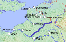
The Oise (/wɑːz/ WAHZ; French: [waz] (![]() listen)) is a river of Belgium and France, flowing for 341 km (212 mi)[1] from its source in the Belgian province of Hainaut, south of Chimay. It crosses the border with France after about 20 km (12 mi). It flows into the Seine at Conflans-Sainte-Honorine, a north-western suburb of Paris. Its main tributary is the Aisne. It gave its name to the French departments of Oise and Val-d'Oise.
listen)) is a river of Belgium and France, flowing for 341 km (212 mi)[1] from its source in the Belgian province of Hainaut, south of Chimay. It crosses the border with France after about 20 km (12 mi). It flows into the Seine at Conflans-Sainte-Honorine, a north-western suburb of Paris. Its main tributary is the Aisne. It gave its name to the French departments of Oise and Val-d'Oise.
| Oise | |
|---|---|
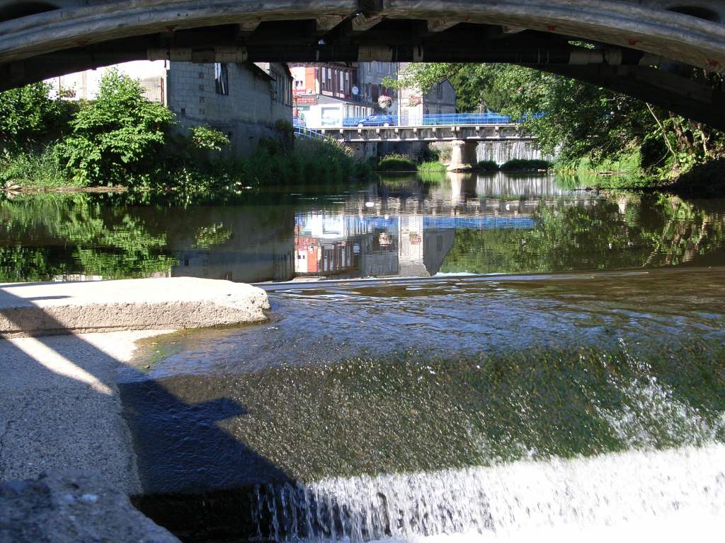
 Boats on the Oise, Charles-François Daubigny, 1865 | |
 | |
| Location | |
| Countries | France and Belgium |
| Physical characteristics | |
| Source | |
| • location | Hainaut |
| • elevation | 309 m (1,014 ft) |
| Mouth | |
• location | Seine |
• coordinates | 48°59′12″N 2°4′17″E |
| Length | 341 km (212 mi) |
| Basin size | 17,000 km2 (6,600 sq mi) |
| Discharge | |
| • average | 110 m3/s (3,900 cu ft/s) |
| Basin features | |
| Progression | Seine→ English Channel |
Places along the river
In France, the Oise flows through the following départements and towns:
- Aisne: Hirson, Guise, Chauny
- Oise (named after the river): Noyon, Compiègne, Creil
- Val-d'Oise (named after the river): Auvers-sur-Oise, Pontoise, Cergy, Jouy-le-Moutier
- Yvelines: Conflans-Sainte-Honorine
Navigation
Over the past few centuries, the Oise has played an important role as an inland shipping waterway connecting the Seine (and thus Paris) with the coastal regions of northern France, Belgium, and the Netherlands. With the projected construction of the Seine-Nord Europe Canal, a high-capacity water transport system currently in development, the Oise will be linked at Janville, north of Compiègne, with the high-capacity Canal Dunkerque-Escaut, east of Arleux. The Seine-Nord Europe Canal will replace the old Canal de Saint-Quentin and the current Canal du Nord, the capacity of which is far below standard. When the new Seine-Nord connection is complete, it will allow large vessels to transport goods from the Seine, and thus Paris and its surrounding area, to the ports of Dunkirk, Antwerp and Rotterdam.
Part of the overall project consists in upgrading the river Oise itself between Creil and Compiègne, a project called MAGEO (Mise au gabarit européen de l'Oise) that was put out to public consultation in 2013. Some bends need to be eased and bridges raised to meet the requirements of a class Vb inland waterway.[2]
Tributaries
Tributaries include
Right bank
- Noirieu
- Divette
- Mas or Matz
- Aronde
- Brèche
- Thérain
Left bank
See also
References
External links
- River Oise and Canal latéral à l'Oise maps and information, on places, ports and moorings on the canal, by the author of Inland Waterways of France, Imray
- Navigation details for 80 French rivers and canals (French waterways website section)
Authority control | |
|---|---|
| General | |
| National libraries | |
| Other |
|
На других языках
[de] Oise
Die Oise ist ein Fluss in Belgien und vor allem in Nordfrankreich und gehört zu den wichtigsten Gewässern dieses Gebietes. Sie entspringt in Belgien, im Gemeindegebiet von Chimay und mündet an der Gemeindegrenze von Conflans-Sainte-Honorine und Andrésy als rechter Nebenfluss in die Seine. Sie hat eine Gesamtlänge von rund 341 Kilometern (davon rund 10 Kilometer auf belgischem Gebiet) und einen Einzugsbereich von 16.667 Quadratkilometern. Die Oise durchfließt die Départements Nord, Aisne, Oise, Val-d’Oise und Yvelines. Die westlichen Ausläufer der Ardennen an der belgischen Grenze, zwischen Hirson und Guise, Thiérache genannt, umfassen neben dem oberen Oisetal auch das Quellgebiet der Sambre und mehrerer Nebenflüsse von Sambre und Oise.- [en] Oise (river)
[es] Río Oise
El río Oise es un río franco-belga, afluente del río Sena, con una longitud total de 302 km, que nace en la provincia belga de Henao, al sur de la ciudad de Chimay, en el macizo boscoso de la Fagne, a una altitud de 309 m sobre el nivel del mar. Aproximadamente a los 20 km de iniciar su recorrido, el Oise se dirige hacia el sur para cruzar la frontera con Francia, siguiendo su curso en dirección hacia el sur y el suroeste por territorio francés hasta desembocar en el Sena a la altura de Conflans-Sainte-Honorine, en las cercanías de París, que queda aguas arriba del río Sena.[it] Oise (fiume)
L'Oise è un fiume del nord della Francia. Nasce in Belgio, a 309 metri di altitudine nel massiccio della Fagne nei pressi di Chimay (Hainaut, Vallonia), e dopo un percorso di 341,1 km (di cui 340,8 in Francia)[1] si getta nella Senna a Conflans-Sainte-Honorine.[ru] Уаза (река)
Уа́за[1] (фр. Oise [waz]) — река в Бельгии и во Франции, правый приток Сены. Длина — 302 км. Общая площадь бассейна — 17 тыс. км². Соединена системой каналов с такими реками, как Мёз, Сомма, Шельда[2]. С бассейном реки Сансе[fr] соединена Северным каналом.Другой контент может иметь иную лицензию. Перед использованием материалов сайта WikiSort.org внимательно изучите правила лицензирования конкретных элементов наполнения сайта.
WikiSort.org - проект по пересортировке и дополнению контента Википедии