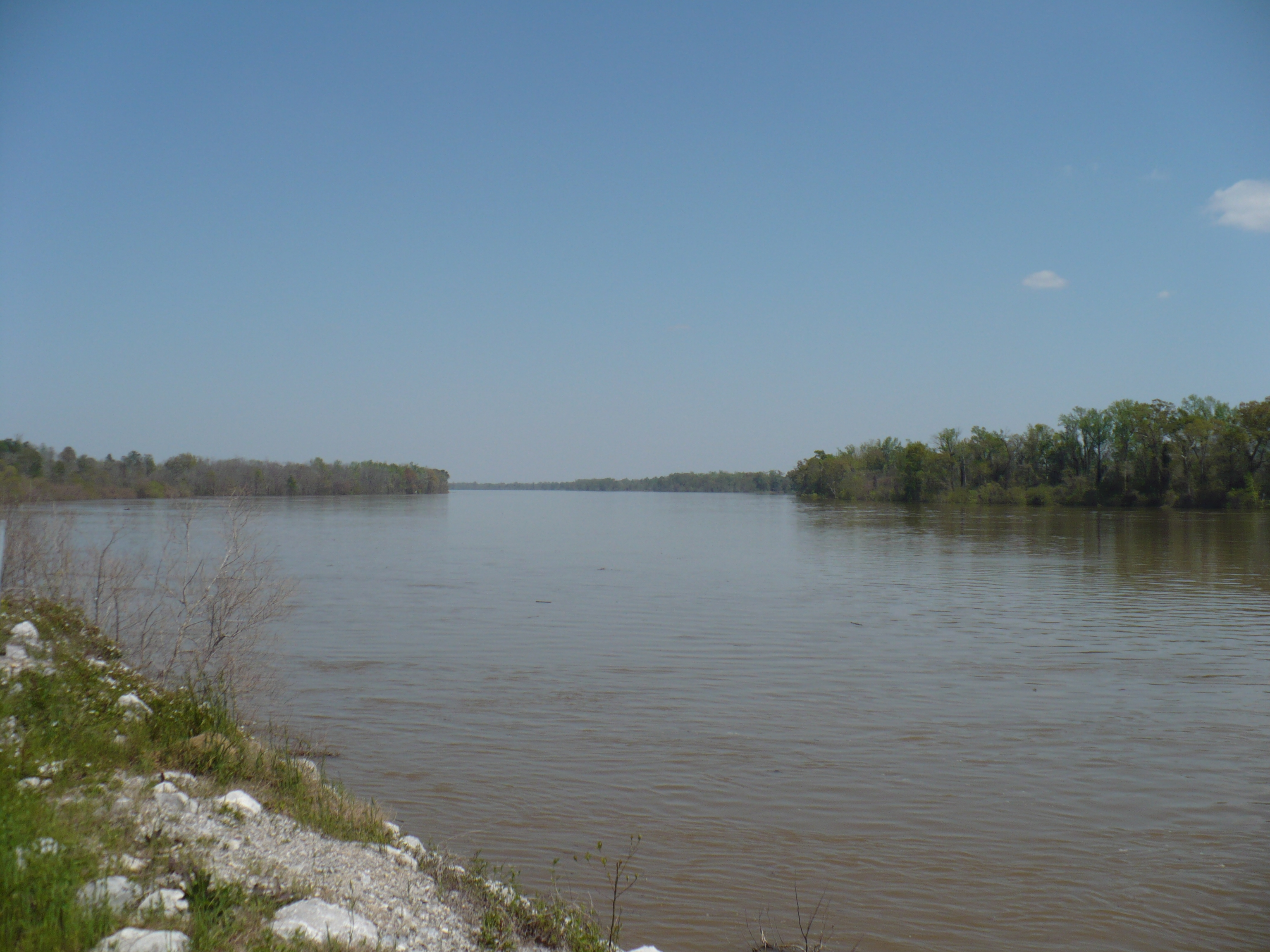
 The Mobile River at the Old Fort Stoddert landing, near Mount Vernon, in 2009.
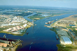 Aerial view of the Mobile River at its confluence with Chickasaw Creek, about 5 miles (8 km) above Mobile Bay. This photograph was taken about 1990 during construction of the Cochrane-Africatown bridge carrying U.S. Route 90 across the river. The bridge piers and construction crane are visible in the picture.
 Map of the Mobile River drainage basin
geo.wikisort.org - River
The Mobile River is located in southern Alabama in the United States. Formed out of the confluence of the Tombigbee and Alabama rivers, the approximately 45-mile-long (72 km) river drains an area of 44,000 square miles (110,000 km2) of Alabama, with a watershed extending into Mississippi, Georgia, and Tennessee. Its drainage basin is the fourth-largest of primary stream drainage basins entirely in the United States. The river has historically provided the principal navigational access for Alabama. Since construction of the Tennessee-Tombigbee Waterway, it also provides an alternative route into the Ohio River watershed.
| Mobile River | |
|---|---|
 Mobile-Alabama-Coosa River system | |
| Location | |
| Country | United States (Alabama, Georgia, Tennessee) |
| Physical characteristics | |
| Source | |
| • location | Confluence of Tombigbee and Alabama rivers |
| • elevation | 10.5 m (34 ft) |
| Mouth | |
• location | Mobile Bay, at Mobile, Alabama |
| Length | 72 km (45 mi) |
| Basin size | 115,000 km2 (44,000 sq mi) |
| Discharge | |
| • average | 67,000 cubic feet per second (1,900 m3/s) Min: 9,959 cubic feet per second (282.0 m3/s) Max: 318,468 cubic feet per second (9,018.0 m3/s)[1] Sediment Discharge: 4.5 million tons/year[2] 12,300 tons sediment/day (average) |
The Tombigbee and Alabama River join to form the Mobile River approximately 50 miles (80 km) northeast of Mobile, along the county line between Mobile and Baldwin counties. The combined stream flows south, in a winding course. Approximately 6 miles (10 km) downstream from the confluence, the channel of the river divides, with the Mobile flowing along the western channel. The Tensaw River, a bayou of the Mobile River, flows alongside to the east, separated from 2 to 5 miles (3 to 8 km) as they flow southward. The Mobile River flows through the Mobile-Tensaw River Delta and reaches Mobile Bay on the Gulf of Mexico just east of downtown Mobile.
Biodiversity
The Mobile River Basin historically supported the greatest biodiversity of freshwater snail species in the world (Bogan et al. 1995), including six genera and over 100 species that were endemic to the Mobile River Basin. During the past few decades, publications in the scientific literature have primarily dealt with the apparent decimation of this fauna following the construction of dams within the Mobile River Basin and the inundation of extensive shoal (a shallow place in a body of water) habitats by impounded waters (Goodrich 1944, Athearn 1970, Heard 1970, Stein 1976, Palmer 1986, Garner 1990).[3]
The James M. Barry Electric Generating Plant, owned by Alabama Power, has a leaking unlined Fly ash pit located "on land that lies within a hairpin crook of the Mobile River."[4] For this reason the river has been described as the third most endangered river in the United States.[5]
Crossings
This is a list of bridges and other crossings of the Mobile River from Mobile Bay upstream to its source at the confluence of the Tombigbee and Alabama rivers. Proposals for a new bridge to carry Interstate 10 over the river have been debated for several years. Currently the Alabama Department of Transportation is conducting an environmental impact study for such a crossing and into the widening of the Jubilee Parkway, which carries Interstate 10 over Mobile Bay. The location of this bridge is of great debate with some parties pushing for a crossing south of the current tunnels while others are opposed to anything south of the Cochrane–Africatown USA Bridge.
| Crossing | Carries | Location | Coordinates |
|---|---|---|---|
| George Wallace Tunnel | Mobile | ||
| Bankhead Tunnel | |||
| Cochrane–Africatown USA Bridge | |||
| 14-Mile Bridge | CSX Transportation | ||
| General W.K. Wilson Jr. Bridge |
Gallery


See also
- Mobile-Tensaw River Delta
- Alabama River
- Tombigbee River
- List of Alabama rivers
- South Atlantic-Gulf Water Resource Region
References
- "River Plume Productivity" (short title), Institute for Marine Remote Sensing (IMaRS), Oceanic Atlas of the Gulf of Mexico, 2001-10-04, web: USF-edu-RPlumeProd Archived 2006-09-02 at the Wayback Machine.
- "River Discharge to the Coastal Ocean: A Global Synthesis", John D. Milliman and Katherine L. Farnsworth, 2011, Cambridge University Press.
- This article incorporates text from a public domain work of the United States Government: Fish and Wildlife Service. October 28, 1998. Endangered and Threatened Wildlife and Plants; Endangered Status for Three Aquatic Snails, and Threatened Status for Three Aquatic Snails in the Mobile River Basin of Alabama. Federal Register, Vol. 63, No. 208, Rules and Regulations. Accessed 26 January 2009.
- Renkl, Margaret (May 9, 2022). "Opinion | On an Endangered River, Another Toxic Disaster Is Waiting to Happen". The New York Times. ISSN 0362-4331. Retrieved May 9, 2022.
- "Mobile River". Retrieved May 9, 2022.
External links
Wikisource has the text of an 1879 American Cyclopædia article about Mobile River.
- USGS: Mobile River Basin
- University of Alabama: Mobile River System
- Mobile River Terminal
- U.S. Geological Survey Geographic Names Information System: Mobile River
- . . 1914.
City of Mobile | |||||
|---|---|---|---|---|---|
| History |
|  | |||
| Geography |
| ||||
| Politics |
| ||||
| Economy |
| ||||
| Culture |
| ||||
| Architecture |
| ||||
| Historic sites |
| ||||
| Green spaces |
| ||||
| Education |
| ||||
| Museums |
| ||||
| Media |
| ||||
| |||||
Authority control | |
|---|---|
| General |
|
| Other | |
На других языках
[de] Mobile River
Der Mobile River ist ein Fluss im Süden des US-Bundesstaates Alabama. Er entsteht durch den Zusammenfluss des Tombigbee River mit dem Alabama River, nach 72 Kilometern mündet er in Mobile Bay in den Golf von Mexiko. Sein Einzugsgebiet umfasst eine Fläche von rund 115.000 km² und erstreckt sich auf Teile der benachbarten Bundesstaaten Mississippi, Georgia und Tennessee.- [en] Mobile River
[es] Río Mobile
El río Mobile (en inglés Mobile River) es un río del sur de Estados Unidos que fluye por el estado de Alabama hasta desaguar en el golfo de México (océano Atlántico) en la ciudad homónima. Aunque tiene una longitud de solamente 72 km, con sus fuentes, el sistema Mobile-Alabama-Coosa alcanza los 1123 km y drena una cuenca de 115 000 km².[it] Mobile (fiume)
Il Mobile è un fiume degli Stati Uniti che scorre nello Stato dell'Alabama.[ru] Мобил (река)
Моби́л (англ. Mobile River) — река в южной Алабаме, США.Текст в блоке "Читать" взят с сайта "Википедия" и доступен по лицензии Creative Commons Attribution-ShareAlike; в отдельных случаях могут действовать дополнительные условия.
Другой контент может иметь иную лицензию. Перед использованием материалов сайта WikiSort.org внимательно изучите правила лицензирования конкретных элементов наполнения сайта.
Другой контент может иметь иную лицензию. Перед использованием материалов сайта WikiSort.org внимательно изучите правила лицензирования конкретных элементов наполнения сайта.
2019-2026
WikiSort.org - проект по пересортировке и дополнению контента Википедии
WikiSort.org - проект по пересортировке и дополнению контента Википедии