geo.wikisort.org - River
The Alabama River, in the U.S. state of Alabama, is formed by the Tallapoosa and Coosa rivers, which unite about 6 miles (10 km) north of Montgomery, near the town of Wetumpka.[1]
| Alabama River | |
|---|---|
 The Alabama River at Montgomery in 2004 | |
 The Mobile, Alabama, and Coosa rivers are essentially a single river the name of which changes at the confluences of major tributaries. | |
| Location | |
| Country | United States |
| Physical characteristics | |
| Source | |
| • location | Tallapoosa and Coosa rivers near Montgomery, Alabama |
| Mouth | |
• location | Mobile River |
| Length | 318 miles (512 km) |
The river flows west to Selma, then southwest until, about 45 miles (72 km) from Mobile, it unites with the Tombigbee, forming the Mobile and Tensaw rivers, which discharge into Mobile Bay.[1]
Description
The run of the Alabama is highly meandering.[2] Its width varies from 50 to 200 yards (46 to 183 m), and its depth from 3 to 40 feet (1 to 12 m). Its length as measured by the United States Geological Survey is 318.5 miles (512.6 km),[3] and by steamboat measurement, 420 miles (680 km).[4]
The river crosses the richest agricultural and timber districts of the state. Railways connect it with the mineral regions of north-central Alabama.
After the Coosa and Tallapoosa rivers, the principal tributary of the Alabama is the Cahaba River, which is about 194 miles (312 km) long[3] and joins the Alabama River about 10 miles (16 km) below Selma. The Alabama River's main tributary, the Coosa River, crosses the mineral region of Alabama and is navigable for light-draft boats from Rome, Georgia, to about 117 miles (188 km) above Wetumpka (about 102 miles (164 km) below Rome and 26 miles (42 km) below Greensport), and from Wetumpka to its junction with the Tallapoosa. The channel of the river has been considerably improved by the federal government.
The navigation of the Tallapoosa River – which has its source in Paulding County, Georgia, and is about 265 miles (426 km) long[3] – is prevented by shoals and a 60-foot (18 m) fall at Tallassee, a few miles north of its junction with the Coosa. The Alabama is navigable throughout the year.
The river played an important role in the growth of the economy in the region during the 19th century as a source of transportation of goods, which included slaves. The river is still used for transportation of farming produce; however, it is not as important as it once was due to the construction of roads and railways.
Documented by Europeans first in 1701,[5] the Alabama, Coosa, and Tallapoosa rivers were central to the homeland of the Creek Indians before their removal by United States forces to the Indian Territory in the 1830s.
Lock and dams
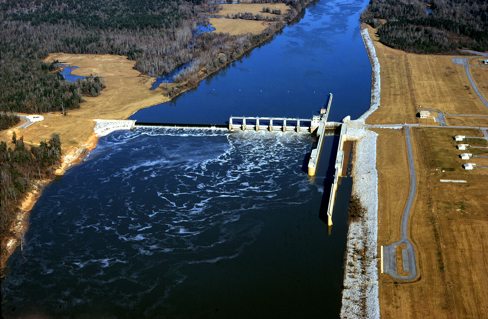
The Alabama River has three lock and dams between Montgomery and the Mobile River. The Robert F. Henry Lock & Dam is located at river mile 236.2, the Millers Ferry Lock & Dam is located at river mile 133.0, and the Claiborne Lock & Dam is located at river mile 72.5.[6]
Gallery
 Claiborne Lock and Dam on the Alabama River, approximately 5 miles (8 km) upriver from Claiborne, Monroe County
 Robert F. Henry Lock and Dam on the Alabama River, approximately 15 miles (24 km) east of Selma
 Millers Ferry Lock and Dam on the Alabama River in Wilcox County, approximately 9.5 miles (15.3 km) northwest of Camden
 Alabama River in Dallas County looking upstream towards Selma.
 The Alabama River in Lowndes County as seen from Benton Park in Benton, Alabama.
 The Edmund Pettus Bridge in Selma overlooking the Alabama River.
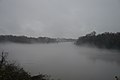 The Alabama River in Selma
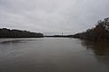 Alabama River at Riverfront Park in Montgomery


See also
- List of Alabama rivers
- Tallapoosa River
- Coosa River
- Mobile River
- South Atlantic-Gulf Water Resource Region
References
- "Alabama River | river, United States | Britannica".
- "CARIA Current Issues - Navigation on the Alabama river". Archived from the original on July 25, 2011. Retrieved May 9, 2010.
- U.S. Geological Survey. National Hydrography Dataset high-resolution flowline data. The National Map Archived March 29, 2012, at the Wayback Machine, accessed April 27, 2011
- Berney, Saffold (2011). Handbook Of Alabama: A Complete Index To The State. Nabu Press. ISBN 978-1-1792-5964-2.
- Willson, Marcius (1847). American History: Comprising Historical Sketches of the Indian Tribes: A Description of American Antiquities, with an Inquiry Into Their Origin and the Origin of the Indian Tribes; History of the United States, with Appendices Showing Its Connection with European History; History of the Present British Provinces; History of Mexico; and History of Texas, Brought Down to the Time of Its Admission Into the American Union. W.H. Moore & Company.
- Courtesy U.S. Army Corps of Engineers Mobile District
External links
- Allrefer.com
- . The American Cyclopædia. 1879.
- . New International Encyclopedia. 1905.
Authority control | |
|---|---|
| General |
|
| National libraries | |
| Other | |
На других языках
[de] Alabama River
Der Alabama River ist ein Fluss im US-Bundesstaat Alabama. Er entsteht durch den Zusammenfluss des Coosa River mit dem Tallapoosa River ungefähr sechs Meilen von Montgomery entfernt.- [en] Alabama River
[es] Río Alabama
El río Alabama es un río del sur de los Estados Unidos, la principal fuente, junto con el río Tombigbee, del río Mobile. Tiene una longitud de 502 km y drena una cuenca de 58.500 km². Es el tramo central del sistema fluvial Mobile-Alabama-Coosa que, con sus 1.123 km de longitud, es uno de los 20 mayores ríos de los Estados Unidos.[it] Alabama (fiume)
L'Alabama è un fiume degli Stati Uniti d'America che dà il nome allo stato omonimo che attraversa.[ru] Алабама (река)
Алаба́ма (англ. Alabama) — река в США, длина 640 километров. Образуется в 6 километрах от Монтгомери слиянием рек Кусы и Таллапусы, стекающих с южных отрогов Аппалачей, в низовье после слияния с рекой Томбигби, уже именуется Мобил-Ривер и впадает в Мобилский залив (иногда именующейся бухтой Мобил), который в свою очередь является частью Мексиканского залива. Название реки происходит от названия индейского племени алабама.Другой контент может иметь иную лицензию. Перед использованием материалов сайта WikiSort.org внимательно изучите правила лицензирования конкретных элементов наполнения сайта.
WikiSort.org - проект по пересортировке и дополнению контента Википедии