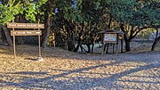
 Mills Canyon Wildlife Area headwaters region
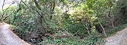 In Mills Canyon
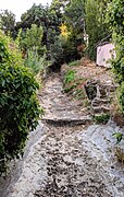 upstream of railroad tracks
 Pano along railroad tracks (left) and Rollins Road (right)
 At Rollins Road
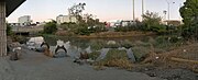 Behind the Adrian Storm Station
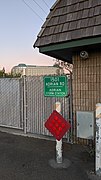 Adrian Storm Station
 Upstream from Old Bayshore Highway
 Slough entering the Bay
geo.wikisort.org - River
Mills Creek is a short eastward-flowing stream whose watershed originates in and around Mills Canyon Park in Burlingame's foothills in San Mateo County, California, United States.[1] The creek runs south of Millbrae Creek and north of Easton Creek watercourses respectively.[1]
| Mills Creek | |
|---|---|
   | |
| Location | |
| Country | United States |
| State | California |
| Region | San Mateo County |
| City | Burlingame |
| Physical characteristics | |
| Source | |
| • location | San Mateo County, California |
| Mouth | |
• location | Burlingame, California |
• coordinates | 37°35′50″N 122°21′57″W |
• elevation | 29 ft (8.8 m) |
The creek is in a mostly natural channel through the hills and residential flatlands of Burlingame. Starting near the Caltrain tracks, it is partially culverted and channelized into the San Francisco Bay.[1]
Watercourse gallery


See also
References
- Mills Creek Watershed, Oakland Museum of California, access date 05-27-2019
External links
San Francisco Bay watershed | ||
|---|---|---|
| Outline |
|  |
| Subdivisions |
| |
| Waterways |
| |
| Parks and protected areas |
| |
| Islands and peninsulas |
| |
| Wetlands |
| |
| Bridges and tubes |
| |
| Ferries |
| |
| Ports and marinas |
| |
| Other |
| |
| ||
Текст в блоке "Читать" взят с сайта "Википедия" и доступен по лицензии Creative Commons Attribution-ShareAlike; в отдельных случаях могут действовать дополнительные условия.
Другой контент может иметь иную лицензию. Перед использованием материалов сайта WikiSort.org внимательно изучите правила лицензирования конкретных элементов наполнения сайта.
Другой контент может иметь иную лицензию. Перед использованием материалов сайта WikiSort.org внимательно изучите правила лицензирования конкретных элементов наполнения сайта.
2019-2026
WikiSort.org - проект по пересортировке и дополнению контента Википедии
WikiSort.org - проект по пересортировке и дополнению контента Википедии