geo.wikisort.org - River
The Lufira River is a tributary of the Lualaba River in the Democratic Republic of the Congo (DRC).
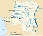
 The Lualaba River in red. Lufira River (not shown) flows in a northwestern direction before joining Lualaba just north of Bukama | |
| Location | |
|---|---|
| Country | Democratic Republic of the Congo |
| Physical characteristics | |
| Mouth | |
• location | Lualaba River |
| Length | 500 km (310 mi) |
Ramsar Wetland | |
| Official name | Bassin de la Lufira |
| Designated | 31 October 2017 |
| Reference no. | 2318[1] |
The Lufira rises in the Shaba plateau south of Likasi. The river was dammed in 1926 at Mwadingusha near Likasi to form Lake Tshangalele, a reservoir for a hydroelectric generator supplying power for copper smelting. It flows northwards through the Bia Mountains for about 500 kilometres (310 mi), joining the Lualaba in Lake Kisale.
References
- "Bassin de la Lufira". Ramsar Sites Information Service. Retrieved 25 April 2018.
На других языках
[de] Lufira (Lualaba)
Der Fluss Lufira ist ein Nebenfluss des Lualaba im Südosten der Demokratischen Republik Kongo.- [en] Lufira River
[it] Lufira
Il Lufira è un fiume della Repubblica Democratica del Congo, affluente del Lualaba.[ru] Луфира (река)
Луфира[1] — река на юге Демократической Республике Конго, правый приток Луалабы (верхнее течение реки Конго).Текст в блоке "Читать" взят с сайта "Википедия" и доступен по лицензии Creative Commons Attribution-ShareAlike; в отдельных случаях могут действовать дополнительные условия.
Другой контент может иметь иную лицензию. Перед использованием материалов сайта WikiSort.org внимательно изучите правила лицензирования конкретных элементов наполнения сайта.
Другой контент может иметь иную лицензию. Перед использованием материалов сайта WikiSort.org внимательно изучите правила лицензирования конкретных элементов наполнения сайта.
2019-2025
WikiSort.org - проект по пересортировке и дополнению контента Википедии
WikiSort.org - проект по пересортировке и дополнению контента Википедии
