geo.wikisort.org - River
Among the longest rivers of Mexico are 26 streams of at least 250 km (160 mi). In the case of rivers such as the Colorado, the length listed in the table below is solely that of the main stem.[1] In the case of the Grijalva and Usumacinta, it is the combined lengths of two river systems that share a delta.[2] In the case of the Nazas and Aguanaval, it is the combined lengths of separate rivers that flow into the same closed basin.[2]

Three rivers in this list cross international boundaries or form them. The Colorado and the Rio Grande (Río Bravo del Norte or Río Bravo) begin in the United States and flow into Mexico, while the Usumacinta begins in Guatemala and flows into Mexico.[3][4]
The primary source for the length, watershed, and surface runoff data in the table below is the 10th edition of Statistics on Water in Mexico, published by the National Water Commission in Mexico (CONAGUA); exceptions are as noted. U.S. states and departments of Guatemala appear in italics in the "States" column.
| Key | |||||
|---|---|---|---|---|---|
| # | Name | Mouth[5] | Length | Watershed area |
Annual surface runoff | States[3][4] | Image |
|---|---|---|---|---|---|---|---|
| 1 | Rio Grande (Río Bravo del Norte or Río Bravo) | Gulf of Mexico 25°57′22″N 97°08′43″W | 3,108 km 1,931 mi | 466,939 km2 180,286 mi2 | 6,090 x 106 m3 2.15 x 1011 ft3 [n 3] | Colorado, New Mexico, Texas, Chihuahua, Coahuila, Nuevo León, Tamaulipas | 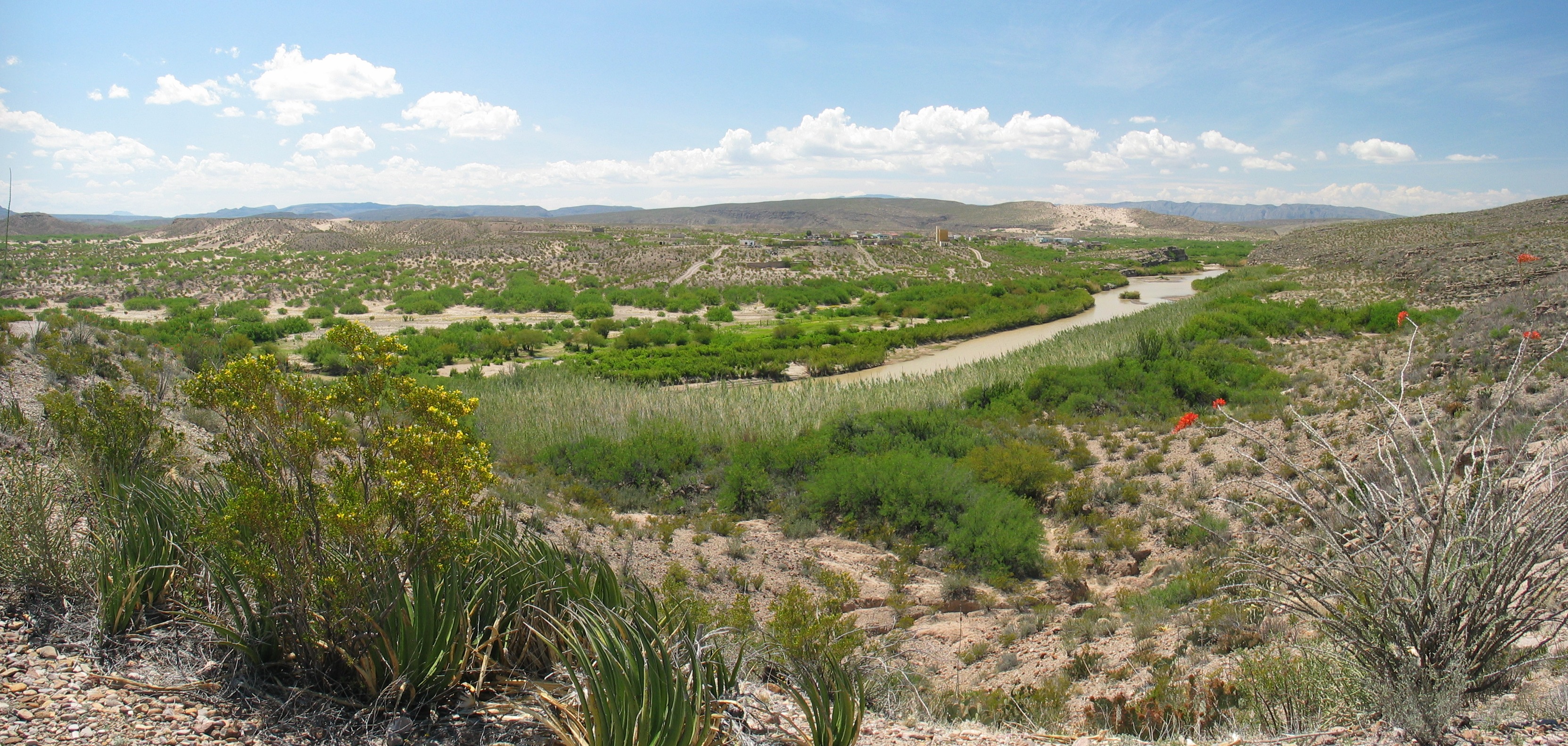 |
| 2 | Colorado River | Gulf of California 31°48′57″N 114°48′22″W | 2,337 km 1,452 mi | 630,783 km2 243,547 mi2 | 17,898 x 106 m3 6.321 x 1011 ft3 [n 6] | Colorado, Utah, Arizona, Nevada, California, Sonora, Baja California | 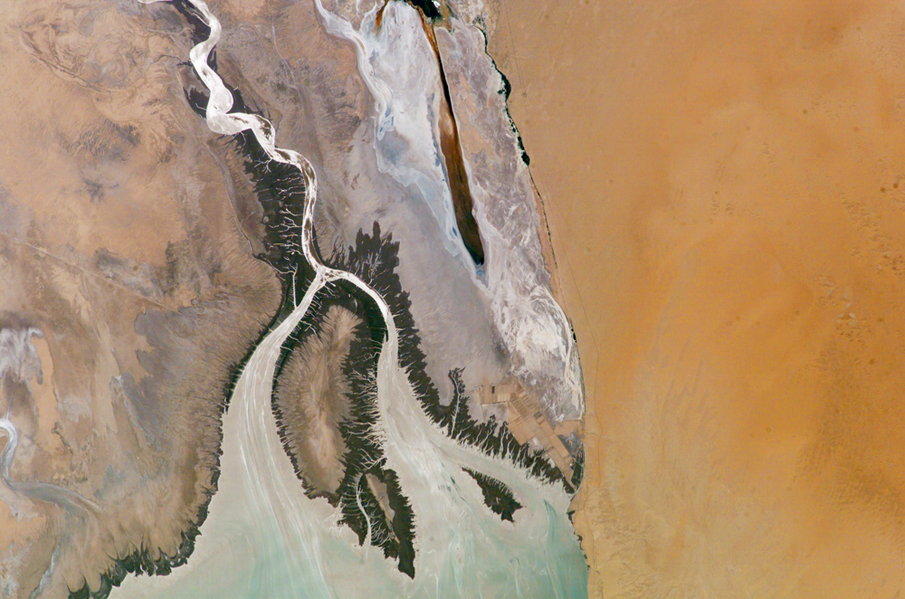 |
| 3 | Grijalva–Usumacinta Rivers | Bay of Campeche 18°35′20″N 92°41′20″W | 1,911 km 1,187 mi | 128,390 km2 49,570 mi2 | 115,536 x 106 m3 4.0801 x 1012 ft3 [n 9] | Petén, Chiapas, Tabasco |  |
| 4 | Nazas–Aguanaval Rivers | Bolsón de Mapimí 25°12′00″N 104°12′00″W | 1,081 km 672 mi | 89,239 km2 34,455 mi2 | 1,912 x 106 m3 6.75 x 1010 ft3 | Durango, Zacatecas, Coahuila |  |
| 5 | Culiacán River | Pacific Ocean 24°29′32″N 107°43′55″W | 875 km 544 mi | 15,731 km2 6,074 mi2 | 3,161 x 106 m3 1.116 x 1011 ft3 | Sinaloa | 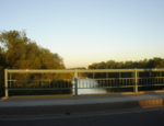 |
| 6 | Balsas River | Pacific Ocean 17°56′22″N 102°08′14″W | 770 km 478 mi | 117,406 km2 45,331 mi2 | 16,587 x 106 m3 5.858 x 1011 ft3 | Puebla, Morelos, Michoacán, Guerrero |  |
| 7 | Lerma River | Lake Chapala 20°15′00″N 103°00′00″W | 708 km 440 mi | 47,116 km2 18,192 mi2 | 4,742 x 106 m3 1.675 x 1011 ft3 | State of Mexico, Querétaro, Michoacán, Guanajuato, Jalisco |  |
| 8 | Rio Grande de Santiago | Pacific Ocean 21°38′00″N 105°26′43″W | 562 km 349 mi | 76,416 km2 29,504 mi2 | 7,849 x 106 m3 2.772 x 1011 ft3 | Jalisco, Nayarit | 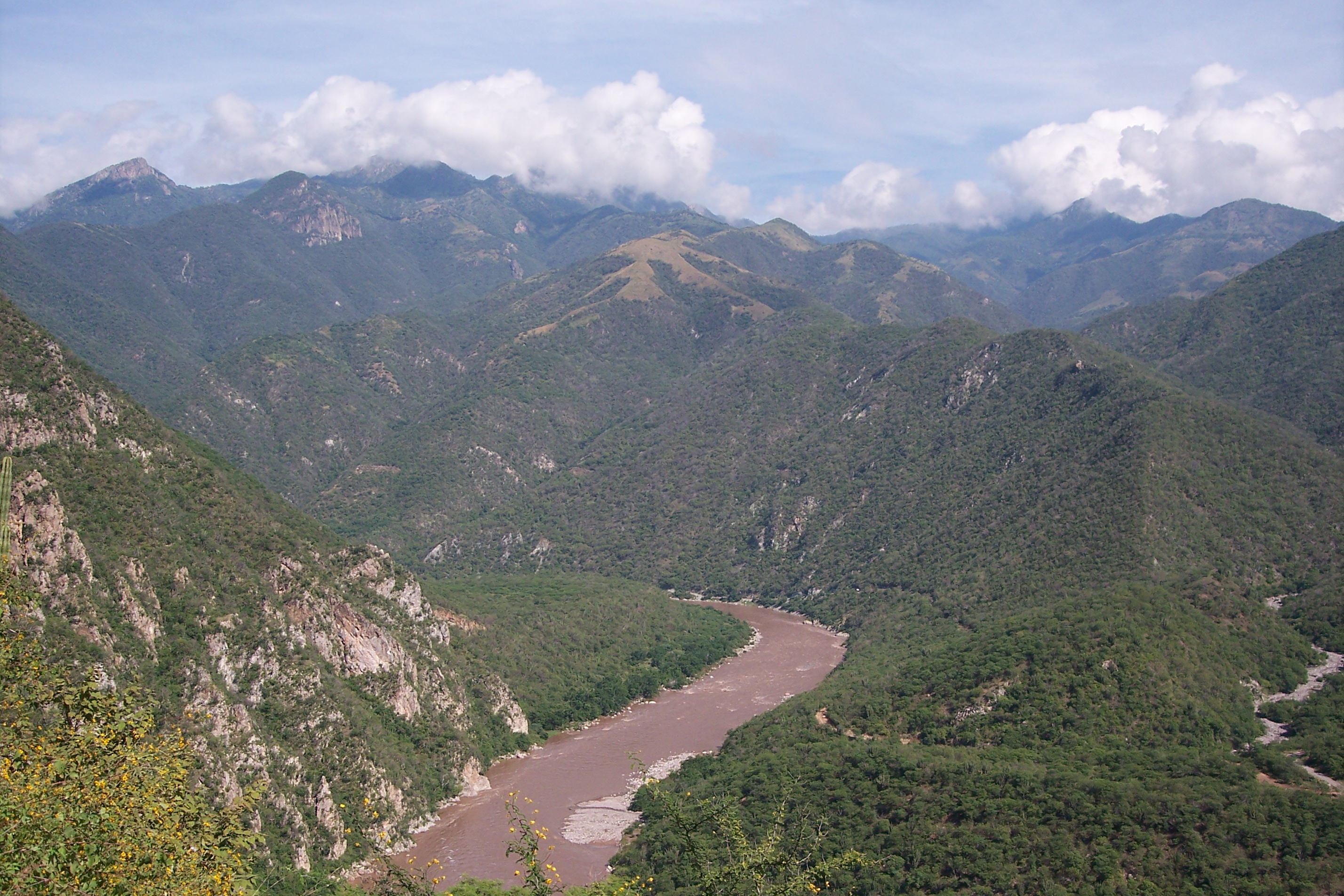 |
| 9 | Fuerte River | Gulf of California 25°48′00″N 109°25′00″W | 540 km 336 mi | 33,590 km2 12,970 mi2 | 5,176 x 106 m3 1.828 x 1011 ft3 | Sinaloa |  |
| 10 | Pánuco River | Gulf of Mexico 22°16′00″N 97°47′00″W | 510 km 317 mi | 84,956 km2 32,802 mi2 | 20,330 x 106 m3 7.18 x 1011 ft3 | Veracruz |  |
| 11 | Rio Conchos | Rio Grande 25°07′00″N 98°32′00″W | 485 km 301 mi[6] | 68,386 km2 26,404 mi2[7] | 2,714 x 106 m3 9.58 x 1010 ft3[8] | Chihuahua | |
| 12 | Sonora River | Gulf of California 28°47′06″N 111°55′11″W | 421 km 262 mi | 27,740 km2 10,710 mi2 | 408 x 106 m3 1.44 x 1010 ft3 | Sonora | |
| 13 | Soto La Marina River | Gulf of Mexico 23°45′56″N 97°44′13″W | 416 km 258 mi | 21,183 km2 8,179 mi2 | 2,086 x 106 m3 7.37 x 1010 ft3 | Tamaulipas | |
| 14 | Yaqui River | Gulf of California 27°39′17″N 110°37′26″W | 410 km 255 mi | 72,540 km2 28,010 mi2 | 3,163 x 106 m3 1.117 x 1011 ft3 | Sonora |  |
| 15 | Sinaloa River | Gulf of California 25°16′51″N 108°29′43″W | 400 km 249 mi | 12,260 km2 4,730 mi2 | 2,126 x 106 m3 7.51 x 1010 ft3 | Sinaloa | |
| 16 | San Fernando River | Gulf of Mexico 24°55′00″N 97°40′00″W | 400 km 249 mi | 17,744 km2 6,851 mi2 | 1,545 x 106 m3 5.46 x 1010 ft3 | Tamaulipas | |
| 17 | Mayo River | Gulf of California 26°45′00″N 109°47′00″W | 386 km 240 mi | 15,113 km2 5,835 mi2 | 1,232 x 106 m3 4.35 x 1010 ft3 | Chihuahua, Sonora | |
| 18 | Tecolutla River | Gulf of Mexico 20°29′00″N 97°00′00″W | 375 km 233 mi | 7,903 km2 3,051 mi2 | 6,095 x 106 m3 2.152 x 1011 ft3 | Veracruz | |
| 19 | Jamapa River | Gulf of Mexico 19°02′00″N 96°08′00″W | 368 km 229 mi | 4,061 km2 1,568 mi2 | 2,563 x 106 m3 9.05 x 1010 ft3 | Veracruz |  |
| 20 | Papaloapan River | Gulf of Mexico 18°42′00″N 95°38′00″W | 354 km 220 mi | 46,517 km2 17,960 mi2 | 44,662 x 106 m3 1.5772 x 1012 ft3 | Oaxaca, Veracruz |  |
| 21 | Verde River | Pacific Ocean 16°25′23″N 94°52′56″W | 342 km 213 mi | 5,937 km2 2,292 mi2 | 5,937 x 106 m3 2.097 x 1011 ft3 | Oaxaca | |
| 22 | Concepción River | Gulf of California 30°32′00″N 113°02′00″W | 335 km 208 mi | 25,808 km2 9,965 2 | 123 x 106 m3 4.3 x 109 ft3 | Sonora | |
| 23 | Coatzacoalcos River | Gulf of Mexico 18°09′00″N 94°24′00″W | 325 km 202 mi | 17,369 km2 6,706 mi2 | 28,093 x 106 m3 9.921 x 1011 ft3 | Oaxaca, Veracruz | |
| 24 | San Lorenzo River | Gulf of California 28°24′00″N 110°19′00″W | 315 km 196 mi | 8,919 km2 3,444 mi2 | 1,680 x 106 m3 5.9 x 1010 ft3 | Durango, Sinaloa | |
| 25 | Sonoyta River | Gulf of California 31°16′00″N 113°19′00″W | 311 km 193 mi | 7,653 km2 2,955 mi2 | 16 x 106 m3 570 x 106 ft3 | Sonora | |
| 26 | San Pedro River | Pacific Ocean 21°43′41″N 105°29′30″W | 255 km 158 mi | 26,480 km2 10,220 mi2 | 3,417 x 106 m3 1.207 x 1011 ft3 | Durango, Nayarit |
See also
Notes and references
- Notes
- Of the total, 1,074 km (667 mi) or about 35 percent are in the United States, and 2,034 km (1,264 mi) (about 65 percent) form a common border between Mexico and the United States.[2]
- Of the total, 225,242 km2 (86,966 sq mi) (about 48 percent) are in Mexico, and 241,697 km2 (93,320 sq mi) (about 52 percent) are in the United States.[2]
- Of the total, 5,588 x 106 m3/year (about 92 percent) come from Mexico and 502 x 106 m3/year (about 8 percent) from the United States.[2]
- Of the total, 2,140 km (1,330 mi) or about 91.5 percent are in the United States; 160 km (99 mi) (about 7 percent) are in Mexico, and 37 km (23 mi) (about 1.5 percent) form a common border between Mexico and the United States.[2]
- Of the total, 3,840 km2 (1,480 sq mi) (about 0.6 percent) are in Mexico, and 626,943 km2 (242,064 sq mi) (about 99.4 percent) are in the United States.[2]
- Of the total, 13 x 106 m3/year, about 0.07 percent, come from Mexico and 17,885 x 106 m3/year (about 99.93 percent) from the United States.[2]
- Of the total, 1,521 km (945 mi) or about 80 percent are in Mexico, and 390 km (240 mi) (about 20 percent) are in Guatemala.[2]
- Of the total, 83,553 km2 (32,260 sq mi) (about 65 percent) are in Mexico, and 44,837 km2 (17,312 sq mi) (about 35 percent) are in Guatemala.[2]
- Of the total, 71,716 x 106 m3/year (about 62 percent) come from Mexico and 43,820 x 106 m3/year (about 38 percent) from Guatemala.[2]
- References
- Kammerer, J.C. (September 1, 2005). "Largest Rivers in the United States". United States Geological Survey. Retrieved July 1, 2011.
- Ministry of Environment and Natural Resources, ed. (June 2010). Statistics on Water in Mexico (PDF) (10th ed.). National Water Commission in Mexico (CONAGUA). pp. 36–39. Retrieved June 10, 2011.
- The Road Atlas. Chicago, Illinois: Rand McNally & Company. 2008. ISBN 0-528-93961-0.
- Mexico AdventureMap (Map) (2010 ed.). National Geographic Society. ISBN 978-1-56695-527-0.
- "GeoNames Search". National Geospatial Intelligence Agency. Retrieved June 13, 2011. Approximate coordinates from GeoNames, in some cases adjusted by geolocating with Google Earth.
- Merriam-Webster's Geographical Dictionary (3rd ed.). Springfield, Massachusetts: Merriam-Webster, Incorporated. 1997. p. 274. ISBN 0-87779-546-0.
- Benke and Cushing, p. 1079
- Kelly, Mary E.; Arias Rojo; Héctor M. "River Habitat Restoration in the Chihuahuan Desert: The Río Conchos and the Forgotten River Stretch of the Rio Grande" (PDF). Southwest Consortium for Environmental Research and Policy. p. 172. Archived from the original (PDF) on March 21, 2012. Retrieved June 28, 2011.
Works cited
- Benke, Arthur C., ed., and Cushing, Colbert E., ed. Rivers of North America. Burlington, Massachusetts: Elsevier Academic Press. ISBN 0-12-088253-1.
На других языках
[de] Liste der längsten Flüsse in Mexiko
Die nachfolgende Liste beinhaltet 26 mexikanische Flüsse mit einer Länge von mehr als 250 Kilometern. Bei drei Flüssen ist zu beachten, dass sie im Gebiet anderer Staaten, nämlich den USA und Guatemala, entspringen und teilweise Grenzflüsse sind; ihr Mündungsgebiet befindet sich jedoch auf dem Territorium Mexikos. Umgekehrt gibt es in dieser Liste keinen einzigen Flusslauf, der in Mexiko entspringt, aber in einem anderen Staat mündet.- [en] List of longest rivers of Mexico
Другой контент может иметь иную лицензию. Перед использованием материалов сайта WikiSort.org внимательно изучите правила лицензирования конкретных элементов наполнения сайта.
WikiSort.org - проект по пересортировке и дополнению контента Википедии