geo.wikisort.org - River
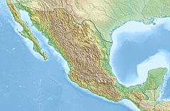
The Aguanaval River is a river located in northeastern Mexico.
| Aguanaval River | |
|---|---|
 | |
| Location | |
| Country | Mexico |
| State | Zacatecas, Durango, Coahuila |
Geography
It originates in the southern Sierra Madre Occidental range of Zacatecas state, and flows generally north through Zacatecas and Durango states to empty into the endorheic Bolsón de Mapimí, in Coahuila state.
Use
The Aguanaval River water is withdrawn and used extensively for irrigation in the Laguna Region of Durango and Coahuila.
See also
На других языках
- [en] Aguanaval River
[es] Río Aguanaval
El río Aguanaval es un río de México. Nace por la confluencia de varios arroyos de la vertiente norte de la sierra de Zacatecas. Tiene 1,081 km de longitud, el área total de la cuenca es de 89,239[1] y en su recorrido recibe los nombre de río Trujillo, río Grande, río de Nieves, río Maravillas y finalmente Río Aguanaval. Desemboca en la región de La Laguna, donde sus aguas se utilizan para el riego. Antiguamente desembocaba en la laguna de Viesca, actualmente seca.Текст в блоке "Читать" взят с сайта "Википедия" и доступен по лицензии Creative Commons Attribution-ShareAlike; в отдельных случаях могут действовать дополнительные условия.
Другой контент может иметь иную лицензию. Перед использованием материалов сайта WikiSort.org внимательно изучите правила лицензирования конкретных элементов наполнения сайта.
Другой контент может иметь иную лицензию. Перед использованием материалов сайта WikiSort.org внимательно изучите правила лицензирования конкретных элементов наполнения сайта.
2019-2025
WikiSort.org - проект по пересортировке и дополнению контента Википедии
WikiSort.org - проект по пересортировке и дополнению контента Википедии
