geo.wikisort.org - River
The Gallatin River is a tributary of the Missouri River, approximately 120 mi (193 km long), in the U.S. states of Wyoming and Montana. It is one of three rivers, along with the Jefferson and Madison, that converge near Three Forks, Montana, to form the Missouri.
| Gallatin River | |
|---|---|
 The Gallatin River during winter | |
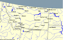 Montana rivers. The Gallatin is in the southwest corner. | |
| Location | |
| Country | United States |
| State | Wyoming, Montana |
| Physical characteristics | |
| Source | Gallatin Range |
| • location | Wyoming |
| • coordinates | 44°51′29″N 110°53′01″W[1] |
| Mouth | Missouri River |
• location | Montana |
• coordinates | 45°56′20″N 111°29′33″W[1] |
| Length | 120 mi (190 km) |
| Discharge | |
| • location | Logan |
| • average | 1,059 cu ft/s (30.0 m3/s)[2] |
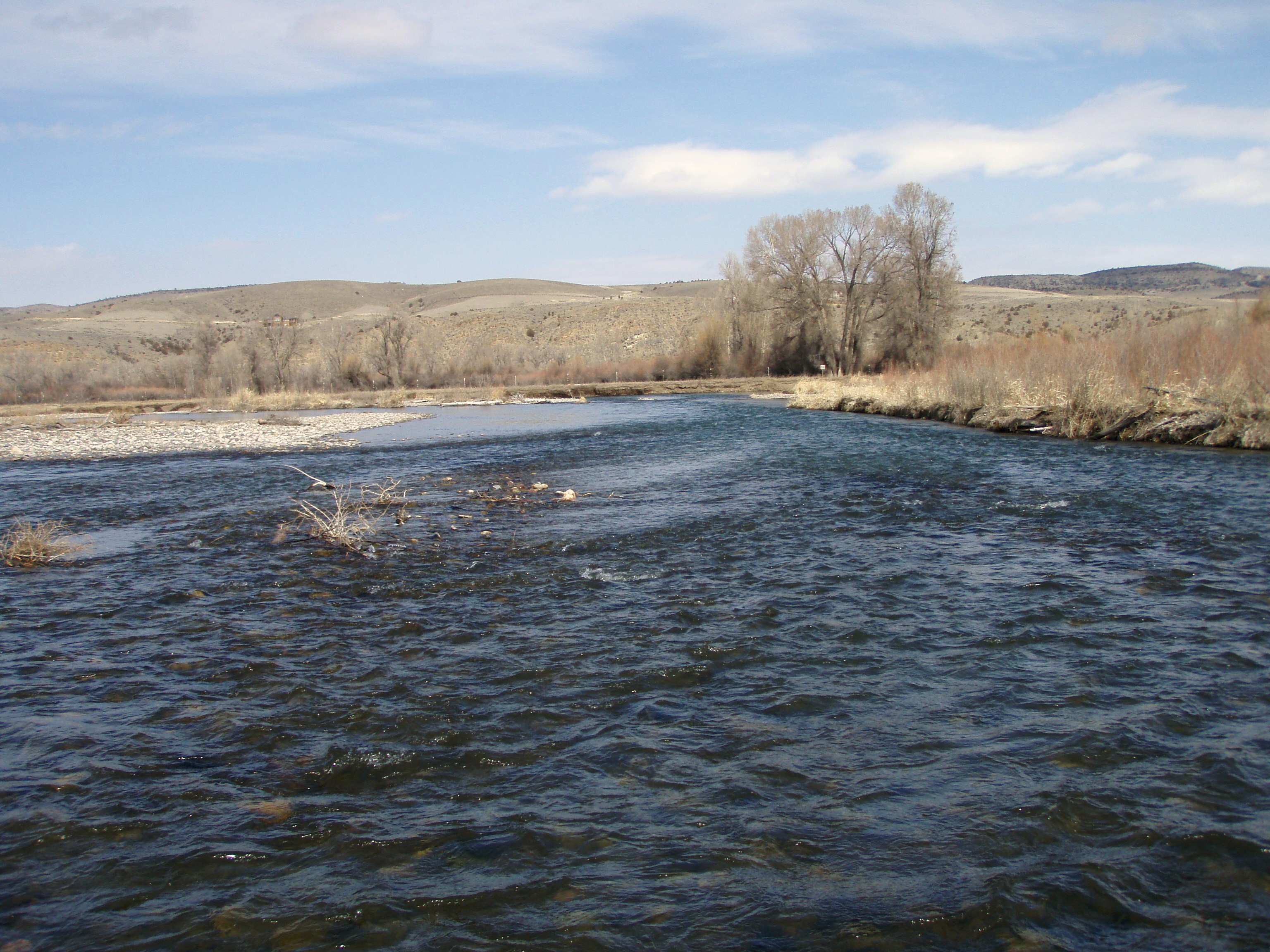

It originates in the northwest corner of Yellowstone National Park in northwestern Wyoming, in the Gallatin Range of the Rocky Mountains. It flows northwest through Gallatin National Forest, past Big Sky, Montana, and joins the Jefferson and Madison approximately 30 mi (48 km) northwest of Bozeman. U.S. Highway 191 follows the river from the Wyoming border to just outside Bozeman.
The river was named in July 1805 by Meriwether Lewis at Three Forks. The eastern fork of the three, it was named for Albert Gallatin,[3] the U.S. Treasury Secretary from 1801–14. The western fork was named for President Thomas Jefferson and the central fork for Secretary of State James Madison.
The Gallatin River is one of the best[according to whom?] whitewater runs in the Yellowstone-Teton Area. In June, when the snowmelt is released from the mountains, the river has a class IV section called the "Mad Mile". This section is over a mile long and contains continuous stretches of challenging whitewater. Rafting companies offer trips on this river – on the Mad Mile Section as well as other, less challenging sections.
The Gallatin River is an amazingly scenic river – winding through high alpine meadows, dropping into the rocky Gallatin Canyon, and flowing out into the Gallatin Valley. It is an exceptionally popular fly fishing destination for rainbow trout, brown trout and mountain whitefish. Portions of the river are designated as a Blue Ribbon trout stream while the remainder is designated Red Ribbon by the Montana Fish, Wildlife and Parks Department.[4] The river is closed to fishing from boats from Yellowstone Park to the confluence with the East Gallatin River.[5]
Parts of the movie A River Runs Through It were filmed on the Gallatin.
The river is a Class I water from the Taylor Fork to its confluence with the Missouri for the purposes of public recreational access.[6]
History
The history of the canyon mirrors much of the activity during the late 1800 and early 1900s in southwestern Montana. The canyon was first explored by Native American hunters, and later fur-trappers and gold prospectors. There was a significant amount of consideration given to the idea of running the railroad through the canyon to increase travel between Yellowstone National Park and Bozeman, Montana. Logging was conducted in the canyon at the turn of the 20th century, and loggers would ride the logs down river to prevent them from jamming.
Pete Karst moved into the canyon in 1898 to homestead a ranch, and ran everything from an inn for travelers to serving liquor he made on the premise during Prohibition days. His most successful endeavor in the canyon was a bus route he ran in 1924 from Salesville (now Gallatin Gateway) to Yellowstone National Park. "Karst Camp", as it came to be known, was home to the first tow rope ski hill in Montana, and held annual ski jumping competitions.[7]
See also
- Angling in Yellowstone National Park
- Fishes of Yellowstone National Park
- Montana Stream Access Law
- List of Wyoming rivers
- List of rivers of Montana
Notes
- U.S. Geological Survey Geographic Names Information System: Gallatin River, USGS GNIS
- "USGS Surface Water data for Montana: USGS Surface-Water Annual Statistics".
- Gannett, Henry (1905). The Origin of Certain Place Names in the United States. Govt. Print. Off. pp. 133.
- MFWP Stream Fishery Classification Archived 2008-07-11 at the Wayback Machine
- "Fishing Regulations". Retrieved 2019-05-11.
- Stream Access in Montana Archived March 10, 2009, at the Wayback Machine
- Smith, Phyllis (1996). Bozeman and the Gallatin Valley: a history. Globe Pequot. ISBN 978-1-56044-540-1.
Further reading
- Smith, Phyllis (1996). Bozeman and the Gallatin Valley. A History. Helena, MT: Falcon Press Publishers. ISBN 1-56044-540-8.
External links
- Gallatin River images from the National Park Service
- US Dept. of Agriculture snowmelt runoff of the Gallatin
- Gallatin County Emergency Management
State of Montana | |
|---|---|
Helena (capital) | |
| Topics | |
| Society |
|
| Regions |
|
| Largest cities | |
| Counties |
|
State of Wyoming | |
|---|---|
Cheyenne (capital) | |
| Topics |
|
| Society |
|
| Regions |
|
| Cities | |
| Counties | |
| Authority control |
|---|
На других языках
[de] Gallatin River
Der Gallatin River ist ein Fluss in den US-Bundesstaaten Wyoming und Montana. Er ist der erste Zufluss des Missouri River.- [en] Gallatin River
[es] Río Gallatin
El río Gallatin es un afluente del río Misuri que fluye por los estados de Wyoming y Montana en los Estados Unidos. Tiene una longitud de aproximadamente 193 km y es, junto con el Jefferson y el Madison, uno de los tres ríos que convergen en Three Forks (Montana) para formar el río Misuri.[ru] Галлатин
Галлатин (англ. Gallatin River) — река в штатах Вайоминг и Монтана, США. Является одним из трёх верховий Миссури наряду с реками Джефферсон и Мадисон, с которыми она соединяется вблизи городка Три-Форкс (округ Галлатин, Монтана). Берёт начало на северо-западе национального парка Йеллоустон, в районе хребта Галлатин Скалистых гор[1]. Длина реки составляет около 193 км[2].Другой контент может иметь иную лицензию. Перед использованием материалов сайта WikiSort.org внимательно изучите правила лицензирования конкретных элементов наполнения сайта.
WikiSort.org - проект по пересортировке и дополнению контента Википедии