geo.wikisort.org - River
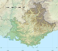
The Bayeux (Baion in Occitan) is a short stream in the southeast of France. In the upper 2 kilometres (1.2 mi) of its course it is called Bayon. It runs from the Montagne Sainte-Victoire[1] to the Arc, near Meyreuil. It is 10 km (6.2 mi) long.[2]
| Bayeux | |
|---|---|
 | |
| Location | |
| Country | France |
| Physical characteristics | |
| Mouth | Arc |
• coordinates | 43°30′3″N 5°30′59″E |
| Length | 10 km (6.2 mi) |
| Basin features | |
| Progression | Arc→ Étang de Berre→ Mediterranean Sea |
References
- "Erudit Article" (PDF). Erudit.org. Retrieved 2013-12-05.
- Sandre. "Fiche cours d'eau - Le Bayeux (Y4020540)".
Текст в блоке "Читать" взят с сайта "Википедия" и доступен по лицензии Creative Commons Attribution-ShareAlike; в отдельных случаях могут действовать дополнительные условия.
Другой контент может иметь иную лицензию. Перед использованием материалов сайта WikiSort.org внимательно изучите правила лицензирования конкретных элементов наполнения сайта.
Другой контент может иметь иную лицензию. Перед использованием материалов сайта WikiSort.org внимательно изучите правила лицензирования конкретных элементов наполнения сайта.
2019-2025
WikiSort.org - проект по пересортировке и дополнению контента Википедии
WikiSort.org - проект по пересортировке и дополнению контента Википедии

