geo.wikisort.org - River
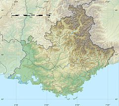
The Arc is an 83-kilometre (52 mi) long river in Southern France.[1] It arises at an elevation of 470 metres (1,540 ft), close to the village of Pourcieux. It then passes through Aix-en-Provence before flowing into the Étang de Berre, a lagoon connected with the Mediterranean Sea to the west of Marseille. Its drainage basin, with a surface area of 716 square kilometres (276 sq mi), is divided between two départments, Var and Bouches-du-Rhône.[2] The Bayeux, the Cause and the Torse are its tributaries.
| Arc | |
|---|---|
 The Arc flowing near Aix-en-Provence | |
| Location | |
| Country | France |
| Physical characteristics | |
| Source | |
| • location | Pourcieux |
| • elevation | 470 m (1,540 ft) |
| Mouth | Étang de Berre |
• coordinates | 43°30′24″N 5°6′49″E |
| Length | 83 km (52 mi) |
| Basin size | 716 km2 (276 sq mi) |
| Basin features | |
| Progression | Étang de Berre→ Mediterranean Sea |
The Roquefavour Aqueduct passes over the river; Paul Cézanne's Mont Sainte-Victoire and the Viaduct of the Arc River Valley is the best known piece of art representing the Arc.
References
- Sandre. "Fiche cours d'eau - L'Arc (Y4--0200)".
- Bassin versant : Arc (L'), Observatoire Régional Eau et Milieux Aquatiques en PACA
На других языках
[de] Arc (Mittelmeer)
Der Arc ist ein Fluss im Süden Frankreichs, der in der Region Provence-Alpes-Côte d’Azur verläuft. Er entspringt im Regionalen Naturpark Sainte-Baume, im Gemeindegebiet von Saint-Maximin-la-Sainte-Baume, entwässert generell in westlicher Richtung, durchquert die Großstadt Aix-en-Provence und mündet schließlich nach rund 83[3] Kilometern im Gemeindegebiet von Berre-l’Étang in den Salzwassersee Étang de Berre, eine Meeresbucht des Mittelmeeres, die sich westlich von Marseille befindet. Auf seinem Weg durchquert der Arc die Départements Var und Bouches-du-Rhône.- [en] Arc (Provence)
[it] Arc (fiume Provenza)
L'Arc è un fiume costiero della Francia meridionale che scorre interamente nella regione Provence-Alpes-Côte d'Azur, tra il dipartimento del Varo e quello delle Bocche del Rodano. Sfocia nella laguna di Berre, dopo un percorso di 83 km.Текст в блоке "Читать" взят с сайта "Википедия" и доступен по лицензии Creative Commons Attribution-ShareAlike; в отдельных случаях могут действовать дополнительные условия.
Другой контент может иметь иную лицензию. Перед использованием материалов сайта WikiSort.org внимательно изучите правила лицензирования конкретных элементов наполнения сайта.
Другой контент может иметь иную лицензию. Перед использованием материалов сайта WikiSort.org внимательно изучите правила лицензирования конкретных элементов наполнения сайта.
2019-2025
WikiSort.org - проект по пересортировке и дополнению контента Википедии
WikiSort.org - проект по пересортировке и дополнению контента Википедии

