geo.wikisort.org - River
The Adige (Italian: [ˈaːdidʒe]; German: Etsch [ɛtʃ] (![]() listen); Venetian: Àdexe [ˈadeze]; Romansh: Adisch [ɐˈdiːʃ] (
listen); Venetian: Àdexe [ˈadeze]; Romansh: Adisch [ɐˈdiːʃ] (![]() listen); Ladin: Adesc; Latin: Athesis; Ancient Greek: Ἄθεσις, romanized: Áthesis, or Ἄταγις, Átagis[1]) is the second-longest river in Italy, after the Po. It rises near the Reschen Pass in the Vinschgau in the province of South Tyrol, near the Italian border with Austria and Switzerland, and flows 410 kilometres (250 mi) through most of northeastern Italy to the Adriatic Sea.
listen); Ladin: Adesc; Latin: Athesis; Ancient Greek: Ἄθεσις, romanized: Áthesis, or Ἄταγις, Átagis[1]) is the second-longest river in Italy, after the Po. It rises near the Reschen Pass in the Vinschgau in the province of South Tyrol, near the Italian border with Austria and Switzerland, and flows 410 kilometres (250 mi) through most of northeastern Italy to the Adriatic Sea.
| Adige | |
|---|---|
 The Adige in Verona | |
 Map of the Adige River | |
| Etymology | Latin Athesis, from Celtic *yt-ese, "the water" |
| Native name | |
| Location | |
| Country | Italy |
| Physical characteristics | |
| Source | Reschen Pass |
| • location | Graun im Vinschgau, South Tyrol, Italy |
| • coordinates | 46°50′04″N 10°30′53″E |
| • elevation | 1,520 m (4,990 ft) |
| Mouth | Adriatic Sea |
• location | Italy |
• coordinates | 45°8′59″N 12°19′13″E |
| Length | 410 km (250 mi) |
| Basin size | 12,100 km2 (4,700 sq mi) |
| Discharge | |
| • average | 235 m3/s (8,300 cu ft/s) |
The river's name is Celtic in origin, from the Proto-Celtic *yt-ese, "the water", cognate with the River Tees in England (anciently Athesis, Teesa).[2]
Description
The river source is near the Reschen Pass (1,504 metres (4,934 ft)) close to the borders with Austria and Switzerland above the Inn valley. It flows through the artificial alpine Lake Reschen. The lake is known for the church tower that marks the site of the former village of Alt Graun ("Old Graun"); it was evacuated and flooded in 1953 after the dam was finished. Near Glurns, the Rom river joins from the Swiss Val Müstair.
The Adige runs eastward through the Vinschgau to Merano, where it is met by the Passer river from the north. The section between Merano and Bolzano is called Etschtal, meaning Adige Valley. South of Bolzano, the river is joined by the Eisack and turns south through a valley which has always been one of the major routes through the Alps, connecting the Reschen and the Brenner passes, at 1,370 metres (4,490 ft) considered the easiest of the main Alpine passes.
The Chiusa di Salorno narrows at Salorno mark the southernmost part of the predominantly German-speaking province of South Tyrol. The Adige was mentioned in the "Lied der Deutschen" of 1841 as the southern border of the German language area. As of 2011 62% of Salorno speaks Italian and 37% speaks German.[3] In 1922 Germany adopted the song as its national anthem, although by that time Italy had taken control of all of the Adige.
Near Trento, the Avisio, Noce, and Fersina rivers join. The Adige crosses Trentino and later Veneto, flowing past the town of Rovereto, the Lagarina Valley, the cities of Verona and Adria and the north-eastern part of the Po Plain into the Adriatic Sea. The Adige and the Po run parallel in the river delta without properly joining.
The Adige is connected to Lake Garda by the Mori-Torbole tunnel, an artificial underground canal built for flood prevention.
Tributaries
The following rivers are tributaries to the river Adige (from source to mouth):
- Left: Karlinbach, Punibach, Schnalser Bach, Passer, Eisack, Avisio, Fersina, Leno, Alpone
- Right: Rambach, Suldenbach, Plima, Falschauer, Noce
Ecology
Fauna
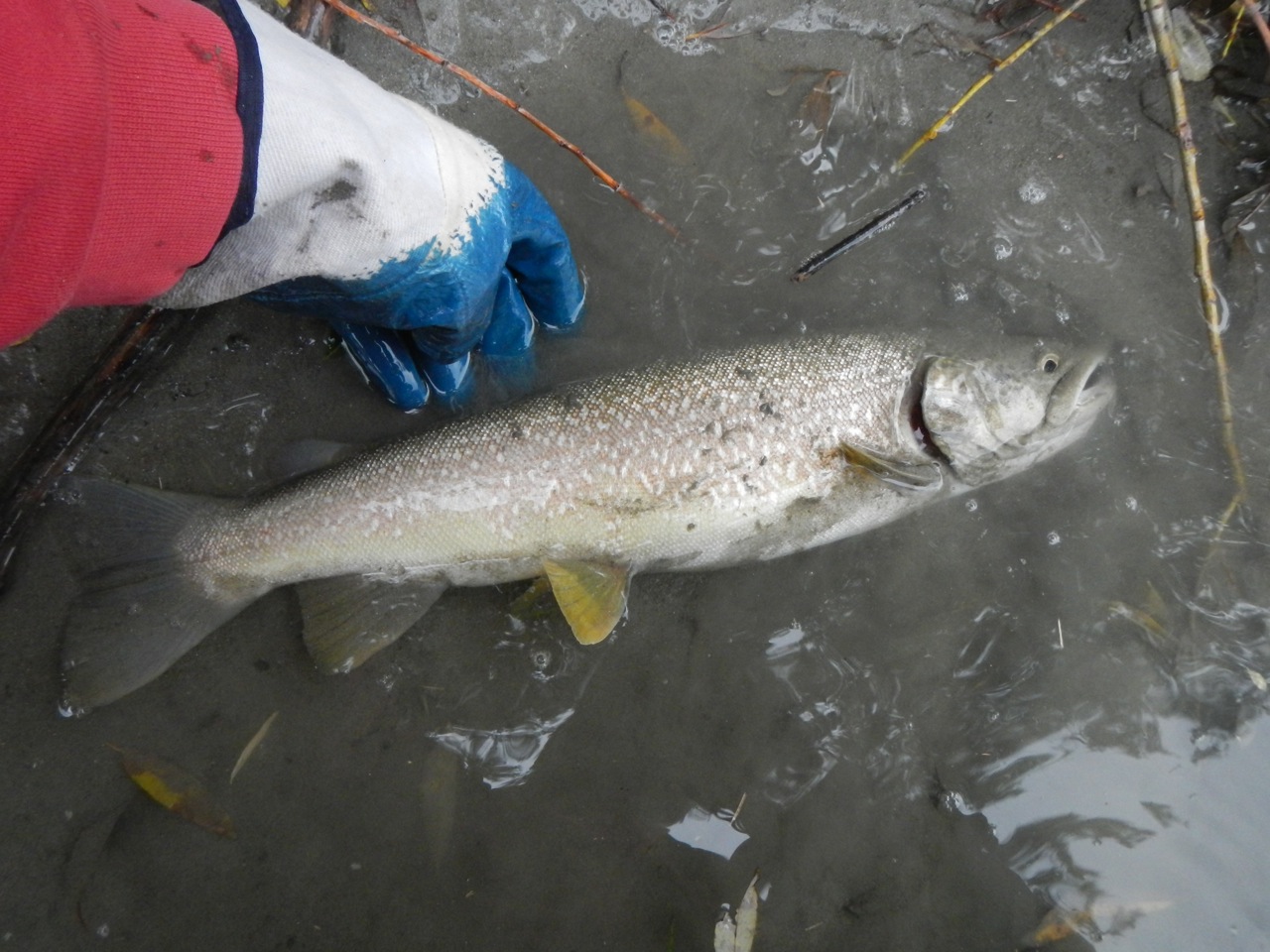
The Adige is a home to the marble trout (Salmo marmoratus), but at far lower populations than in the past. Fish stocking is one of the most significant causes of the sharp reduction in the original (indigenous) fish population of this subspecies. It will spawn with and interbreed with brown trout, which are regularly stocked in the river and its tributaries.[4]
Gallery
 The true source of Adige inside a bunker of the Alpine Wall
 The false source
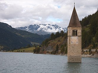 Graun, the bell tower in the Reschensee.
 The Adige between Laas and Göflan in the Vinschgau.
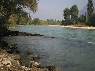 The Adige flowing through Lagarina Valley.
 Adige canyon at Chiusa.
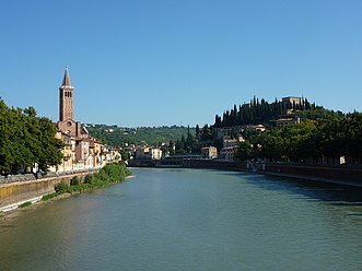 The Adige flowing through Verona.
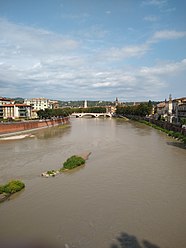 The Adige flowing through Verona, as seen from the Castelvecchio Bridge.
 The Adige flowing through Verona.
 The Adige flowing through Verona seen from Castel San Pietro.
 Adige river and Ponte Pietra in Verona.
 The mouth of the Adige at Rosolina Mare


See also
- Leno, one of the main tributaries of the Adige river
References
- "Athesis, Athesis". Numen - The Latin Lexicon - An Online Latin Dictionary - A Dictionary of the Latin Language.
- Local Etymology: A Derivative Dictionary of Geographical Names. Houlston and Wright. 22 May 2019 – via Google Books.
- "Linguistic census province of Bolzano 2011" (PDF). 2011.
- Karel Kovar "Hydrology, Water Resources and Ecology in Headwaters". p. 505
External links
- Encyclopædia Britannica
- Coolidge, William Augustus Brevoort (1911). . Encyclopædia Britannica. Vol. 1 (11th ed.). p. 192.
Authority control | |
|---|---|
| General | |
| National libraries | |
| Other | |
На других языках
[de] Etsch
Die Etsch [.mw-parser-output .IPA a{text-decoration:none}ɛtʃ] (italienisch Adige [ˈaːdid͡ʒe], ladinisch Adesc, trentinisch Àdes, rätoromanisch Adisch?/i, bei den Römern Athesis) ist mit ihren 415 km der zweitlängste Fluss in Italien. Sie entspringt in den Bergen in Südtirol, durchfließt das Etschtal und die Po-Ebene in Oberitalien und mündet südlich der Laguna Veneta in die Adria, ein Seitenbecken des Mittelmeeres.- [en] Adige
[es] Adigio
El río Adigio (en italiano, Adige; en alemán y en dialecto surtirolés, Etsch; en ladino, Adiç; en dialecto trentino, Ades; en veneciano, Adexe; en latín, Athesis) es un río del noreste de Italia, que discurre por las regiones de Trentino-Alto Adigio y Véneto y desemboca en el mar Adriático. Tiene una longitud de 409 km (que lo convierten en el segundo río más largo de Italia, tras el río Po) y drena una cuenca de 12 100 km².[it] Adige
L'Adige (AFI: /ˈadiʤe/[1]; anticamente anche Adice, /ˈadiʧe/[2]; Etsch in tedesco e in dialetto sudtirolese, Adesc in ladino, Ades in trentino, Àdexe in veneto, Athesis in latino, Άθεσης, Atheses in greco antico) è un fiume dell'Italia nordorientale, per lunghezza – circa 410 km – il secondo fiume italiano dopo il Po, il terzo per ampiezza di bacino dopo Po e Tevere, il quarto per volume d'acque dopo Po, Ticino e Tevere, con 235 m³/s di portata media annua presso la foce.[ru] Адидже
А́дидже (итал. Adige, устар. Эч[1], Адиж[2] нем. Etsch, вен. Àdexe', романш. Adisch, ладинск. Adesc, лат. Athesis) — река в Северной Италии протяжённостью 410 км при площади бассейна 14 700 км²[3]. Средний расход воды — 266 м³/с[4]. На Адидже расположены города Тренто и Верона. Крупнейшие притоки — Изарко и Авизио. Судоходна в нижнем течении.Другой контент может иметь иную лицензию. Перед использованием материалов сайта WikiSort.org внимательно изучите правила лицензирования конкретных элементов наполнения сайта.
WikiSort.org - проект по пересортировке и дополнению контента Википедии