geo.wikisort.org - Bacino
Kerið è un lago craterico islandese. Si trova nell'area dei Grímsnes e fa parte del Cerchio d'Oro.
| Kerið | |
|---|---|
 | |
| Stato | |
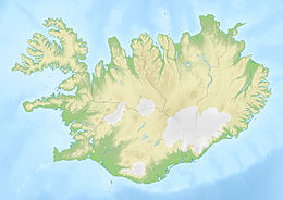
| Regione | Suðurland |
| Coordinate | 64°02′24″N 20°53′17″W |
| Dimensioni | |
| Superficie | 0,05 km² |
| Lunghezza | 0,27 km |
| Larghezza | 0,17 km |
| Profondità massima | 14 m |
 Kerið | |
La caldera è composta di pietra vulcanica rossa dovuta alla presenza di ematite, come anche negli altri vulcani della zona, ed è lunga 270 metri, larga 170 e profonda 55. Si è formata circa 6500 anni fa, probabilmente da un cono di scorie.
Il lago ha una profondità massima che varia tra i 7 e i 14 metri, a seconda delle piogge e di altri fattori, e i minerali nel suolo gli conferiscono una colorazione acquamarina.
Voci correlate
Altri progetti
 Wikimedia Commons contiene immagini o altri file su Kerið
Collegamenti esterni
- (EN) Sito ufficiale, su kerid.is.
На других языках
[de] Kerið
Der Kerið ist ein Kratersee in Island. Er ist der östlichste von fünf Kratern der zum postglazialen Grímsnes-Vulkanfeld gehörenden Kraterreihe Tjarnarhólar, die ihrerseits zum Eruptionsgürtel im Reykjanes–Langjökull–Gebiet zählen. Kerið liegt in der Region Suðurland an der Straße von Selfoss ins Haukadalur.[en] Kerið
Kerið (Icelandic pronunciation: [ˈcʰɛːrɪθ]; also Kerith or Kerid) is a volcanic crater lake located in the Grímsnes area in south Iceland, along the Golden Circle. It is one of several crater lakes in the area, known as Iceland's Western Volcanic Zone, which includes the Reykjanes peninsula and the Langjökull Glacier, created as the land moved over a localized hotspot, but it is the one that has the most visually recognizable caldera still intact. The caldera, like the other volcanic rock in the area, is composed of a red (rather than black) volcanic rock. The caldera itself is approximately 55 m (180 ft) deep, 170 m (560 ft) wide, and 270 m (890 ft) across. Kerið's caldera is one of the three most recognizable volcanic craters because at approximately 3,000 years old, it is only half the age of most of the surrounding volcanic features. The other two are Seyðishólar and Kerhóll.- [it] Kerið
[ru] Керид
Керид (исл. Kerið) — вулканическое озеро на юге Исландии, близ города Сельфосс. Расположено на популярном туристическом пути, известном как Золотое кольцо.Текст в блоке "Читать" взят с сайта "Википедия" и доступен по лицензии Creative Commons Attribution-ShareAlike; в отдельных случаях могут действовать дополнительные условия.
Другой контент может иметь иную лицензию. Перед использованием материалов сайта WikiSort.org внимательно изучите правила лицензирования конкретных элементов наполнения сайта.
Другой контент может иметь иную лицензию. Перед использованием материалов сайта WikiSort.org внимательно изучите правила лицензирования конкретных элементов наполнения сайта.
2019-2026
WikiSort.org - проект по пересортировке и дополнению контента Википедии
WikiSort.org - проект по пересортировке и дополнению контента Википедии