geo.wikisort.org - Réservoir
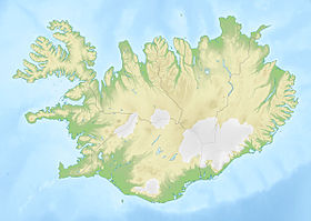
Le Kleifarvatn est un lac situé sur la Reykjanesskagi, en Islande.
Géographie
Il se trouve dans la partie sud de la péninsule, dans le fond d'un petit graben du Krýsuvík. Sa profondeur maximale est de 97 mètres[1].
Près du lac, à Krýsuvík, on trouve deux lieux à température haute (Seltún et un deuxième de l'autre côté du lac). Il est accessible par la route 42.
Histoire
Après un tremblement de terre important en 2000, l'eau du lac commence à disparaître dans le sol, sa superficie diminuant alors de 20 % environ. Les failles s'étant partiellement obstruées depuis, le lac a retrouvé son niveau d'avant le tremblement de terre.
Notes et références
- (en) « Iceland in statistics » (consulté le ).
Annexes
Articles connexes
- Volcans d'Islande
- Lacs d'Islande
Liens externes
- Portail de l’Islande
- Portail des lacs et cours d'eau
На других языках
[de] Kleifarvatn
Der Kleifarvatn ist ein See auf der isländischen Reykjanes-Halbinsel.[en] Kleifarvatn
Kleifarvatn (Icelandic pronunciation: [ˈkʰleiːvarˌvahtn̥]) is the largest lake on the Reykjanes Peninsula in Iceland, situated in the southern part of the peninsula. It is located on the fissure zone of the Mid-Atlantic Ridge. The lake has no visible water coming in or going out as most of its water comes and leaves underground.[1] The lake can be reached via a track, and there are two areas with high temperature that can be found not far from it: Seltún/Krýsuvík and another to the east. The lake's greatest depth is 97 m. After the 2000 Iceland earthquakes, the lake began to diminish, and 20% of its surface has since disappeared.- [fr] Kleifarvatn
[it] Kleifarvatn
Il lago Kleifarvatn si trova in Islanda, nella parte centro-meridionale della penisola di Reykjanes; è il lago maggiore della regione e uno dei più profondi del paese, con 97 m. Il lago è circondato da numerose sorgenti termali e solforiche, la più famosa e suggestiva delle quali è quella di Krýsuvík. Una leggenda narra che nelle sue acque vi sia un mostro dalle fattezze di serpente e dalle dimensioni di una balena.[ru] Клейварватн
Кле́йварватн[3][4] (исл. Kleifarvatn[5]) — самое крупное озеро на полуострове Рейкьянес в Исландии, расположенное рядом с геотермальными областями Крисювик и Гуннухвер[2].Текст в блоке "Читать" взят с сайта "Википедия" и доступен по лицензии Creative Commons Attribution-ShareAlike; в отдельных случаях могут действовать дополнительные условия.
Другой контент может иметь иную лицензию. Перед использованием материалов сайта WikiSort.org внимательно изучите правила лицензирования конкретных элементов наполнения сайта.
Другой контент может иметь иную лицензию. Перед использованием материалов сайта WikiSort.org внимательно изучите правила лицензирования конкретных элементов наполнения сайта.
2019-2025
WikiSort.org - проект по пересортировке и дополнению контента Википедии
WikiSort.org - проект по пересортировке и дополнению контента Википедии

