geo.wikisort.org - Reservoir
Tagish Lake is a lake in Yukon and northern British Columbia, Canada. The lake is more than 100 km (62 mi) long and about 2 km (1 mi) wide.
| Tagish Lake | |
|---|---|
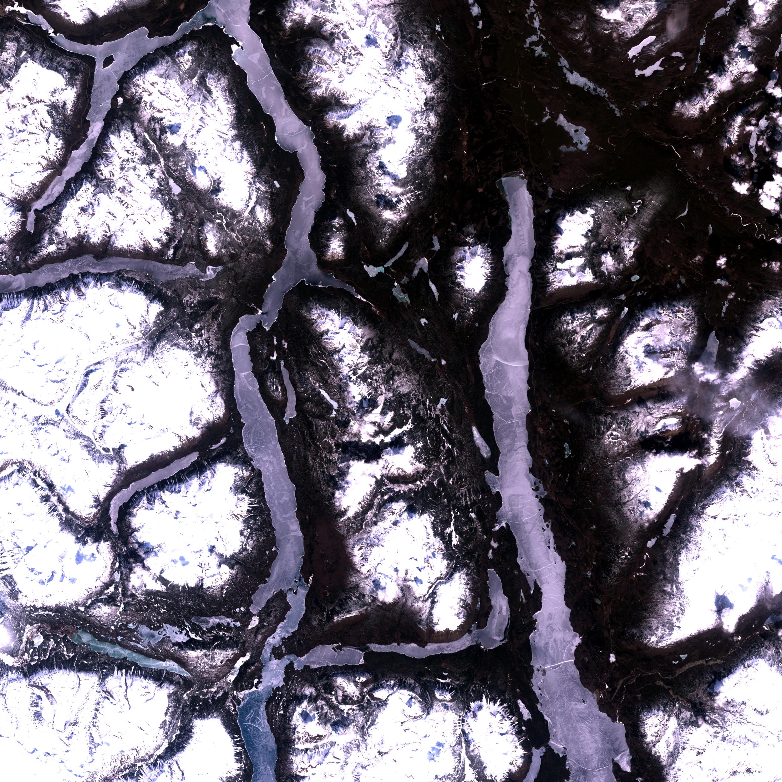 A portion of Tagish Lake (on the left half of the image) during the Winter, as seen from space. Windy Arm is in the upper left corner, while the Taku Arm is on the right centre. The lake seen on the right half of the image is Atlin Lake. | |
 Tagish Lake | |
| Location | Yukon, British Columbia |
| Coordinates | 60°00′N 134°15′W |
| Primary inflows | Wann River, Swanson River, Fantail River, Tutshi River |
| Basin countries | Canada |
| Max. length | 100 km (62 mi) |
| Max. width | 2 km (1.2 mi) |
| Surface area | 361 km2 (139 sq mi) |


It has two arms, the Taku Arm in the east which is very long and mostly in British Columbia and Windy Arm in the west, mostly in Yukon. The Klondike Highway runs along Windy Arm south of Carcross. Bennett Lake flows into Tagish Lake, so the northern portion of Tagish Lake was part of the route to the Klondike used by gold-seekers during the Klondike Gold Rush.
The meteorite
On January 18, 2000, a carbonaceous chondrite meteorite now known as "Tagish Lake", fell on the frozen surface of the Taku Arm. A number of fragments were recovered and studied by researchers from the University of Calgary, University of Western Ontario, and NASA; the meteorite currently resides in the University of Alberta meteorite collection.
The name
The lake is named for the Tagish people. Tagish means fish trap in the old Tagish language, an Athabascan language.[1] [2] Other sources translate Tagish as "it (spring ice) is breaking up" .[3]
| Wikimedia Commons has media related to Tagish Lake. |
Fauna
Tagish lies in the path of migratory swans that come every spring to wait out the melting of the more Northern Lakes.
Tagish is also home to the Southern Lakes with trophy fishing.
References
- Spotswood, Ken. "The History of Tagish, Yukon Territory". The Community History Project. YukonAlaska.com andYukon Anniversaries Commission. Archived from the original on 2006-11-09. Retrieved 2006-12-01.
- Indian and Northern Affairs Canada. "Tagish (Yukon)". Northern Information Network Community Profiles. Archived from the original on 2006-10-02. Retrieved 2006-12-01.
- Yukon Native Language Centre. "Tagish". Archived from the original on 2007-07-10. Retrieved 2006-12-01.
На других языках
[de] Tagish Lake
Der Tagish Lake ist ein See in der Provinz British Columbia und im Territorium Yukon in Kanada.- [en] Tagish Lake
[fr] Lac Tagish
Le lac Tagish est un lac situé au Yukon et au nord de la Colombie-Britannique au Canada. Il fait environ 100 kilomètres (62 mi) de long et 2 kilomètres (1 mi) de large.[ru] Тагиш (озеро)
Тагиш (англ. Tagish Lake) — озеро на границе провинции Британская Колумбия и территории Юкон в Канаде. Озеро очень длинное и узкое, длина составляет сто километров, ширина — менее двух километров. Озеро также имеет несколько рукавов, соединено с расположенным чуть восточнее озером Атлин. Ледостав с декабря по июнь. Сток из озера по озеру Марш и реке Юкон, пятой по величине в Северной Америке, в Берингово море (бассейн Тихого океана)[1]. Одноимённый посёлок находится в 3 километрах к северу[2]. Во время золотой лихорадки 1897—1898 годов река Юкон была основной транспортной артерией для десятков тысяч старателей, направлявшихся к Доусону, часть из них избирала путь не через Аляску, а через район озёр Атлин и Тагиш.Другой контент может иметь иную лицензию. Перед использованием материалов сайта WikiSort.org внимательно изучите правила лицензирования конкретных элементов наполнения сайта.
WikiSort.org - проект по пересортировке и дополнению контента Википедии