geo.wikisort.org - Reservoir
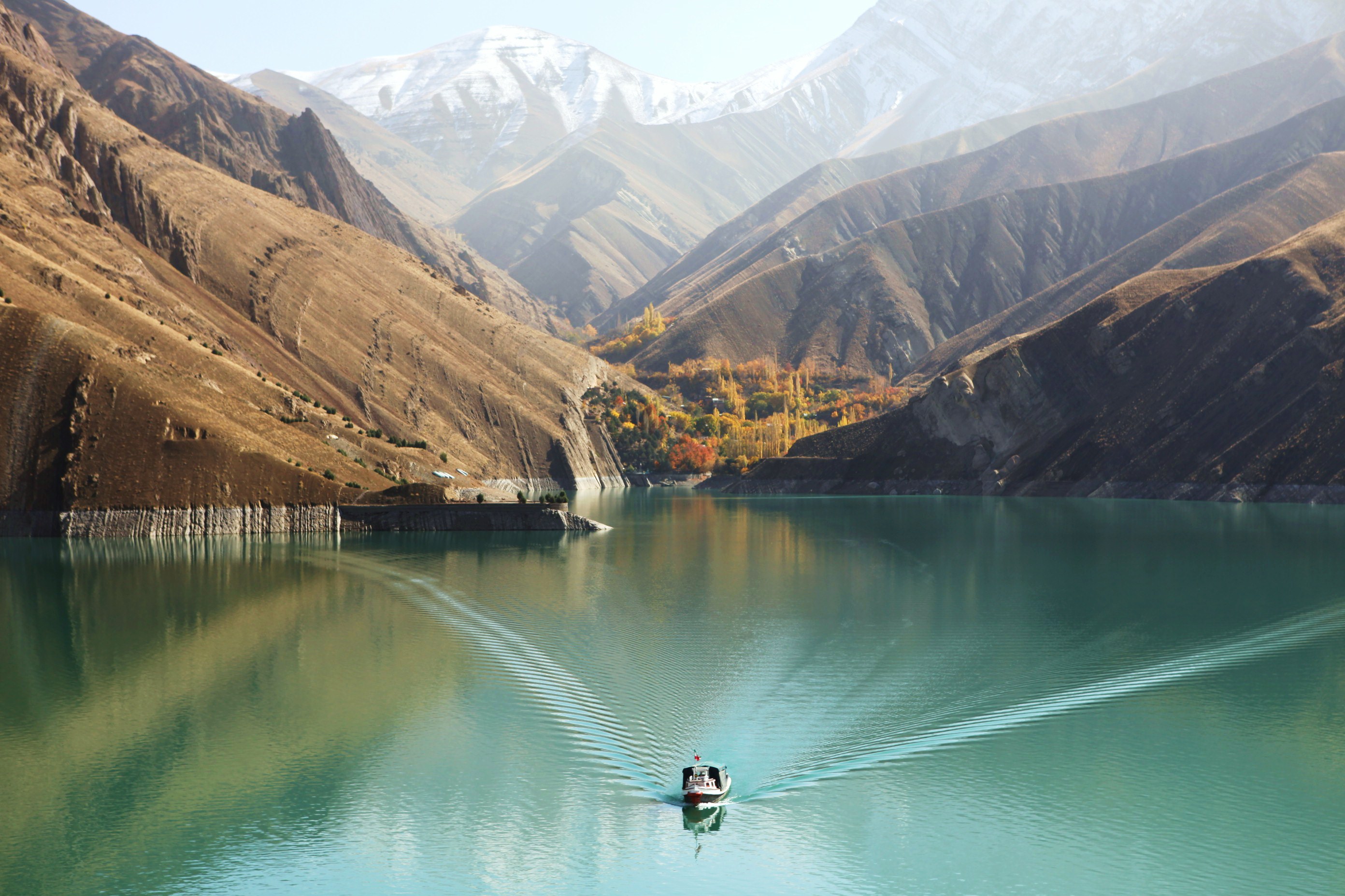
The Sumbar Dam is a rock-fill embankment dam just east of Gholaman in North Khorasan Province, Iran. The primary purpose of the dam is flood control and water supply for irrigation and municipal uses.[1]
| Sumbar Dam | |
|---|---|
 Location of Sumbar Dam in Iran | |
| Country | Iran |
| Location | Gholaman, North Khorasan Province |
| Coordinates | 38°03′59.6″N 057°09′41.7″E |
| Purpose | Flood control, municipal, irrigation water |
| Status | Operational |
| Dam and spillways | |
| Type of dam | Embankment, rock-fill |
| Height | 23 m (75 ft) |
| Length | 900 m (3,000 ft) |
| Elevation at crest | 1,342 m (4,403 ft) |
| Reservoir | |
| Total capacity | 16,200,000 m3 (13,100 acre⋅ft) |
References
- Barani, H. R. Rostami; Khatib, M. M. (8 January 2015). "Back Analysis of Grout Treatment at Sumbar Dam Using the Joint Hydraulic Factor". Rock Mechanics and Rock Engineering. 48 (6): 2485–2488. doi:10.1007/s00603-014-0706-6. ISSN 0723-2632.
| Major reservoirs and dams in Iran |
|  |
|---|---|---|
| Under construction |
| |
| Ancient dams | ||
Also See: Dams and reservoirs in Iran | ||
This article about a dam or floodgate in Iran is a stub. You can help Wikipedia by expanding it. |
Текст в блоке "Читать" взят с сайта "Википедия" и доступен по лицензии Creative Commons Attribution-ShareAlike; в отдельных случаях могут действовать дополнительные условия.
Другой контент может иметь иную лицензию. Перед использованием материалов сайта WikiSort.org внимательно изучите правила лицензирования конкретных элементов наполнения сайта.
Другой контент может иметь иную лицензию. Перед использованием материалов сайта WikiSort.org внимательно изучите правила лицензирования конкретных элементов наполнения сайта.
2019-2026
WikiSort.org - проект по пересортировке и дополнению контента Википедии
WikiSort.org - проект по пересортировке и дополнению контента Википедии