geo.wikisort.org - Reservoir
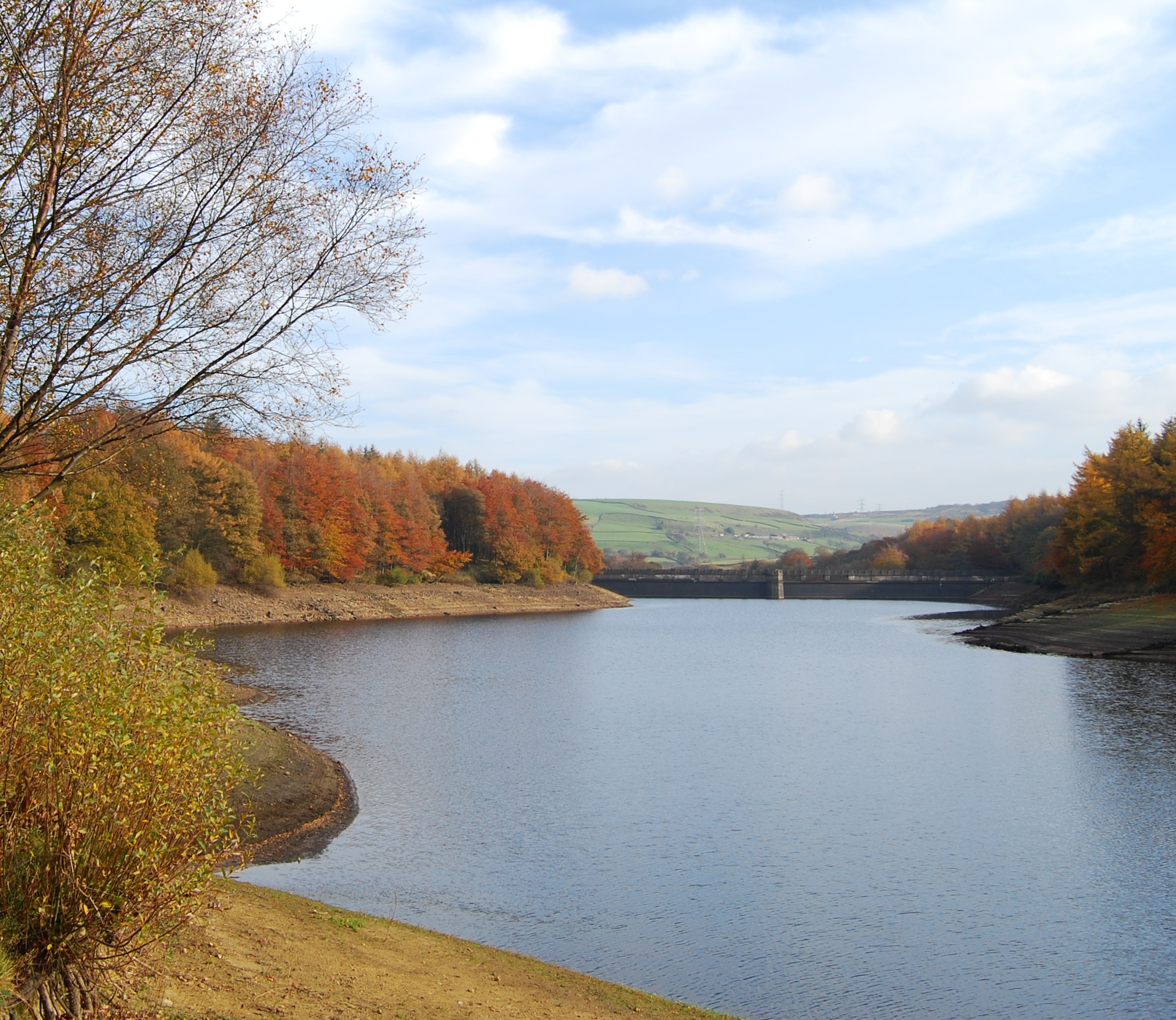
Ryburn Reservoir is a supply reservoir operated by Yorkshire Water close to Ripponden in the Yorkshire Pennines, England.[1] It lies in the valley of the River Ryburn and is the lower of two reservoirs built in the valley to supply Wakefield with water and was completed in 1933.[2] The upper reservoir is Baitings Reservoir.[3]
| Ryburn Reservoir | |
|---|---|
 | |
 Ryburn Reservoir | |
| Location | West Yorkshire |
| Coordinates | 53°39′55″N 1°58′09″W |
| Type | reservoir |
| Basin countries | United Kingdom |
| Surface area | 11 ha (27 acres) |
| Max. depth | 29 m (95 ft) |
Ryburn reservoir is the earlier of the two reservoirs.[3] It lies just south of the A58 road and its concrete dam is situated in a deep part of the valley.[4] Being surrounded by woods, it is a popular area for walkers just outside the settlements of Ripponden and Rishworth.[5]
References
- "OL 21" (Map). South Pennines. 1:50,000. Explorer. Ordnance Survey. 2015. ISBN 978-0-319-24260-5.
- "Ryburn Reservoir, Yorkshire Water". Archived from the original on 10 December 2017. Retrieved 24 February 2009.
- Jacklin, Tim (February 2010). "Ryburn Reservoir, West Yorkshire" (PDF). wildtrout.org. p. 3. Retrieved 19 June 2017.
- Buglas, John; Smith, Linda (August 2015). "Ryburn Reservoir, Rishworth, Calderdale" (PDF). celebrate-our-woodland.co.uk. p. 3. Retrieved 19 June 2017.
- "Ryburn Reservoir, go4awalk.com". Archived from the original on 16 December 2007. Retrieved 24 February 2009.
Reservoirs in Yorkshire | ||
|---|---|---|
| North Yorkshire |  | |
| South Yorkshire | ||
| West Yorkshire | ||
| Authority control: National libraries |
|---|
This West Yorkshire location article is a stub. You can help Wikipedia by expanding it. |
This water supply–related article is a stub. You can help Wikipedia by expanding it. |
Другой контент может иметь иную лицензию. Перед использованием материалов сайта WikiSort.org внимательно изучите правила лицензирования конкретных элементов наполнения сайта.
WikiSort.org - проект по пересортировке и дополнению контента Википедии