geo.wikisort.org - Reservoir
Mavrovo Lake (Macedonian: Мавровско Езеро, romanized: Mavrovsko ezero) is situated in the Mavrovo region, in the Mavrovo and Rostuša municipality of the Republic of North Macedonia, less than 100 km from Skopje. It is an important tourist destination, being frequented for recreational activities such as swimming, boating and trout fishing during the summer; a distinctive building in the lake is the half-submerged church of Saint Nicholas. Since 1952 it is part of the Mavrovo National Park. With its surface of 13.7 km2 (3,400 acres), is one of the most extensive artificial lakes of the country.
This article does not cite any sources. (November 2019) |
| Mavrovo | |
|---|---|
 | |
 Mavrovo | |
| Location | Mavrovo region |
| Coordinates | 41°41′N 20°45′E |
| Type | reservoir |
| Primary inflows | Mavrova |
| Primary outflows | Mavrova |
| Basin countries | Republic of North Macedonia |
| Max. length | 10 km (6.2 mi) |
| Max. width | 5 km (3.1 mi) |
| Surface area | 1,370 ha (3,400 acres) |
| Max. depth | 50 m (160 ft) |
| Water volume | 357 hm3 (289,000 acre⋅ft) |
 | |
The lake is surrounded by the Šar Mountains on the North and the Bistra Mountains on the South, both exceeding heights of 2000 m.
Gallery
 View of the lake in winter
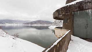 Watchtower at the dam
 Watchtower at the dam


References
Wikimedia Commons has media related to Mavrovo Lake.
На других языках
[de] Mavrovosee
Der Mavrovosee (mazedonisch Мавровско Езеро .mw-parser-output .Latn{font-family:"Akzidenz Grotesk","Arial","Avant Garde Gothic","Calibri","Futura","Geneva","Gill Sans","Helvetica","Lucida Grande","Lucida Sans Unicode","Lucida Grande","Stone Sans","Tahoma","Trebuchet","Univers","Verdana"}Mavrovsko Ezero; albanisch Liqen/-i i Mavrovës) ist ein in der Mitte des 20. Jahrhunderts erstellter Stausee im Westen Nordmazedoniens. Er gehört zur Opština Mavrovo i Rostuša und liegt inmitten des Mavrovo-Nationalparkes in der Region Mavrovo sowie im Mavrovo-Tal. Die umliegenden Bergketten erreichen Höhen von bis zu 2000 Meter über Adria und gehören teilweise zum Gebirgsmassiv der Šar Planina (Norden) und teilweise zu demjenigen der Bistra (Süden). Dieser ist nur 20 Kilometer Luftlinie westlich vom See entfernt. Mit 13,7 km² Wasseroberfläche gehört der Mavrovosee zu den größeren Seen des Landes. Bei seiner tiefsten Stelle ist er 48 Meter tief.[1]- [en] Mavrovo Lake
[fr] Lac de Mavrovo
Le lac de Mavrovo (en macédonien : Мавровско Езеро), est un lac situé dans l'ouest de la Macédoine du Nord, dans la municipalité de Mavrovo et Rostoucha. Il se trouve au pied du massif du mont Korab et il a été créé par un barrage, construit en 1947 sur la Radika. Depuis 1952, il fait partie du parc national de Mavrovo.[ru] Мавровское озеро
Ма́вровское о́зеро[3][4] (макед. Мавровско Езеро)[2][5][4], также Мавровское водохранилище[6] — третье по величине водохранилище Северной Македонии. Устроено в 1957 году на реке Мавровска[mk][2] в Мавровском полье[mk][1].Текст в блоке "Читать" взят с сайта "Википедия" и доступен по лицензии Creative Commons Attribution-ShareAlike; в отдельных случаях могут действовать дополнительные условия.
Другой контент может иметь иную лицензию. Перед использованием материалов сайта WikiSort.org внимательно изучите правила лицензирования конкретных элементов наполнения сайта.
Другой контент может иметь иную лицензию. Перед использованием материалов сайта WikiSort.org внимательно изучите правила лицензирования конкретных элементов наполнения сайта.
2019-2025
WikiSort.org - проект по пересортировке и дополнению контента Википедии
WikiSort.org - проект по пересортировке и дополнению контента Википедии