geo.wikisort.org - Reservoir
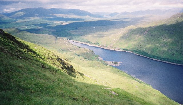
Loch Treig is a 9 km freshwater loch situated in a steep-sided glen 20 km east of Fort William, in Lochaber, Highland, Scotland. While there are no roads alongside the loch, the West Highland Line follows its eastern bank.
This article needs additional citations for verification. (July 2020) |
| Loch Treig | |
|---|---|
 with Glen Spean | |
 Loch Treig | |
| Location | Highland, Scotland |
| Coordinates | 56.81399°N 4.72704°W |
| Type | freshwater loch, natural, reservoir |
| Basin countries | United Kingdom |
Since 1929 Loch Treig has been a reservoir, retained behind the Treig Dam, forming part of the Lochaber hydro-electric scheme, which required diversion of the West Highland Railway.[1] The increase in water level following the construction of the dam submerged the hamlets of Kinlochtreig and Creaguaineach at the loch's southern end, which were stopping points on a cattle drovers' road along the Road to the Isles, which linked up Lochaber and the Inner Hebrides to markets in Perthshire in the south.
See also
- List of reservoirs and dams in the United Kingdom
References
- "Loch Treig, Dam". Canmore. Retrieved 2 July 2020.
This Highland location article is a stub. You can help Wikipedia by expanding it. |
На других языках
[de] Loch Treig
Loch Treig ist ein Stausee in den schottischen Highlands. Er liegt in der Region Lochaber, etwa 15 Kilometer östlich des Ortes Spean Bridge. Sein gälischer Name bedeutet in etwa Loch des Todes oder Loch der Toten. Der See war ursprünglich wesentlich kleiner und wurde in den 1920er Jahren als Teil des Lochaber Hydro-Electric Power Scheme aufgestaut.[1][2]- [en] Loch Treig
Другой контент может иметь иную лицензию. Перед использованием материалов сайта WikiSort.org внимательно изучите правила лицензирования конкретных элементов наполнения сайта.
WikiSort.org - проект по пересортировке и дополнению контента Википедии