geo.wikisort.org - Reservoir
The following is a list of lakes in Oklahoma located entirely (or partially, as in the case of Lake Texoma) in the state. Oklahoma has more than 200 lakes created by dams. All lakes listed are man-made. Oklahoma's only natural lakes are oxbow and playa lakes. Oklahoma has sixty-two oxbow lakes at least 10 acres in size. The largest, near the Red River in McCurtain County is 272 acres.
Playa lakes are found in saucer-shaped depressions in the high plains region. They are usually intermittent, holding water only after rains. Oklahoma has about 600 playa lakes.[1]
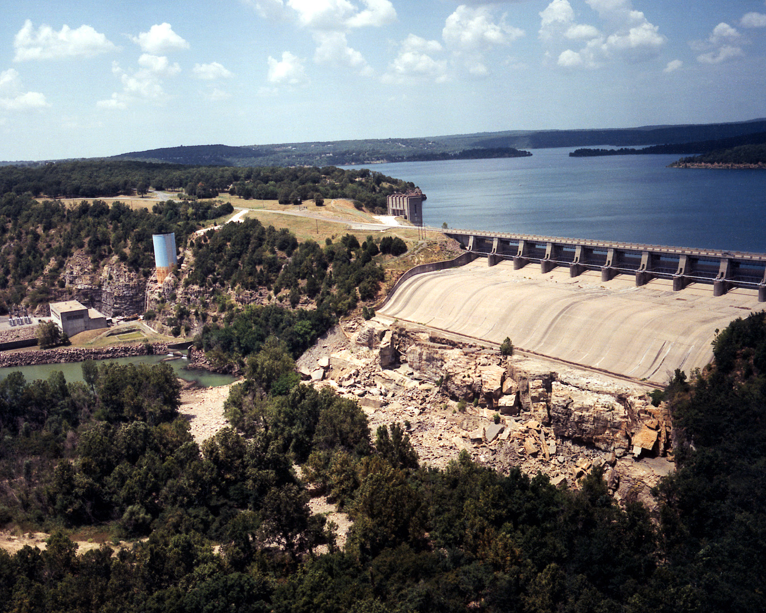
Lakes and reservoirs by size
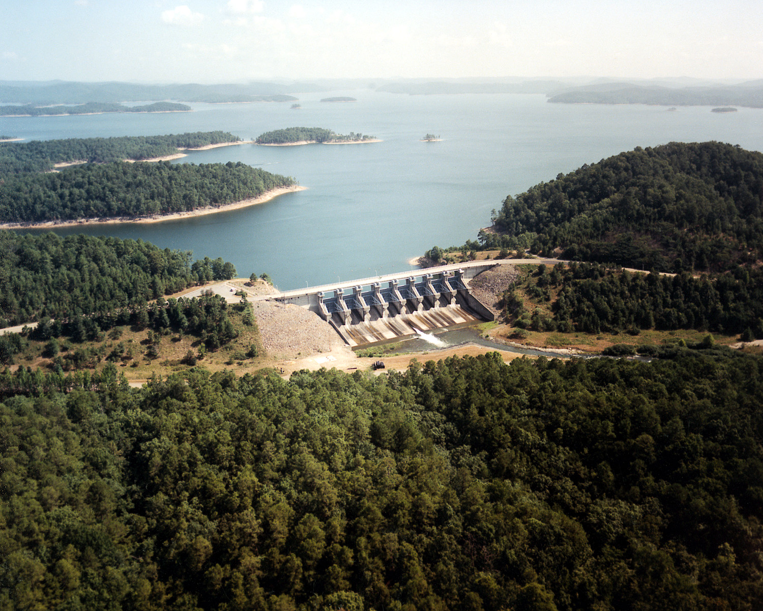


Ranked by surface acres, Lake Eufaula is the 34th largest lake in the United States and Lake Texoma is the 38th largest.[2]
| Name | Capacity in acre feet (normal pool) | surface acres (normal pool) | average depth | water clarity |
|---|---|---|---|---|
| Lake Texoma | 2,643,000 | 88,000 acres (35,612 ha) | 30 feet (9.1 m) | average to excellent |
| Eufaula Lake | 2,314,000 | 105,500 | 22 | poor to excellent |
| Grand Lake o' the Cherokees | 1,515,416[3] | 41,779[3] | 36.3[3] | average to excellent |
| Broken Bow Lake | 918,070 | 14,200 | 65 | excellent |
| Tenkiller Ferry Lake | 654,100 | 12,900 | 51 | excellent |
| Keystone Lake | 557,600 | 23,610 | 23 | average |
| Oologah Lake | 553,400 | 29,640 | 19 | average |
| Robert S. Kerr Reservoir | 525,700 | 43,800 | 12 | poor |
| Foss Reservoir | 437,000 | 8,800 | average | |
| Kaw Lake | 428,600 | 17,040 | 25 | poor to average |
| Fort Gibson Lake | 355,200 | 14,900 | 24 | good |
| Skiatook Lake | 322,700 | 10,190 | 32 | good |
| Sardis Lake | 274,330 | 13,610 | 20 | average |
| Waurika Lake | 203,100 | 10,100 | 20 | average |
| Markham Ferry Reservoir (Lake Hudson) | 200,300 | 10,900 | 18 | average |
| Webbers Falls Lake | 170,100 | 11,600 | 15 | average |
| Hugo Lake | 157,600 | 13,250 | 12 | poor |
| Lake Murray | 153,250 | 5,728 | 27 | excellent |
| Sooner Lake | 149,000 | 5,400 | 28 | excellent |
| Lake Altus-Lugert | 132,830 | 6,260 | 21 | fair |
| Atoka Lake | 125,000 | 5,700 | 22 | poor |
| Lake Thunderbird | 119,600 | 6,070 | 20 | average |
| McGee Creek Reservoir | 113,930 | 3,810 | 30 | excellent |
| Canton Lake | 111,310 | 7,910 | 14 | average |
| Tom Steed Reservoir | 109,276 | 6,400 | - | - |
| Lake Ellsworth | 92,500 | 5,600 | 17 | fair to poor |
| Lake Stanley Draper | 87,296 | 2,900 | 30 | good |
| Fort Cobb Reservoir | 80,010 | 4,100 | 20 | average |
| Lake Eucha | 79,600 | 2,860 | 28 | excellent |
| Lake Hefner | 75,000 | 2,500 | 30 | good |
| Lake of the Arbuckles | 72,400 | 2,350 | 31 | excellent |
| Wister Lake | 61,423 | 7,300 | 9 | average |
| Carl Blackwell Lake | 61,500 | 3,370 | 18 | average |
| Lake Lawtonka | 56,574 | 2,398 | 24 | good |
| Pine Creek Lake | 53,750 | 3,750 | 14 | good |
| Lake W. R. Holway, formerly Chimney Rock Lake | 48,000 | 712 | 67 | excellent |
| Copan Lake | 43,400 | 4,850 | 9 | average |
| Lake Spavinaw | 38,000 | 1,584 | 24 | excellent |
| Great Salt Plains Lake | 31,240 | 8,690 | 4 | poor |
| Hulah Lake | 31,160 | 3,570 | 9 | poor |
| Arcadia Lake | 27,520 | 1,820 | 15 | average |
| Chouteau Reservoir | 23,840 | 2,270 | ||
| Konawa Reservoir | 23,000 | 1,350 | 17 | excellent |
| Shawnee Twin Lake, No. l | 22,600 | 1,336 | 17 | good |
| Fuqua Lake | 21,100 | 1,500 | 14 | average |
| Lake McMurtry | 19,733 | 1,155 | 17 | average |
| Birch Lake | 19,200 | 1,137 | 17 | good |
| Bluestem Lake | 17,000 | 762 | 22 | average |
| Dripping Springs Lake | 16,200 | 1,150 | 14 | excellent |
| Bellcow Lake | 15,613 | 1,153 | 14 | average |
| Lake Overholser | 13,526[4] | 1,581[4] | 16.9 max[4] | fair to poor |
| Greenleaf Lake | 14,720 | 920 | 16 | good |
| Lake Ponca | 14,440 | 805 | 18 | good |
| Okmulgee Lake | 14,170 | 668 | 21 | good |
| Wes Watkins Reservoir | 14,065 | 1,142 | 12 | good |
| Fort Supply Lake | 13,900 | 1,820 | 8 | fair to poor |
| Lake McAlester | 13,398 | 1,521 | 9 | average |
| Lake R. C. Longmire | 13,162 | 918 | 14 | good |
| Okemah Lake | 13,100 | 761 | 17 | average |
| Elmer Thomas Lake | 12,000 | 334 | 36 | excellent |
| Lake Humphreys | 11,900 | 840 | 14 | good |
| Chickasha Lake | 11,480 (est) | 820 | 14 | good |
| Holdenville Lake | 11,000 | 550 | 20 | average to good |
| Lake Yahola | 4,000,000,000 US gallons (12,000 acre⋅ft) | 439 | excellent |
Source: Oklahoma Water Atlas . and , accessed Mar 1, 2011. Some inconsistencies exist between the two sources.
Lakes geography and administration
| Reservoir | Nearby town | River basin | Surface acres | Elevation MSL, ft. | Maintained by | Comments |
|---|---|---|---|---|---|---|
| Lake Altus-Lugert | Altus | North Fork of the Red River | 6,260 | 1,547[5] | Bureau of Reclamation | information and photos |
| American Horse Lake | Geary | 100 | Oklahoma Wildlife Department[6] | information | ||
| Lake of the Arbuckles | Sulphur | Rock Creek | 3,127 | 881.5 | National Park Service | information |
| Arcadia Lake | Arcadia, Edmond | Deep Fork | 1,820 | 974 | Army Corps of Engineers[7] | information |
| Atoka Lake | Atoka | North Boggy Creek | 5,700 | 617 | Oklahoma City | information |
| Bell Cow Lake | Chandler, Oklahoma | Bell Cow Creek | 1,153 | 892 | City of Chandler | |
| Birch Lake | Barnsdall | Birch Creek | 1,137 | 695 | Army Corps of Engineers[8] | |
| Bixhoma Lake | Bixby | 110 | 899 | City of Bixby | ||
| Carl Blackwell Lake | Stillwater | Stillwater Creek | 3,350 | 977 | Oklahoma State University | [9] |
| Bluestem Lake | Pawhuska | Middle Bird Creek | 720 | 876 | ||
| Boomer Lake | Stillwater | Stillwater Creek | 251 | 896 | ||
| Broken Bow Lake | Broken Bow | Mountain Fork River | 14,200 | 627 | Army Corps of Engineers | information |
| Lake Burtschi | Chickasha | 180 | Oklahoma Wildlife Department[6] | |||
| Canton Lake | Canton | North Canadian River | 7,910 | 974 | Army Corps of Engineers | information and photos |
| Cedar Lake | Heavener | Big Cedar Creek | 86 | 900 | U.S. Fish and Wildlife Service | information and photos;[11] |
| Evan Chambers Lake | 80 | Oklahoma Wildlife Department[6] | ||||
| Chickasha Lake | Caddo County, Oklahoma | Spring Creek | 2086.8 | 1192 | City of Chickasha | |
| Chouteau Reservoir | Chouteau | Arkansas River | 2270 | 511.5 | Corps of Engineers MKARNS L&D 17 | |
| Clayton Lake | Clayton | Peal Creek | 66 | 665 | information and photos | |
| Claremore Lake | Claremore | Dog Creek | 470 | 610 | City of Claremore | |
| Clear Creek Lake | Duncan | Clear Creek | 600 | 1148 | ||
| Ozzie Cobb Lake | Rattan | Rock Creek | 116 | 513 | Oklahoma Wildlife Department[6] | |
| Copan Lake | Copan | Caney River | 4,850 | Army Corps of Engineers | information | |
| Lake Dahlgren | Noble | 30 | Oklahoma Wildlife Department[6] | |||
| Dripping Springs Lake | Okmulgee | 1150[12] | 741[12] | City of Okmulgee | information and photos [12] | |
| Ellsworth Lake | Lawton | East Cache Creek | 5,000 | information | ||
| Elmer Lake | Kingfisher | 60 | 1,119 | Oklahoma Wildlife Department[6] | information and photos | |
| Carl G. Etling Lake | Boise City | Carrizo Creek | 159 | Oklahoma Wildlife Department[6] | ||
| Eucha Lake | Eucha, Oklahoma | Spavinaw Creek | 2,800 | 778 | City of Tulsa | |
| Eufaula Lake | Eufaula | Canadian River | 102,000 | 585 | Army Corps of Engineers | information, photos and videos |
| Fort Cobb Reservoir | Fort Cobb | Cobb Creek | 2000 | 1341 | information and photos | |
| Fort Gibson Lake | Fort Gibson | Grand River | 19,900 | 582 | Army Corps of Engineers | information, photos and video |
| Fort Supply Lake | Fort Supply | Wolf Creek | 1,800 | 2,400 | Army Corps of Engineers | information |
| Foss Reservoir | Foss | Washita River | 5,956 | 1,652 | Bureau of Reclamation | information and photos |
| Raymond Gary Lake | Fort Towson | Gates Creek | 263 | 400 feet (120 m) (approx.) [13] | Oklahoma Wildlife Department[6] | |
| Newt Graham Reservoir | Inola, Tulsa Port of Catoosa | Arkansas River | 1490 | 532 | Army Corps of Engineers | |
| Grand Lake | Grove, Afton, Langley | Grand River | 41,749[3] | Grand River Dam Authority | information, photos and videos | |
| Great Salt Plains Lake | Jet, Cherokee | Salt Fork Arkansas River | 8,700 | Army Corps of Engineers | information, photos and video | |
| Greenleaf Lake | Braggs | Greenleaf Creek | 930 | 699 | information and photos | |
| Lake Hall | Oklahoma Wildlife Department[6] | |||||
| John Paul Hammerschmidt Lake | Fort Smith, Arkansas, Moffett, Oklahoma | Arkansas River | 7,700 | 392 | Army Corps of Engineers | |
| Hefner Lake | Oklahoma City | 2,500 | information, photos and video | |||
| Heyburn Lake | Kellyville | Polecat Creek | 890 | 784 | Army Corps of Engineers | information |
| Holdenville Lake | Holdenville | Little River | 550 | 787 | ||
| W. R. Holway Lake | Salina | Grand River | 712 | 865 | Grand River Dam Authority | |
| Hudson Lake | Locust Grove | Grand River | 12,000 | 649 | Grand River Dam Authority | |
| Hugo Lake | Hugo | Kiamichi River | 18,196 | 404.5 (normal) | Army Corps of Engineers | information and video |
| Hulah Lake | Copan | Caney River | 3,570 | 733 | Army Corps of Engineers | information, photos, and video |
| Lake Humphreys | Stephens County, Oklahoma | Wildhorse Creek | 882 | City of Duncan, Oklahoma | ||
| Lake Jap Beaver | 65 | Oklahoma Wildlife Department | [6] | |||
| Lake Jed Johnson | Lawton | Blue Beaver Creek | 57.5 | U.S. Fish & Wildlife Service | ||
| Kaw Lake | Ponca City | Arkansas River | 17,000 | 1,010 | Army Corps of Engineers | information and photos |
| Robert S. Kerr Reservoir | Sallisaw | Arkansas River | 43,800 | 478 | Grand River Dam Authority | information |
| Keystone Lake | Sand Springs | Arkansas River | 23,600 | Army Corps of Engineers | information, photos and videos | |
| Konawa Reservoir | Konawa | Canadian River (Jumper Creek) | 1,350 | 924 | Oklahoma Gas & Electric Company | |
| Lone Chimney Lake | Pawnee County | Camp Creek | 550 | |||
| W. D. Mayo Reservoir | Le Flore County, Sequoyah County | Arkansas River | 1595 | 413 | Army Corps of Engineers | |
| McGee Creek Reservoir | Atoka | McGee Creek | 3810 | 577 | ||
| McMurtry Lake | Stillwater | North Stillwater Creek | 155 | 950 | City of Stillwater | |
| Nanih Waiyah Lake | Tuskahoma | 131 | 594 | Oklahoma Wildlife Department[6] | ||
| Jean Neustadt Lake | Ardmore | 462 | City of Ardmore | |||
| Oklahoma Lake | Okmulgee | - | - | - | - | |
| Oologah Lake | Oologah, Nowata, Claremore | Verdigris River | 29,500 | 638 | Army Corps of Engineers | information, photos and video |
| Optima Lake | Hardesty | Beaver River | Army Corps of Engineers | information | ||
| Overholser Lake | Oklahoma City, Bethany, and Yukon | North Canadian River | 1,581[4] | 1,242 | City of Oklahoma City and the Oklahoma City Water Utilities Trust | |
| Pine Creek Lake | Fort Towson | Little River (Red River) | 3,750 | Army Corps of Engineers | information | |
| Sahoma Lake | Sapulpa | Rock Creek | 277 | 716 | City of Sapulpa | 2,543 acre feet, 9.15' mean depth, & 35.66' maximum depth. Hydrographic Survey, 2011, OWRB |
| Sardis Lake | Clayton | Jackfork River | 14,360 | 599 | Army Corps of Engineers | information, photos and video |
| Schooler Lake | 35 | Oklahoma Wildlife Department[6] | ||||
| Skiatook Lake | Skiatook | Hominy Creek | 10,190 | 714 | Army Corps of Engineers | information, photos and video |
| Spavinaw Lake | Spavinaw | Spavinaw Creek | 1,636 | 679 | ||
| Tom Steed Reservoir | Snyder | Otter Creek | 6,400 | 1,407 | ||
| Stroud Lake | Stroud | Lincoln Creek | 621 | 855 | ||
| Tenkiller Lake | Cookson, Vian, Gore, Park Hill, Tahlequah | Illinois River | 12,900 | 632 | Army Corps of Engineers | information, photos and videos |
| Texoma Lake | Kingston | Red River | 93,000 | Army Corps of Engineers | information, photos and videos | |
| Elmer Thomas Lake | Lawton | Little Medicine Creek | 334 | 1,383 | information, photos and video | |
| Thunderbird Lake | Norman | Little River (Canadian River) | 5,349 | 1,039 | The Bureau of Reclamation owns the dam, which is operated by the local Central Oklahoma Master Conservancy District.[14] | |
| Vanderwork Lake | Gotebo | Oklahoma Wildlife Department[6] | ||||
| Vincent Lake | Arnett | Oklahoma Wildlife Department[6] | ||||
| Watonga Lake | Watonga | 55 | 1375 | Oklahoma Wildlife Department[6] | ||
| Waurika Lake | Waurika | Beaver Creek | 10,100 | 951 | Army Corps of Engineers | information and photos |
| Webbers Falls Lake | Webbers Falls | Arkansas River | 11,600 | Army Corps of Engineers | ||
| Wister Lake | Wister | Poteau River | 7,300 | 478 | Army Corps of Engineers | information and photos |
| Yahola Lake | Tulsa | 400 | City of Tulsa |
Lakes and reservoirs (alphabetically)
This list is incomplete; you can help by adding missing items. (August 2008) |
- Altus City Reservoir
- Lake Altus-Lugert
- American Horse Lake
- Lake of the Arbuckles
- Arcadia Lake
- Ardmore City Lake
- Atoka Lake
- Bellcow Lake
- Birch Lake
- Lake Bixhoma
- Bluestem Lake
- Boomer Lake
- Broken Bow Lake
- Brushy Lake (Sallisaw, Oklahoma)[lower-alpha 1]

- Lake Burtschi
- Canton Lake
- Carl Albert Lake
- Carl Blackwell Lake
- Lake Carl Etling
- Lake Carlton
- Carter Lake
- Cedar Lake
- Chandler Lake
- Lake Checotah
- Chickasha Lake
- Chouteau Lock & Dam (MKARNS L&D #15)
- Claremore Lake
- Clayton Lake
- Clear Creek Lake
- Cleveland City Lake
- Clinton Lake
- Coalgate City Lake
- Comanche Lake
- Copan Lake
- Cordell Reservoir
- Crowder Lake
- Cushing Municipal Lake
- Lake Dahlgren
- Dead Warrior Lake
- Dripping Springs Lake
- Lake Durant
- Lake Ellsworth
- Lake Elmer
- Lake El Reno
- Lake Eucha
- Evans Chambers Lake
- Foss Reservoir
- Fort Cobb Reservoir
- Fort Supply Lake
- Lake Frederick
- Fuqua Lake
- Newt Graham Reservoir (MKARNS L&D 18)
- Greenleaf Lake
- Grand Lake O' the Cherokees
- Great Salt Plains Lake

- Guthrie Lake
- John Paul Hammerschmidt Lake
- Heyburn Lake
- Hobart Lake (a.k.a. Rocky Lake)
- Holdenville Lake
- Lake Hudson (formerly named Markham Ferry Reservoir)
- Hulah Lake
- Lake Humphreys
- Hugo Lake
- Lake Jean Neustadt
- Lake Jed Johnson
- Keystone Lake
- Konawa Reservoir
- Lake Lawtonka
- Liberty Lake
- Lloyd Church Lake
- Lake Lloyd Vincent[15]
- Lone Chimney Lake
- W. D. Mayo Reservoir (MKARNS L&D #14)
- Lake McAlester|McAlester Lake
- Lake McMurtry
- Mountain Lake
- Lake Murray
- Oklahoma Lake
- Okmulgee Lake
- Okemah Lake

- Oologah Lake
- Lake Overholser
- Ozzie Cobb Lake
- Pine Creek Lake
- Pauls Valley Lake
- Ponca Lake, Ponca City lake
- Pretty Water Lake
- Lake R.C. Longmire
- Raymond Gary Lake
- Rock Creek Reservoir
- Sahoma Lake
- Sardis Lake
- Shawnee Twin Lakes
- Skiatook Lake
- Skipout Lake
- Sooner Lake
- Lake Spavinaw
- Sportsman Lake
- Spring Creek Lake
- Stroud Lake
- Lake Stanley Draper
- Tom Steed Reservoir
- Lake Talequah
- Elmer Thomas Lake
- Lake Thunderbird
- Watonga Lake
- Waurika Lake
- Wes Watkins
- Lake Wayne Wallace
- Webbers Falls Reservoir (MKARNS L&D #16)
- Wes Watkins Reservoir
- Wewoka Lake
- Lake Wister
- Lake W. R. Holway
- Lake Yahola
See also
Notes
- Formerly known as Brushy Creek Reservoir
References
- digital.library.okstate.edu http://digital.library.okstate.edu/encyclopedia/entries/L/LA010.html. Retrieved Mar 2, 2011.
{{cite web}}: Missing or empty|title=(help) - "Search our extensive lake database". www.lakelubbers.com. Retrieved 3 Mar 2011.
- OWRB Hydrographic Survey of Grand Lake http://www.owrb.ok.gov/studies/reports/reports_pdf/GrandLake--hydrologicsurvey.pdf
- OWRB Lakes of Oklahoma (2015) http://www.owrb.ok.gov/news/publications/lok/lakes/Overholser.php
- "Lake Altus-Lugert, Oklahoma, USA." Accessed June 28, 2017.
- "Map of (Oklahoma Wildlife) Department Lakes". Archived from the original on October 7, 2010.
- "Arcadia Reservoir". Archived from the original on 2009-08-09. Retrieved 2010-01-27.
- "Birch Lake". Archived from the original on 2004-10-21. Retrieved 2010-02-05.
- "Lake Carl Blackwell | TravelOK.com - Oklahoma's Official Travel & Tourism Site". www.travelok.com.
- "Carl Blackwell Lake, Oklahoma." anglerhub. undated. Accessed May 27, 2018.
- "Cedar Lake." Accessed August 9, 2015.
- Oklahoma Department of Wildlife Conservation (ODWC). "Dripping Springs Lake 5-Year Management Plan." October 2013. Accessed February 2, 2019.
- "Lake Raymond Gary Topo Zone Map in Choctaw County OK." Topozone. Accessed May 28, 2018
- http://www.usbr.gov/projects/Project.jsp?proj_Name= Norman%20Project
- - Retrieved 2019-09-23
External links
- Oklahoma Lakes information on TravelOK.com Official Oklahoma Tourism & Recreation Department website
- Oklahoma Lakes
- Oklahoma Department of Wildlife Conservation homepage
- Oklahoma Lake Levels
- Oklahoma Digital Maps: Digital Collections of Oklahoma and Indian Territory
Lakes of the United States | |
|---|---|
| States |
|
| Federal district | Washington, D.C. |
| Insular areas |
|
Oklahoma City (capital) | ||
| Topics |
|  |
| Society |
| |
| Regions |
| |
| Largest cities |
| |
| Counties |
| |
| Authority control: National libraries |
|---|
Другой контент может иметь иную лицензию. Перед использованием материалов сайта WikiSort.org внимательно изучите правила лицензирования конкретных элементов наполнения сайта.
WikiSort.org - проект по пересортировке и дополнению контента Википедии