geo.wikisort.org - Reservoir
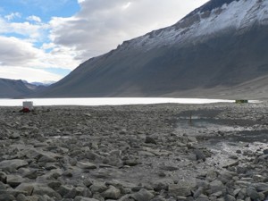
Lake Vanda is a lake in Wright Valley, Victoria Land, Ross Dependency, Antarctica. The lake is 5 km (3.1 mi) long and has a maximum depth of 69 m (226 ft).[2] On its shore, New Zealand maintained Vanda Station from 1968 to 1995. Lake Vanda is a hypersaline lake with a salinity more than ten times that of seawater[3] and more than the salinity of the Dead Sea. Lake Vanda is also meromictic, which means that the deeper waters of the lake don't mix with the shallower waters.[4] There are three distinct layers of water ranging in temperature from 23 °C (73 °F) on the bottom to the middle layer of 7 °C (45 °F) and the upper layer ranges from 4–6 °C (39–43 °F).[5] It is only one of the many saline lakes in the ice-free valleys of the Transantarctic Mountains. The longest river of Antarctica, Onyx River, flows west, inland, into Lake Vanda. There is a meteorological station at the mouth of the river.
| Lake Vanda | |
|---|---|
 Landsat 7 image | |
 Lake Vanda | |
| Location | Wright Valley, Victoria Land, Ross Dependency, Antarctica |
| Coordinates | 77°31′47″S 161°34′32″E |
| Lake type | Hypersaline lake |
| Primary inflows | Onyx River Bartley Stream Clark Stream Meserve Stream |
| Primary outflows | none |
| Basin countries | |
| Max. length | 8 km (5.0 mi) |
| Max. width | 2 km (1.2 mi) |
| Surface area | 5.2 km2 (2.0 sq mi) |
| Average depth | 30.8 m (101 ft) |
| Max. depth | 75 m (246 ft) |
| Water volume | 160 million cubic metres (130,000 acre⋅ft) |
| Surface elevation | 143 metres (469 ft) |
| Settlements | Vanda Station Lake Vanda Hut |
| References | [1] |
The lake is covered by a transparent ice sheet 3.5–4 metres (11–13 ft) year-round, though melting in late December forms a moat out to approximately 50 metres (160 ft) from the shore. The surface of the ice is not covered with snow and is "deeply rutted with cracks and melt lines".[5] During the colder months, the moat refreezes.
While no species of fish live in Lake Vanda or the Onyx River, microscopic life, such as cyanobacteria algal blooms, have been recorded. Due to the concerns over impact to the natural environment that may occur during research, scientific diving operations are limited to work in the upper layer (above 30 metres (98 ft)) and remotely operated underwater vehicle use is not allowed.[5]
Vanda Station
Lake Vanda Station was well known for The Royal Lake Vanda Swim Club.[6] Visitors to Lake Vanda Station could dip into the high salinity waters when the icecap edge melted out during summer to form a 'moat', and receive a Royal Lake Vanda Swim Club shoulder patch. Vanda staff would assist the melt by hacking out a 'pool'. Many dignitaries and politicians were inducted into the club, The dip had to be naked (Rule 1), complete immersion (Rule 4), witnessed by a 'Vandal' (Vanda Station staffer) and with no restrictions on photography (Rule 6) to qualify. Rule 10 allowed a natural figleaf, but it had to be natural and also naturally green without artificial aid.
Vanda Station was removed in 1995 as lake levels rose, and is replaced by a shelter, Lake Vanda Hut, that is periodically staffed by 2-8 stream researchers.[7]

References
- Lyons, W.; Priscu, J. (2014). "Lake Descriptions". mcm.lternet.edu. Environmental Data Initiative. doi:10.6073/pasta/7d9fec7af7c424ec82eae5f7e9df1c3b. Retrieved 2021-03-23.
- Mathez, Edmond A. (July–August 2005). "Cold Fire". Natural History.
- Priscu, J. C.; Priscu, L. R.; Vincent, Warwick F.; Howard-Williams, Clive (1981). "Photosynthate distribution by microplankton in permanently ice-covered Antarctic desert lakes". Limnol. Oceanogr. 32 (1): 260–270. doi:10.4319/lo.1987.32.1.0260. Archived from the original (PDF) on 2011-07-04.
- Gibson, John A.E. (1999). "The meromictic lakes and stratified marine basins of the Vestfold Hills, East Antarctica". Antarctic Science. 11 (2): 175–192. Bibcode:1999AntSc..11..175G. doi:10.1017/S0954102099000243.
- Mercer, Steve (2000). "Antarctic lake diving with the semi-closed rebreather". In: Hallock and French (Eds). Diving for Science...2000. Proceedings of the 20th Annual Scientific Diving Symposium. American Academy of Underwater Sciences. Archived from the original on 2012-09-02. Retrieved 2011-01-06.
{{cite journal}}: CS1 maint: unfit URL (link) - Parfit, Michael (1988). South light: a journey to Antarctica. London: Bloomsbury. pp. 206–210. ISBN 0-7475-0134-3.
- "Stream Team Field Manual" (PDF). Mcmlter.org. Retrieved 2013-11-27.
External links
На других языках
[de] Vandasee
Der Vandasee ist ein abflussloser See im Wright Valley im ostantarktischen Viktorialand. An seinem Ufer befand sich von 1968 bis 1995 die neuseeländische Vanda-Station.- [en] Lake Vanda
[fr] Lac Vanda
Le lac Vanda est un lac salé situé dans la vallée de Wright, terre Victoria, dans la dépendance de Ross, en Antarctique.[it] Lago Vanda
Il lago Vanda è un lago ipersalino dell'Antartide situato nella valle di Wright, nella Terra della Regina Vittoria, Dipendenza di Ross. Sulle sue sponde la Nuova Zelanda ha mantenuto in funzione dal 1968 al 1995 la base antartica Stazione Vanda.[ru] Ванда (озеро)
Ванда — озеро в долине Райт на земле Виктории в Антарктиде, в которое впадает река Оникс. Длина озера 5 км, а максимальная глубина — 69 метров[1]. Объём воды — 0,16 км³.[источник не указан 1954 дня] Площадь поверхности — 5,2 км².[источник не указан 1954 дня]Другой контент может иметь иную лицензию. Перед использованием материалов сайта WikiSort.org внимательно изучите правила лицензирования конкретных элементов наполнения сайта.
WikiSort.org - проект по пересортировке и дополнению контента Википедии