geo.wikisort.org - Reservoir
Lake Sils (German Silsersee, Romansh: Lej da Segl) is a lake in the Upper Engadine valley, Grisons, Switzerland. It takes its name from the village of Sils im Engadin.
| Lake Sils | |
|---|---|
 View from Plaun da Lej towards the Chastè peninsula | |
 Lake Sils  Lake Sils  Lake Sils  Lake Sils | |
| Location | Engadin, Grisons |
| Coordinates | 46°25′0″N 9°43′51″E |
| Native name | |
| Primary inflows | Inn, Aua da Fedoz |
| Primary outflows | Inn (named Sela until Lake Silvaplana) |
| Basin countries | Switzerland |
| Max. length | 5 km (3.1 mi) |
| Surface area | 4.1 km2 (1.6 sq mi) |
| Average depth | 35 m (115 ft) |
| Max. depth | 71 m (233 ft) |
| Water volume | 137 million cubic metres (111,000 acre⋅ft) |
| Residence time | 2.2 years |
| Surface elevation | 1,797 m (5,896 ft) |
| Islands | Chaviolas (islet) |
| Settlements | Sils, Maloja |
 | |
Geography
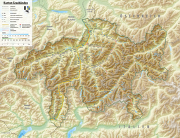
The lake lies at an altitude of 1,797 metres above sea level, between Maloja Pass and Lake Silvaplana. Several mountains over 3,000 metres overlook the lake, notably Piz Corvatsch, Piz Grevasalvas and Piz da la Margna. The lake's drainage basin culminates at Piz Fora (3,336 m) and comprises the Vadrec da Fedoz glacier.
With a surface area of 4.1 km², Lake Sils is the largest lake of the Engadine. It is also the largest natural lake in the Alps lying above 1,000 metres.[1] The lake was formed by a prehistoric landslide dam, similarly to Lake Silvaplana.[2]

The wooded Chastè peninsula extends into the lake at its north-eastern end. At the end of the peninsula there is a plaque to Friedrich Nietzsche with a passage from Thus Spoke Zarathustra. Near the peninsula is located the wooded island of Chaviolas, the largest in Lake Sils. Annually, in winter, the cross-country Engadin Skimarathon crosses the lake, starting at its edge in the Maloja Palace.
Boat connections run from end of June to end of September, making Lake Sils one of the highest lake in Europe with public transport boat route.[3]
The largest villages on Lake Sils are Sils im Engadin and Maloja (part of Bregaglia), located respectively at the eastern and western ends of the lake. Other hamlets are Cadlägh, Isola and Plaun da Lej.
See also
References
- Johannes Eue, Wandern im Engadin, p. 29
- Stephen G. Evens, Natural and Artificial Rockslide Dams, p. 103
- Sils im Engadin Archived 2011-08-30 at the Wayback Machine, Hiking in Switzerland, wanderland.ch
External links
 Media related to Lake Sils at Wikimedia Commons
- Lakes of the Upper Engadine valley in Romansh, German, French and Italian in the online Historical Dictionary of Switzerland.
- Waterlevels of Lake Sils at Sils Baselgia
Authority control | |
|---|---|
| General |
|
| National libraries | |
This article related to a lake in Graubünden is a stub. You can help Wikipedia by expanding it. |
На других языках
[de] Silsersee
Der Silsersee (rätoromanisch Lej da Segl?/i) – benannt nach der Ortschaft Sils im Engadin/Segl – ist der südwestlichste der drei im Oberengadin liegenden Seen der Engadiner Seenplatte.- [en] Lake Sils
[fr] Lac de Sils
Le lac de Sils (en allemand : Silsersee, en romanche : Lej da Segl ; du nom de la localité de Sils im Engadin/Segl sur son rivage) est situé dans le canton des Grisons (Suisse) sur le plateau engadinois au col de la Maloja, il est au sud-ouest des lacs de Silvaplana et St Moritz. À 1 800 mètres d'altitude, le lac de Sils est desservi par le plus haut service régulier de navigation d'Europe[1].[it] Lago di Sils
Il lago di Sils (in tedesco Silsersee, in romancio lai da Segl, in italiano storico lago di Siglio[1][2]) è un lago dell'Alta Engadina, nel cantone dei Grigioni, in Svizzera. il nome deriva da quello del paese sulle sue sponde, ossia Sils im Engadin/Segl. Seguendo il corso dell'Inn, precede i laghi di Silvaplana e di Sankt Moritz.[ru] Зильс (озеро)
Зильс[1] или Зи́льзерзе[2] (нем. Silsersee, романш. Lej da Segl) — высокогорное озеро в Верхнем Энгадине, кантон Граубюнден, округ Малоя, коммуны Брегалья и Зильс-им-Энгадин, Швейцария. Его имя происходит от названия расположенного на его берегу деревни Зильс.Другой контент может иметь иную лицензию. Перед использованием материалов сайта WikiSort.org внимательно изучите правила лицензирования конкретных элементов наполнения сайта.
WikiSort.org - проект по пересортировке и дополнению контента Википедии