geo.wikisort.org - Reservoir
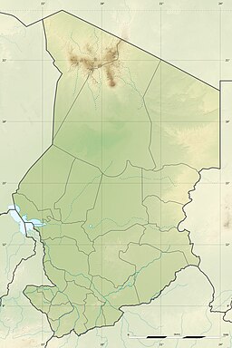
The Lake Katam is one of the larger lakes in Ounianga Kebir, a lake system in the Borkou-Ennedi-Tibesti Region in the north-east basin of Chad. These lakes are notable for their running in the north–south headlands, by the Trade wind are formed. They are the remnant of a much larger lake, that filled the basin during the so-called green Sahara-time, which lasted from about BC 10000–1500.
| Lake Katam | |
|---|---|
 | |
| Location | Sahara Chad |
| Coordinates | 19°1′N 20°30′E |
| Primary inflows | subsurface; evaporation |
| Primary outflows | subsurface |
| Basin countries | Chad |
| Max. length | 2.4 km (1.5 mi) |
| Max. width | 1 km (0.62 mi) |
| Surface elevation | 377 m (1,237 ft) |
See also
На других языках
[de] Katam-See
Der Katam-See ist ein See im Tschad.- [en] Lake Katam
[fr] Lac Katam
Le lac Katam est un lac de l'Ennedi, au Tchad.[ru] Катам
Катам[1] — бессточное реликтовое озеро на северо-востоке Чада, одно из озёр группы Унианга.Текст в блоке "Читать" взят с сайта "Википедия" и доступен по лицензии Creative Commons Attribution-ShareAlike; в отдельных случаях могут действовать дополнительные условия.
Другой контент может иметь иную лицензию. Перед использованием материалов сайта WikiSort.org внимательно изучите правила лицензирования конкретных элементов наполнения сайта.
Другой контент может иметь иную лицензию. Перед использованием материалов сайта WikiSort.org внимательно изучите правила лицензирования конкретных элементов наполнения сайта.
2019-2025
WikiSort.org - проект по пересортировке и дополнению контента Википедии
WikiSort.org - проект по пересортировке и дополнению контента Википедии

