geo.wikisort.org - Reservoir
Lake Fitri is located in the center of Chad about 300 km east of N’Djamena. The normal size of the lake is about 50,000 hectares (120,000 acres). The size of this lake can triple in wetter years. This freshwater lake is shallow and is fed by seasonal rainfall and run-off from a catchment area estimated at 70,000 square kilometres (27,000 sq mi). The principal river feed is the seasonal Batha River which carries water from the Ouaddai massif to the west.
| Lake Fitri | |
|---|---|
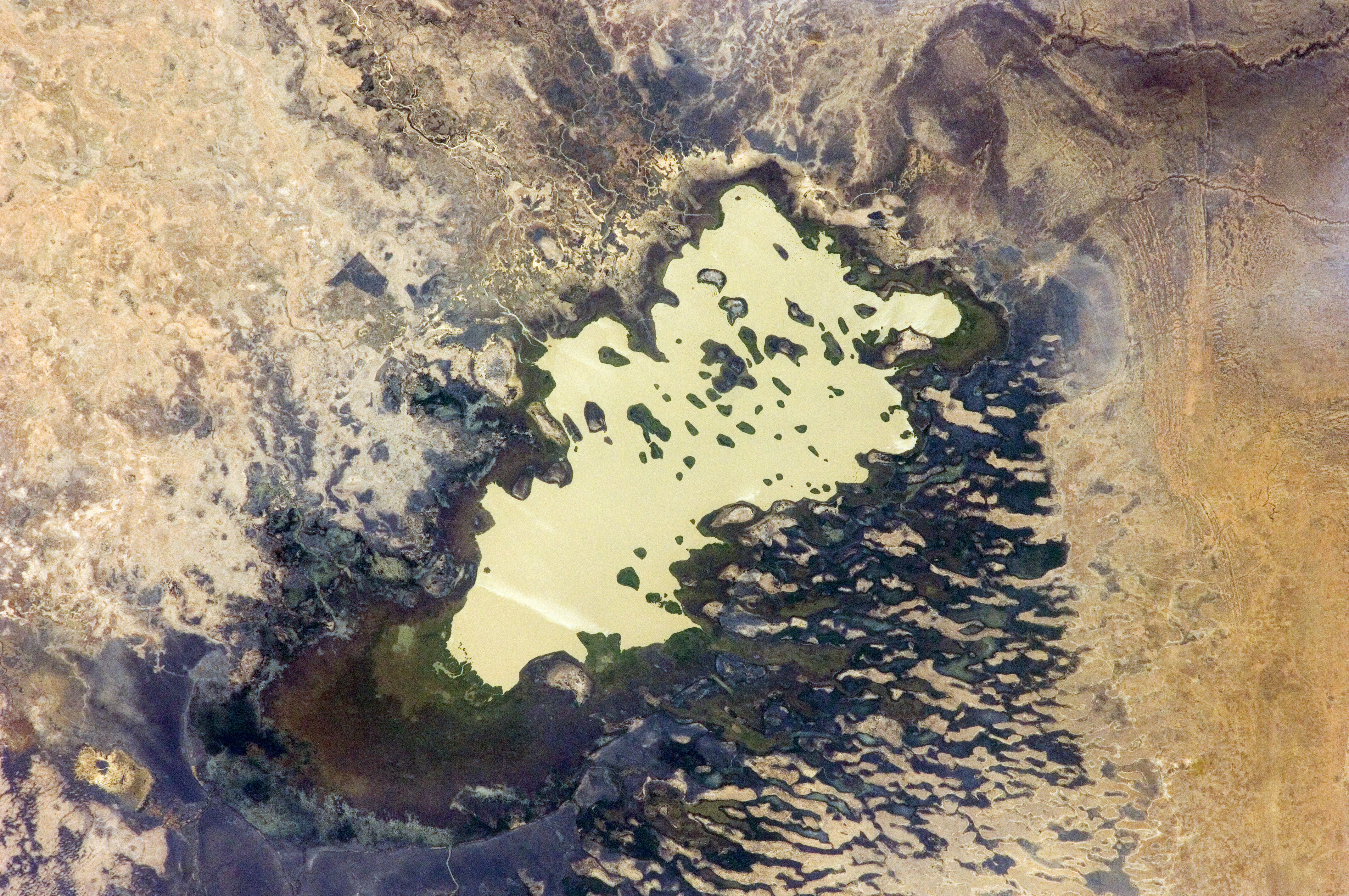 | |
 Lake Fitri  Lake Fitri | |
| Coordinates | 12°48′33″N 17°30′9″E |
| Primary inflows | Batha River |
| Catchment area | 70,000 km2 (27,000 sq mi) |
| Basin countries | Chad |
| Surface area | 500 km2 (190 sq mi) |
Ramsar Wetland | |
| Official name | Lac Fitri |
| Designated | 13 June 1990 |
| Reference no. | 486[1] |
Similarly to Chad's other lake, Lake Chad, it is not quite as large as it once was. It has been designated under the Ramsar Convention as a Wetland of International Importance. The normally permanent lake may dry out during severe drought periods, such as occurred at the beginning of the twentieth century and again in 1984–1985.
References
- "Lac Fitri". Ramsar Sites Information Service. Retrieved 25 April 2018.

This Chad location article is a stub. You can help Wikipedia by expanding it. |
На других языках
[de] Fitri-See
Der Fitri-See ist ein See im Zentrum des Tschad.- [en] Lake Fitri
[fr] Lac Fitri
Le lac Fitri est un lac situé dans le centre sahélien du Tchad. Il a été désigné site Ramsar le 13 juin 1990[1].[it] Lago Fitri
Il lago Fitri è situato nella parte centrale del Ciad, in Africa, circa 300 km a est della capitale del paese, N'Djamena.[ru] Фитри (озеро)
Фи́три[2] — бессточное реликтовое озеро, находится в центральной Африке, на территории Чада, в 278 км к востоку от Нджамены. Обычно озеро имеет площадь около 50 000 га, однако в дождливые годы эта цифра может утраиваться. Глубина этого пресноводного озера не велика, озеро питается за счёт сезонных осадков и стока от своего бассейна, имеющего площадь около 70 000 км². В дождливое время озеро также питается за счёт стока реки Батха[en][3], несущей свои воды с массива Уаддай на запад.Другой контент может иметь иную лицензию. Перед использованием материалов сайта WikiSort.org внимательно изучите правила лицензирования конкретных элементов наполнения сайта.
WikiSort.org - проект по пересортировке и дополнению контента Википедии