geo.wikisort.org - Reservoir
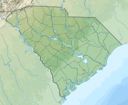
Lake Hartwell is a man-made reservoir bordering Georgia and South Carolina and encompassing parts of the Savannah, Tugaloo, and Seneca rivers. Lake Hartwell is one of the Southeastern United States' largest recreation lakes. The lake was created by the construction of the Hartwell Dam, completed in 1962 and located on the Savannah River seven miles (11 km) below the point at which the Tugaloo and Seneca Rivers join to form the Savannah. Extending 49 miles (79 km) up the Tugaloo and 45 miles (72 km) up the Seneca at normal pool elevation, the lake comprises nearly 56,000 acres (230 km2) of water with a shoreline of 962 miles (1,548 km). The entire Hartwell "Project" contains 76,450 acres (309 km2) of land and water. I-85 bisects Hartwell Lake and makes the area easily accessible to visitors.[3]
| Lake Hartwell | |
|---|---|
 A finger of the lake extends into Clemson, SC. | |
 Lake Hartwell | |
| Location | Georgia / South Carolina |
| Coordinates | 34.45°N 82.85°W |
| Type | Reservoir |
| Primary inflows | Savannah, Tugaloo, and Seneca Rivers |
| Primary outflows | Savannah River to Lake Russell |
| Basin countries | United States |
| Surface area | 56,000 acres (23,000 ha) |
| Average depth | 45 ft (14 m) [1] |
| Max. depth | 185 ft (56 m) [1] |
| Water volume | 2,550,000 acre⋅ft (3.15 km3) |
| Shore length1 | 962 mi (1,548 km) |
| Surface elevation | 660 ft (201 m) [2] |
| 1 Shore length is not a well-defined measure. | |
Background
The Flood Control Act of 17 May 1950 authorized the Hartwell Dam and Reservoir as the second unit in the comprehensive development of the Savannah River Basin. The estimated cost was $68.4 million based on 1948 price levels and preliminary designs. The original project provided for a gravity-type concrete dam 2,415 feet (736 m) long with earth embankments at either end, which would be 6,050 feet (1,840 m) long on the Georgia side and 3,935 feet (1,199 m) long on the South Carolina side. The 12,400 foot (3,800 m) long dam was to be topped with a roadway 24 feet (7.3 m) wide. The main dam was to consist of two non-overflow concrete sections on the right and left banks 887 feet (270 m) and 940 feet (290 m) long, respectively; a gravity-type concrete spillway 588 feet (179 m) long equipped with 12 tainter gates 26 feet by 40 feet in the channel; and a powerhouse on the South Carolina side of the river. Full power pool was designed to be 660 feet above mean sea level.
At this elevation, the reservoir would extend 7.1 miles (11.4 km) up the Savannah River to the confluence of the Tugaloo and Seneca Rivers; 41 miles up the Tugaloo to within approximately 2 miles of the existing Yonah Dam; 27 miles up the Seneca to the mouth of the Little River, South Carolina; 2 miles up the Little River to the Newry site; and 7 miles up the Keowee to the Old Pickens site. The reservoir would cover 56,500 acres and would involve the relocation of 3 sections of railroad totaling 2 miles, the raising of 2 railroad bridges, construction of 6 sections of new state high- ways, totaling 19.6 miles, and 9 sections of county roads totaling 12.7 miles; the construction of 9 new bridges and the raising of 4 existing bridges, and the relocation of 2 power transmission lines.[4]
Construction of the Hartwell project took place from 1955 and was completed in 1963. Construction of the dam started in 1955 and was finished in 1959.[3] Salvage archeological excavations were conducted at several sites in an effort to recover artifacts and information from prehistoric and historic sites that would be inundated by Lake Hartwell. Dr. Joseph Campbell led a team from the University of Georgia in this work, especially from 1957 to 1959.
Lake Hartwell is named for the American Revolutionary War figure Nancy Hart. Nancy Hart lived in the Georgia frontier, and was known for her devotion to freedom. A county, city, lake, state park and highway among others, bear her name.[5]
Droughts and water levels of Lake Hartwell
1989 was the first year the lake hit a level 3, dropping to its lowest level during the drought that year. 2008 was the second time the lake hit a level 3. In December 2008, due to severe drought in the southeastern United States, the lake dropped to more than 22 feet (6.7 m) below its normal water level. This revealed old highways that were typically underwater, exposed islands that are usually topped with buoys to warn boaters, and left some boat shells sitting on dry land.[6]
The Lake reached its lowest level, 637.49 feet (194.31 m), on December 9, 2008. The highest lake elevation was 665.4 feet (202.8 m), reached on April 8, 1964. Overall the average lake elevation is 657.5 feet (200.4 m).[3] As of the first of October 2010, the lake had returned to just over 654 feet (199 m).[7] This rebound in lake level is due to releases from the lake being suspended for a month ending April 10, 2009, in an effort to return Lake Hartwell to normal elevations.[8]
Early lake history
The area around Lake Hartwell has a rich history of indigenous settlement, dating to before the Mississippian culture period, which began about 800 CE. Numerous villages and platform mounds were built by people of that culture, along the upper tributaries of the Savannah River, such as the Chauga, Tugaloo, and Seneca rivers.
The Cherokee Indians settled throughout much of this Piedmont and mountainous area, declaring it their homeland. Initial relations with colonists were through trading, but after the Revolutionary War, European-American settlers increasingly encroached on Cherokee territory. They have since named many streams, rivers and recreation areas after the historic Cherokee and Muscogee Creek, who were among the Five Civilized Tribes removed from the Southeast under President Andrew Jackson in the 1830s.
Other historic figures who lived around this area were Andrew Pickens and John C. Calhoun, both statesmen from South Carolina. The botanist William Bartram traveled the area recording vegetation types and plant species.[4]
Challenges to construction
In August 1956 Mrs. Eliza Brock and her daughter refused to allow workmen to come on their property to begin clearing for the reservoir area. The government had gained ownership of 103 acres of land in June 1956, but apparently Mrs. Brock never received the offer for her land. She refused to allow workmen on her property. After an October 1956 federal ruling, Mrs. Brock settled on accepting $6,850 for her property.[9]
In late 1956 Clemson College objected to damage that would be done to its property as a result of the impounded water in the reservoir. For instance, plans would cause the flooding of their Memorial Stadium. After countless meetings, Clemson finally settled with the government, agreeing to two diversion dams to be built in the vicinity of Clemson College in order to rechannel the Seneca River around its property.[4]

Fishing
Since its construction, Hartwell Reservoir has provided good fishing habitat for many species. Bream, catfish, smallmouth bass, walleye, and largemouth bass are naturally occurring species in the lake, with quality fishing available for those species. The most popular fishing on Lake Hartwell, however, has been of striped bass. Striped Bass, also known as rock fish and normally a saltwater fish, were discovered able to survive in freshwater after the construction of a dam on the Santee-Cooper system in lower South Carolina trapped many striped bass in fresh water. Striped bass were eventually introduced to the three lower Savannah River System lakes: Hartwell, Russel, and Thurmond.[citation needed] Fish heavier than 60 pounds (27 kg) have been caught on Lake Hartwell, with 20 pounds (9.1 kg) fish being common. The majority of striped bass caught on the lake will range from 5 to 12 pounds (2.3 to 5.4 kg).
Recreation
This section contains content that is written like an advertisement. (July 2020) |
- Camping: there are 9 campgrounds at Lake Hartwell with a total of 524 campsites.[10]
- Trails: a 7.6 miles (12.2 km) multi-purpose trail is in the Paynes Creek Campground area.[10]
- Fishing: many fish species inhabit Lake Hartwell, including largemouth bass, bream, hybrid and striped bass, crappie, white bass, trout, and walleye.[11]
- Swimming: the lake is considered suitable for swimming despite there have been over 200 deaths on the lake.[11]
- Water sport: activities such as tubing, water skiing, and wake boarding are permitted on the lake.[11]
- Boating: there are five marinas along the lake, including Clemson Marina, Big Water Marina, Harbor Light Marina, Hartwell Marina, and Portman Marina as well as many public boat ramps.
- Wildlife: there are more than 250 species of birds and 40 different mammals around Lake Hartwell.[11]
Places to visit
- Issaqueena Dam. Located along the Keowee River, past Clemson, this dam has a waterfall about 25 feet tall and 150 feet wide, carrying overflow from Lake Issaqueena into Lake Hartwell. The waterfall is posted with danger signs, as some deaths have occurred here.[11]

- Eighteen Mile Creek. Eighteen Mile Creek is a curvy and narrow waterway. It is off the Seneca River at buoy marker S-42. It is well known by fishermen and birders. The creek extends about five miles, ending in a big shallow area with an old bridge. It is a site of many birds and wildlife.[11]
- Rock Quarry. This has many overhanging rocks, whose height seems to change with varying lake levels. Some areas within this cove are shallower than others.[11]
- Ghost Island. At its center high point are fifty old grave headstones; some cannot be read. Some above-ground concrete vaults are marked identifying the graves from the War of 1812. Others are from the 1700s. Many people camp on this island unaware of their "company".[11]
- Andersonville Island. Andersonville, South Carolina was once a well-known port and resort town. It had a barge system with daily service to Savannah, Georgia. It flourished for years, attracting both industry and tourists. Andersonville was said to be as large as Anderson or Pendleton, both also in South Carolina. Today it survived only as a large island, nearly 400 acres. It is the largest island on the lake, and is between two and three miles long. A paved road across the island is grown over. Visitors can explore building ruins, artifacts, rare plants and wildlife.[11]
See also
- List of lakes in South Carolina
References
- "Lakes and Waterways". www.dnr.sc.gov.
- "Georgia Lake Levels".
- "Hartwell Dam and Lake". US Army Corps of Engineers- Savannah District. 2011-10-01. Retrieved 2013-12-19.
- "Hartwell Dam and Lake – History". US Army Corps of Engineers- Savannah District. Retrieved 2013-12-19.
- "Hartwell Dam and Lake Nancy Hart-Revolutionary War Heroine". Archived from the original on February 22, 2013. Retrieved March 12, 2012.
- "'Forgotten' lake shows South's stubborn drought". The Victoria Advocate. Victoria, TX. Associated Press. December 20, 2008. p. A4.
- "Period of Record Summary of Average Monthly Values". US Army Corps of Engineers- Savannah District. Retrieved 2013-12-19.
- "Hartwell to stay plugged for now". Greenville News. Greenville, SC. April 7, 2009.[dead link]
- AP (1956-10-12). "Hartwell Dam Area Property Dispute Settled". The Index-Journal. Retrieved 2018-05-01 – via Newspapers.com.
- "Hartwell Dam and Lake Welcome". US Army Corps of Engineers. Retrieved 14 February 2012.
- Smith, Russell (2007). Lake Hartwell The Great Lake of the South. Greenville: Backseat Publishing.
Sources
![]() This article incorporates public domain material from the United States Army document: "History of Hartwell Dam & Lake".
This article incorporates public domain material from the United States Army document: "History of Hartwell Dam & Lake".
External links
Clemson University | ||
|---|---|---|
Located in: Clemson, South Carolina | ||
| Academics |
|  |
| Athletics |
| |
| Campus |
| |
| Student life |
| |
| People |
| |
| Authority control |
|---|
На других языках
[de] Lake Hartwell
Lake Hartwell (auch Hartwell Lake) ist ein Stausee in Georgia und South Carolina. Der Tugaloo River und der Seneca River münden in ihn. Der Savannah River bildet den Abfluss des Stausees. Der Stausee wird durch den Hartwell Dam aufgestaut, etwa 11 km unterhalb der Stelle, an welcher sich ursprünglich die beiden Zuflüsse zum Savannah River vereinigten.- [en] Lake Hartwell
[fr] Lac Hartwell
Le lac Hartwell est un lac réservoir épousant la frontière entre la Géorgie et la Caroline du Sud et formé par le barrage d'Hartwell construit entre 1955 et 1962 sur la Savannah, et ses affluents le Tugaloo et la Seneca. Le lac Hartwell est l'un des lacs de loisirs les plus grands et les plus populaires du sud-est des États-Unis.Другой контент может иметь иную лицензию. Перед использованием материалов сайта WikiSort.org внимательно изучите правила лицензирования конкретных элементов наполнения сайта.
WikiSort.org - проект по пересортировке и дополнению контента Википедии