geo.wikisort.org - Reservoir
Lake Enriquillo (Spanish: Lago Enriquillo) is a hypersaline lake in the Dominican Republic located in the southwestern region of the country. Its waters are shared between the provinces of Bahoruco and Independencia, the latter of which borders Haiti. Lake Enriquillo is the largest lake in both the Dominican Republic and Hispaniola, as well as the entire Caribbean. It is also the lowest point for an island country.[4]
| Lake Enriquillo | |
|---|---|
 Viewed from space, northeast to southwest, September 1993 | |
 Lake Enriquillo | |
| Location | Hoya de Enriquillo |
| Coordinates | 18°30′N 71°35′W |
| Lake type | saline lake |
| Primary inflows | Yaque del Sur |
| Primary outflows | evaporation |
| Basin countries | |
| Surface area | 375 km2 (145 sq mi)[1] |
| Max. depth | 52 m (171 ft) |
| Surface elevation | −46 m (−151 ft) |
| Islands | Isla Cabritos (Two former islands submerged by December 2011)[2] |
| Settlements | Boca de Cachón, La Descubierta, Postrer Río, Neyba, Duvergé, Jimaní |
Ramsar Wetland | |
| Official name | Lago Enriquillo |
| Designated | 15 May 2002 |
| Reference no. | 1179[3] |
Hydrology

Lake Enriquillo covers an area of 145 mi2 (375 km2),[1] and is the lowest point for an island country, falling 46 m (151 ft) below sea level.[5] Its drainage basin includes 10 minor river systems. The rivers that rise in the Neiba Mountains to the north (lower center and lower right of the image) are perennial. Those rivers that rise in the Baoruco Mountains to the south are intermittent. Lake Enriquillo has no outlet. The lake's water level varies because of a combination of storm-driven precipitation events and the region's high evaporation rate. Salinity in the lake can vary between 33 parts per thousand (comparable to seawater) and over 100 parts per thousand (hypersaline).
The region has a hot, semiarid climate. Annual rainfall is not evenly distributed, with peak precipitation occurring in May and October. The dry season is December through April when rainfall may be less than 20 mm (0.79 in). Due to the length of the lake, annual rainfall averages also vary at the eastern and western ends: 729 mm (28.7 in) on the northwest shore, and 508 mm (20.0 in) in the southeast.[6]
Flooding trend
Between 2004 and 2009, the lake doubled its surface area. Records for 2004 show the lake to be 164 km2 (63 sq mi); measurements from 2011 put the area at 350 km2 (140 sq mi).[7][lower-alpha 1]
Reasons for the flooding are being debated, but may be a combination of several, including increases in rainfall in the region in recent years, increase of sediments going into the lake from run-off due to deforestation that are contributing to raising the lakebed, and milder temperatures, which are reducing the surface evaporation rate.[7]
Geography
The lake lies in a valley that stretches from near Port-au-Prince in Haiti to Bahia de Neiba in the Dominican Republic. The valley is known as the Hoya de Enriquillo in the Dominican Republic and as the Plain du Cul-de-Sac in Haiti. Parts of the depression are below sea level and are covered by large salt lakes, including Lake Enriquillo and Etang Saumâtre.
There are three islands in the lake: Barbarita, Islita, and Isla Cabritos. Once, when water levels dropped during dry spells, the islands were linked to one another by sandbars. As of December 2011, only Isla Cabritos remains; the other two islands are submerged by the rising level of the lake.[2]
Geology
Lake Enriquillo is located within a linear depression that formed as a ramp basin between the Haiti fold and thrust belt to the north and the uplifted oceanic crust of the Massif de la Selle and Sierra de Bahoruco mountain ranges to the south.[9] The Enriquillo-Plantain Garden fault is a later strike-slip fault, cutting across the depression, which extends from Jamaica in the west, to near Neiba in the Dominican Republic in the east.[lower-alpha 2] The valley, a former marine strait, was created around one million years ago when the water level fell and the strait was filled in by sediments of the Yaque del Sur River.[10] Tremors in the region are common.
Ecology

Lake Enriquillo is home to the largest population of American crocodiles (Crocodylus acutus) in the Caribbean.[10] Three species of fish inhabit the lake: the blackbanded limia (Limia melanonotata), the Hispaniolan gambusia (Gambusia hispaniolae), and the Hispaniola pupfish (Cyprinodon bondi).[11] Two endangered iguanas endemic to Hispaniola live sympatrically on Isla Cabritos: the Ricord's iguana (Cyclura ricordii), and the rhinoceros iguana (Cyclura cornuta).[12] The endemic Hispaniola racer (Haitiophis anomalus), a snake, is also native to the area. Among the numerous bird species found at the lake, American flamingos (Phoenicopterus ruber) are prominent;[13] flocks of flamingos are especially concentrated on Isla Cabritos and near the eastern end of the lake.[14]
Plants that thrive in arid places, such as cacti (especially the endemic Melocactus lemairei), can be found here.
A national park was established in 1974 to preserve the area; in 2002 it was combined with two other parks to form the Jaragua-Bahoruco-Enriquillo Biosphere Reserve.[15]
History
The lake is named after Enriquillo, a cacique of the indigenous Taíno, who rebelled against the Spaniards in the early 16th century, and hid in the mountains south of the lake.[16] It was previously called Lake Xaragua, after the Taino chiefdom in which it was located.
Economy

Land near Lake Enriquillo has long been used for agriculture, with crops such as bananas, sweet potatoes, and yuca being grown there, as well as pasture for cattle. The rising water levels have affected hundreds of nearby residents in townships bordering the lake, with abundant loss of agricultural land.[7][17][lower-alpha 3]
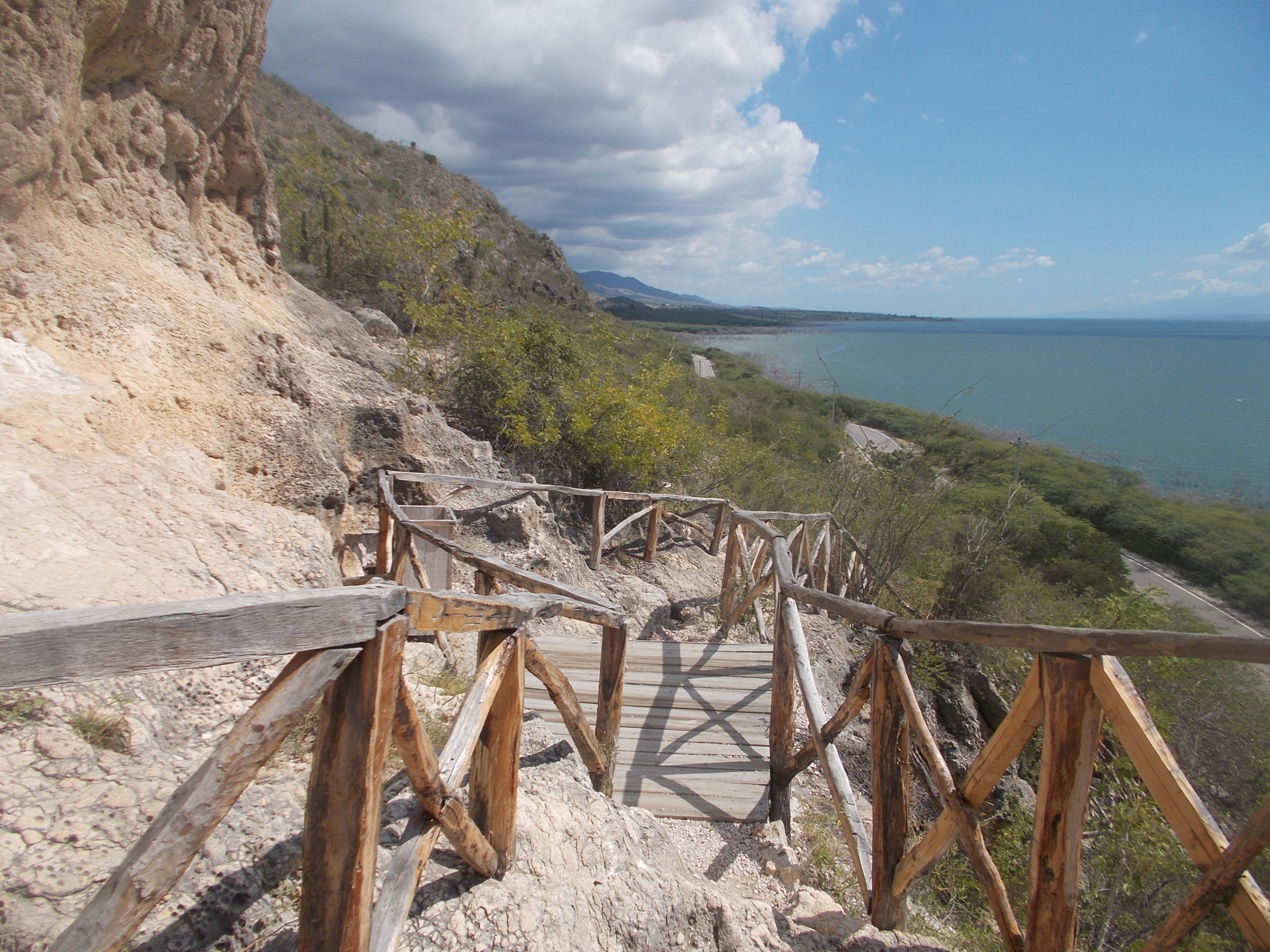
Important towns near the shores of Enriquillo include Neiba, the capital of Baoruco Province, on the northeast, and Jimaní, the capital of Independencia Province, at the western end of the lake near the border with Haiti. La Descubierta is the town nearest to the entrance of Lago Enriquillo and Isla Cabritos National Park.[10] The community of Boca de Cachon, near the lake and severely affected by the rising waters, has been the subject of government relocation efforts, including the construction of a new town further from the shores of Enriquillo.[17]
Lake Enriquillo has become an important tourist destination, both for national and foreign tourism. There is a group of possibly pre-Taino indigenous petroglyphs (locally named "las caritas", "the faces"), from where there is a view of the lake. There are several small hotels in the nearby towns, usually used by travelers linked to commerce, and which are also used by tourists to see the attractions of the area. A transportation system with buses also links this community with Santo Domingo and other communities between them.
Notes
References
- "UE otorga 200.000 euros a afectados por la crecida Lago Enriquillo" [EU gives €200,000 to people affected by the flooding of Lake Enriquillo]. Listín Diario (in Spanish). Agencia EFE. 20 October 2011. Archived from the original on 7 April 2014. Retrieved 19 July 2012.
... según el Instituto Nacional de Recursos Hidráulicos (INDHRI), su superficie ha alcanzado 37.500 hectáreas. [... according to the National Institute of Water Resources (INDHRI), the area has reached 37,500 hectares.]
- Peguero, Adriana (8 December 2011). "Lago Enriquillo amenaza casas de sus alrededores" [Homes around Lake Enriquillo threatened]. Listín Diario (in Spanish). Retrieved 21 December 2011.
... investigador Jorge E. Rodríguez resaltó que han encontrado que el lago Enriquillo ha aumentado en 100%, duplicando su tamaño desde el año 1984, ya que registra una superficie de 350 kilómetros cuadrados, frente a 172 kilómetros cuadrados. [... researcher Jorge E. Rodriguez stressed that he found Lake Enriquillo has increased by 100%, doubling in size since 1984 as it records an area of 350 square kilometers, compared to 172 square kilometers.]
- "Lago Enriquillo". Ramsar Sites Information Service. Retrieved 25 April 2018.
- "Highest and Lowest Points of Countries of the World".
- Romero Luna, Eva Joelisa; Poteau, Dina (August 2011). Water Level Fluctuations of Lake Enriquillo and Lake Saumatre in Response to Environmental Changes (PDF) (Thesis). Cornell University. Retrieved 4 December 2012.
- Buck, David G.; Brenner, Mark; Hodell, David A.; Curtis, Jason H.; et al. (2005). "Physical and chemical properties of hypersaline Lago Enriquillo, Dominican Republic" (PDF). Internationale Vereinigung für Theoretische und Angewandte Limnologie Verhandlungen. 29 (2): 725–731. Retrieved 18 February 2015.
- Ramírez Mac-Lean, Mariana (16 January 2012). "La vida después del agua" [Life after water]. Diario Libre (in Spanish). Retrieved 18 February 2015.
- Steenhuis, T.S.; Hrnčíř, M.; Poteau, D.; Romero Luna, E.J.; et al. (2013). "A Saturated Excess Runoff Pedotransfer Function for Vegetated Watersheds" (PDF). Vadose Zone Journal. 12 (4): vzj2013.03.0060. doi:10.2136/vzj2013.03.0060.
- Saint Fleur N.; Feuillet N.; Grandin R.; Jacques E.; Weil-Accardo J.; Klinger Y. (2015). "Seismotectonics of southern Haiti: A new faulting model for the 12 January 2010 M7.0 earthquake" (PDF). Geophysical Research Letters. 42 (23): 10, 273–10, 281. doi:10.1002/2015GL065505.
- Baker, Christopher P. (2008). National Geographic Traveler: Dominican Republic. National Geographic Society. pp. 44, 189–191. ISBN 978-1-4262-0232-2.
- Haney, Dennis C.; Walsh, Stephen J. (2003). "Influence of Salinity and Temperature on the Physiology of Limia melanonotata (Cyprinodontiformes: Poeciliidae): A Search for Abiotic Factors Limiting Insular Distribution in Hispaniola" (PDF). Caribbean Journal of Science. 39 (3): 327–337.
- Lemm, Jeffrey; Alberts, Allison C. (2011). Cyclura: Natural History, Husbandry, and Conservation of West Indian Rock Iguanas. Academic Press. pp. 60–61. ISBN 978-1-4377-3517-8.
- Wauer, Roland H. (2010). A Birder's West Indies: An Island-by-Island Tour. University of Texas Press. p. 57. ISBN 978-0-292-78672-1.
- Paulino, M. M.; Mejia, D. A.; Latta, S. C. (2013). "A new review of the status of the Caribbean Flamingo Phoenicopterus ruber in the Dominican Republic and Haiti" (PDF). Grupo Para la Conservacion del Flamenco del Caribe. Archived from the original (PDF) on 20 February 2015. Retrieved 19 February 2015.
- "Jaragua-Bahoruco-Enriquillo Biosphere Reserve". Grupo Jaragua. 6 July 2006. Retrieved 2015-02-21.
- Harvey, Sean (2009). The Rough Guide to the Dominican Republic. Rough Guides Limited. p. 307. ISBN 978-1-85828-811-6.
- Archibold, Randal C. (11 January 2014). "Rising Tide Is a Mystery That Sinks Island Hopes". New York Times. Retrieved 19 February 2015.
External links
- Jaragua-Bahoruco-Enriquillo Reserve, Biosphere Reserve Information at UNESCO, MAB Directory
На других языках
[de] Lago Enriquillo
Der Enriquillo-See (spanisch Lago Enriquillo) ist ein 375 km²[1] großer Salzsee im Westen der Dominikanischen Republik nahe der Grenze zu Haiti im Parque Nacional Isla Cabritos. Er ist der größte See der Antillen. Benannt ist er nach Enriquillo, einem Häuptling der Taíno. Im See liegt die 25 km² große Insel Cabritos, die letzte Zuflucht der Taíno.[2]- [en] Lake Enriquillo
[es] Lago Enriquillo
El lago Enriquillo es la mayor reserva natural de agua de la La Española y de todas las Antillas en su conjunto, con una superficie de 265 km² hacia octubre de 2011,[2] aunque su área no es constante. Es el resto de un antiguo canal marino que unía las bahías de Neiba y Puerto Príncipe en la República Dominicana. Sus aguas son compartidas entre las provincias Independencia y Bahoruco. Forma parte del parque nacional lago Enriquillo e isla Cabritos y de la reserva de la biósfera Jaragua-Bahoruco-Enriquillo.[fr] Lac Enriquillo
Le lac Enriquillo est une grande étendue d'eau salée située en République dominicaine.[it] Lago Enriquillo
Il lago Enriquillo è una vasta distesa di acqua salmastra situata, nella Repubblica Dominicana, nella parte più depressa della pianura del Cul-de-Sac. Si estende tra la Sierra de Neiba a nord e la Sierra de Baoruco a sud.[ru] Энрикильо
Энрикильо (исп. Enriquillo) — бессточное солёное озеро на острове Гаити, расположено в западной части Доминиканской Республики. Является одним из немногих солёных озёр в мире, в которых обитают крокодилы.Другой контент может иметь иную лицензию. Перед использованием материалов сайта WikiSort.org внимательно изучите правила лицензирования конкретных элементов наполнения сайта.
WikiSort.org - проект по пересортировке и дополнению контента Википедии