geo.wikisort.org - Reservoir
Lake Amtkeli or Amtkel[2] (Abkhazian: Амтҟьал; Georgian: ამტყელის ტბა; Russian: Амткел) is a lake in the Gulripshi District of Abkhazia, Georgia that was formed on 3 October 1891 when an earthquake caused a landslide on the south-western slope of Mt. little Shkhapach into the valley of the Amtkeli River.[3][4][5]
| Lake Amtkeli | |
|---|---|
 | |
 Lake Amtkeli 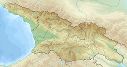 Lake Amtkeli | |
| Location | Gulripshi district |
| Coordinates | 43°05′42″N 41°17′54″E |
| Lake type | Glacial lake |
| Primary inflows | Amtkeli |
| Primary outflows | Jampali (through sinkholes) Amtkeli |
| Catchment area | 153 km2 (59 sq mi) |
| Basin countries | Georgia, (Abkhazia[1]) |
| Built | 3 October 1891 |
| Max. length | 2.4 km (1.5 mi) |
| Surface area | 0.58 km2 (0.22 sq mi) |
| Max. depth | 65 m (213 ft) |
| Surface elevation | 512 m (1,680 ft) |
| Frozen | very rarely |
| Settlements | Azanta |
 | |
Geography
Lake Amtkeli is fed by the Amtkeli River, but only a small part of its water percolates through the obstructing rubble back into the river. The greater part leaves the lake through underground passages to the Jampal River. Due to the lake's limited discharge capacity, its water level rises strongly during snowmelt in May, leading to annual fluctuations of up to 40 m (131 ft) in the lake's average 512 m (1,680 ft) height above sea level and 65 m (213 ft) maximal depth, and increasing its length from 2.4 km (1.5 mi) to 4 km (2.5 mi). The average surface area of Lake Amtkeli is 0.58 km2 (0.22 sq mi), and its drainage basin measures 153 km2 (59 sq mi).
Due to the lake's origin, its underwater slopes are steep, following the surface slopes.[4]
Environment
Lake Amtkeli is home to trout, chub, nase, barbel and spirlin.
In July and August, the lake's average surface temperature is 20 °C (68 °F), in Winter it rarely freezes over.[4]
Human settlement
The village of Azanta is located next to lake Amtkeli, and some of its inhabitants keep fishing boats on its shore.[4]
References
- The political status of Abkhazia is disputed. Having unilaterally declared independence from Georgia in 1992, Abkhazia is formally recognised as an independent state by 6 UN member states (one other state recognised it but then withdrew its recognition), while Georgia continues to claim it as part of its own territory, designating it as Russian-occupied territory.
- "Lake Amtkel", page 63, A Checklist of the Ground-beetles of Russia and Adjacent Lands
- Solonenko, V.P. (1979). "Mapping the After-Effects of Disastrous Earthquakes and Estimation of Hazard for Engineering Constructions". Bulletin of the International Association of Engineering Geology. Krefeld. 19: 138–142. doi:10.1007/bf02600466.
- Озеро, рожденное обвалом (in Russian). bluekaz.ru. 2009. Retrieved 18 February 2010.[permanent dead link]
- Bondyrev, I. V.; Z. K. Tatashidz; V. P. Singh; E. D. Tsereteli; A. Yilmaz (2004). "Impediments to the Sustainable Development of the Caucasus-Pontdes Region". Journal of Comparative Social Welfare. London: Routledge. 20 (1): 33–48. doi:10.1080/17486830408417009.
| Eastern Georgia |
| ||||
|---|---|---|---|---|---|
| Western Georgia |
| ||||
На других языках
- [en] Lake Amtkeli
[ru] Амткел (озеро)
Амтке́л (абх. Амтҟьал — Амткял; груз. ამტყელის ტბა) — озеро запрудного типа в Гулрыпшском районе Республики Абхазии[2]. Образовалось в результате горного обвала во время сильного землетрясения 3 октября 1891 года. Установлено, что это был не первый обвал в истории ущелья реки Амткел[en]. Нынешний уровень озера — наиболее высокий, о чём говорят торчащие из воды стволы деревьев, выросших до обвала.Другой контент может иметь иную лицензию. Перед использованием материалов сайта WikiSort.org внимательно изучите правила лицензирования конкретных элементов наполнения сайта.
WikiSort.org - проект по пересортировке и дополнению контента Википедии