geo.wikisort.org - Reservoir
Lake Alexandrina is a coastal freshwater lake[1] located between the Fleurieu and Kangaroo Island and Murray and Mallee regions of South Australia, about 100 kilometres (62 mi) south-east of Adelaide. The lake adjoins the smaller Lake Albert (together known as the Lower Lakes)[4] and a coastal lagoon called The Coorong to its southeast, before draining into the Great Australian Bight via a short, narrow opening known as Murray Mouth.
| Lake Alexandrina | |
|---|---|
 Lake Alexandrina is the larger lake to the left. Lake Albert is the smaller lake to the right. | |
 Lake Alexandrina Location in South Australia | |
| Location | South Australia |
| Coordinates | 35°25′S 139°07′E |
| Type | Freshwater[1] |
| Primary inflows | Murray, Bremer, Angas, and Finniss Rivers |
| Primary outflows | Murray Mouth |
| Catchment area | 1,061,469 km2 (409,835 sq mi) |
| Basin countries | Australia |
| Surface area | 64,900 ha (251 sq mi)[2] |
| Average depth | 2.8 m (9.2 ft)[2] |
| Max. depth | 6 m (20 ft)[2] |
| Water volume | 1,610 GL (430×109 US gal; 350×109 imp gal)[2] |
| Surface elevation | 0.75 m (2.5 ft)[2] |
| Settlements | Clayton Bay, Milang, Raukkan |
Ramsar Wetland | |
| Official name | The Coorong, Lake Alexandrina & Albert Wetland |
| Designated | 1 November 1985 |
| Reference no. | 321[3] |
Nomenclature
Aboriginal naming
Aboriginal people having an association with the lake were reported as knowing it by such names as Mungkuli, Parnka and Kayinga.[5]
European naming
English settlers named the lake after Princess Alexandrina, niece and successor of King William IV of Great Britain and Ireland. When the princess ascended the throne and took the name Queen Victoria, there was some talk of changing the name of the lake to Lake Victoria, but the idea was dropped.[6]
Description
Lake Alexandrina is located north of Encounter Bay and east of Fleurieu Peninsula within what are now the two following South Australian government regions: Fleurieu and Kangaroo Island region, and the Murray Mallee region.[7] The Murray River is the major river to flow into Lake Alexandrina. Others include the Bremer, Angas, and Finniss rivers, all from the eastern side of the southern Mount Lofty Ranges. The lake is shallow and contains a number of islands near the southern end. Loveday Bay is an inlet located at the south-east of Lake Alexandrina, adjacent to Tauwitchere Channel.[8] Lake Alexandrina is connected by a narrow channel to the smaller Lake Albert to the south-east.
The lake empties into the Southern Ocean via a channel known as the Murray Mouth, south-east of the town of Goolwa, but when the river flow is low, the mouth is often blocked by a sand-bar. Originally subjected to tidal and storm inflows of seawater, the lake is now maintained as a fresh water one by a series of barrages known as the Goolwa Barrages; these cross five channels between the mainland and three islands near the Murray Mouth.[9][10]
Though the lake has been historically connected to the ocean, the fresh and salt water flows mixed very little, with the lake area remaining fresh over 95% of the time with normal river inflow. Salt water inflows from the ocean would result in relatively little mixing of fresh and salt water, either vertically in the water column or laterally across the flow stream.[11] An 2020 review of hundreds scientific studies relating to the Coorong, Lower Lakes and Murray Mouth has found that it was a freshwater ecosystem prior to European settlement of South Australia.[12]
Hindmarsh Island is reputed to be the largest island in the world with salt water on one side and fresh water on the other.[citation needed]
History
In Aboriginal mythology known as Dreamtime, the lake was inhabited by a monster known as the Muldjewangk.
Edward Wilson, visiting the lake in the 1850s described it as follows:
"Lake Alexandrina is the finest sheet of fresh water I ever saw. Indeed so formidable did it look, with a stiff wind blowing up quite a sufficient swell to make one seasick, that I could scarcely believe it to be fresh. Such is the fact however. It is forty or fifty miles long by twelve or fifteen wide and the shores around it receded into the dim distance until they become invisible, in the way which we are accustomed only with ideas of salt water. Supplied almost entirely by the Murray, the whole lake retains the muddy tinge of which I have spoken, and this sadly detracts from the otherwise beautiful appearances of this magnificent sheet of water."[13]
In 2008, water levels in Lake Alexandrina and Lake Albert became so low that there was a high risk of large quantities of acid sulphate soils forming. The soils on the lake beds are naturally rich in iron sulphides. When exposed to the air, such as may occur in a time of severe drought, the sulphides oxidise, producing sulphuric acid. The barrages now prevent the seawater inflows that had formerly prevented this phenomenon in every drought since the last ice age.[14] A weir was proposed near Pomanda Point where the river entered the lake, in order to protect upriver and Adelaide's water supplies should it become necessary to open the barrages, but this plan was dropped by the South Australian government after a campaign by the River, Lakes and Coorong Action Group highlighted the many environmental problems such a weir would cause.[citation needed]
Environment
Turtles live in the lake, with lizards and snakes being present along the shoreline. Insect species include dragonflies, a range of moths and butterflies, and large numbers of beetles (coleoptera). Freshwater fish inhabit the lake, including the introduced European carp. The soils around the lake are relatively low in organic carbon, although good barley and vegetable crops may be produced. Non-wetting soils are present along the south eastern bounds of Lake Albert and in areas around Lake Alexandrina.
Birds
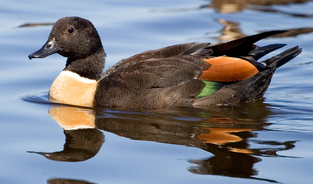
The lake is a habitat for many species of waterbird, including migratory waders, or shorebirds, which breed in northern Asia and Alaska. Species supported by the lake include the critically endangered orange-bellied parrots, endangered Australasian bitterns, vulnerable fairy terns, as well as over 1% of the world populations of Cape Barren geese, Australian shelducks, great cormorants and sharp-tailed sandpipers.[15]
Protected area status
Australian government
Lake Alexandrina is part of the wetland complex known as the Coorong and Lakes Alexandrina and Albert Wetland which is listed as a Ramsar site. The wetland is also appears in the non-statutory list known as A Directory of Important Wetlands in Australia.[16][17]
South Australian government
Lake Alexandrina includes the following protected areas declared under the National Parks and Wildlife Act 1972 - Currency Creek Game Reserve, Mud Islands Game Reserve, Salt Lagoon Islands Conservation Park and Tolderol Game Reserve.[18][19][20][21]
Non-statutory arrangements
Lake Alexandrina is included within the boundary of the Lakes Alexandrina and Albert Important Bird Area which is an area considered by BirdLife International to be a place of ‘international significance for the conservation of birds and other biodiversity.’[15][22]
See also
- List of lakes of South Australia
- List of islands within the Murray River in South Australia
References
- Walker, Keith. "Alexandrina always was a freshwater lake" (transcript). Media Watch. Australia: ABC TV. Retrieved 16 August 2015.
- "The Facts: The Lower Murray, Lakes and Coorong" (PDF). Government of South Australia. 20 November 2008. Archived from the original (PDF) on 18 February 2011. Retrieved 28 October 2010.
- "The Coorong, Lake Alexandrina & Albert Wetland". Ramsar Sites Information Service. Retrieved 25 April 2018.
- Name used by the Australian Government, see
- "Search result for Lake Alexandrina (Record no. SA0000745)". Government of South Australia, Department of Planning Transport and Infrastructure. Archived from the original on 12 October 2016. Retrieved 17 August 2015.
- "Alexandrina, Lake". Place Names of South Australia. State Library of South Australia. Retrieved 12 January 2007.
- "Murray and Mallee SA Government region" (PDF). The Government of South Australia. Retrieved 17 August 2015.
- "Barker (Geological Survey of South Australia)" (PDF). Mapping - PIRSA. Department for Manufacturing, Innovation, Trade, Resources and Energy. Retrieved 19 January 2017.
- "The barrages". Murray-Darling Basin Commission. Archived from the original on 19 March 2012. Retrieved 17 November 2012.
- "Lower Lakes Barrages". Murray-Darling Basin Authority. Archived from the original on 9 January 2015. Retrieved 9 January 2015.
- Fluin, Jennie; Gell, Peter; Haynes, Deborah; Tibby, John; Hancock, Gary (2007). "Palaeolimnological evidence for the independent evolution of neighbouring terminal lakes, the Murray Darling Basin, Australia". Hydrobiologia. 591: 117–134. doi:10.1007/s10750-007-0799-y.
- Jasper, Clint; Sullivan, Kath (11 May 2020). "Murray River's Lower Lakes review finds Ramsar-listed area is a freshwater ecosystem". ABC News. Australian Broadcasting Corporation. Retrieved 11 May 2020.
- Wilson, Edward (1859). Rambles at the Antipodes: a series of sketches of Moreton Bay, New Zealand, the Murray River and South Australia and the overland route. With 2 maps; and 12 tinted lithographs, illustrative of Australian life. W.H. Smith. p. 45. Retrieved 2 January 2011.
- "Catalyst - Fire, Flood and Acid Mud". Retrieved 7 May 2008.
- "Important Bird Areas factsheet: Lakes Alexandrina and Albert". BirdLife International. Retrieved 19 January 2015.
- "Coorong and Lakes Alexandrina and Albert Wetland Ramsar site" (PDF). Department of Environment Water and Natural Resources. 28 January 2014. Retrieved 19 January 2015.
- "Australian Wetlands Database - Directory Wetland Information Sheet: The Coorong, Lake Alexandrina & Lake Albert - SA063". Commonwealth of Australia, Department of the Environment. 31 May 2005. Retrieved 19 January 2015.
- "Register of the National Estate (Non-statutory archive), Currency Creek Game Reserve, Laffin Point via North Goolwa, SA, Australia". Commonwealth of Australia (C of A), Department of the Environment. 21 October 1980. Retrieved 10 January 2015.
- "Register of the National Estate (Non-statutory archive), Mud Islands Game Reserve, Lake Alexandrina via Goolwa, SA, Australia". Commonwealth of Australia (C of A), Department of the Environment. 21 October 1980. Retrieved 10 January 2015.
- "Register of the National Estate (Non-statutory archive), Salt Lagoon Conservation Park, Salt Lagoon, Narrung, SA, Australia". Commonwealth of Australia (C of A), Department of the Environment. 21 October 1980. Retrieved 10 January 2015.
- "Register of the National Estate (Non-statutory archive), Tolderol Game Reserve, Langhorne Creek, SA, Australia". Commonwealth of Australia (C of A), Department of the Environment. 21 October 1980. Retrieved 10 January 2015.
- "Sites - Important Bird and Biodiversity Areas (IBAs)". BirdLife International. Retrieved 19 January 2015.
Wetlands and conservation | |
|---|---|
| Generally |
|
| Classification systems |
|
| Organizations |
|
| Authority control |
|
|---|
На других языках
[de] Lake Alexandrina (South Australia)
Der Lake Alexandrina ist ein See im Süden des australischen Bundesstaates South Australia. Er liegt ca. 100 km südöstlich von Adelaide und ist mit dem Indischen Ozean verbunden.- [en] Lake Alexandrina (South Australia)
[es] Lago Alexandrina
El lago Alexandrina (en inglés: Lake Alexandrina) es un lago de Australia, localizado en la parte suroriental del estado de Australia del Sur, adyacente a la costa del océano del Sur, a unos 100 km al sudeste de Adelaida. El río Murray es su principal afluente, además de otros como el río Angas, el río Bremer y el río Finniss, todos del lado este de los Prados del Monte Lofty. El lago es poco profundo y tiene algunas islas. El lago desemboca cerca de Goolwa por un canal conocido como la Boca Murray (Murray Mouth), pero cuando el río fluye suavemente, la boca se sedimenta y se cierra. El agua en el lago se mantiene dulce gracias a una serie de barreras construidas entre las islas cerca de la boca Murray. La isla Hindmarsh tiene la reputación de ser la mayor isla del mundo en tener agua dulce de un lado y agua salada del otro.[fr] Lac Alexandrina
Le lac Alexandrina est situé en Australie-Méridionale près de l'océan Indien — antarctique pour les Australiens —, à environ 100 kilomètres au sud-est d'Adelaïde.[ru] Алегзандрина (озеро, Австралия)
Алегзандри́на[1][2] (Александрина[3]; англ. Lake Alexandrina[2]) — озеро в Южной Австралии[2], прилегающее к побережью Большого Австралийского залива, который является частью Индийского океана[1].Другой контент может иметь иную лицензию. Перед использованием материалов сайта WikiSort.org внимательно изучите правила лицензирования конкретных элементов наполнения сайта.
WikiSort.org - проект по пересортировке и дополнению контента Википедии